Clear Sky Science · en
A quantile-based composite ionospheric disturbance estimator for RTK positioning reliability
Why satellite navigation sometimes stumbles
Modern life leans heavily on satellite navigation, from precision farming and land surveying to guiding aircraft and autonomous vehicles. These applications often depend on real-time kinematic (RTK) positioning, a technique that can pinpoint locations to within a few centimeters. But RTK has an Achilles’ heel: a restless layer of charged particles high above Earth—the ionosphere—can suddenly warp radio signals and cause the position solutions to falter. This study presents a new way to turn complex ionospheric behavior into a simple, practical risk score for RTK users.
A restless layer above our heads
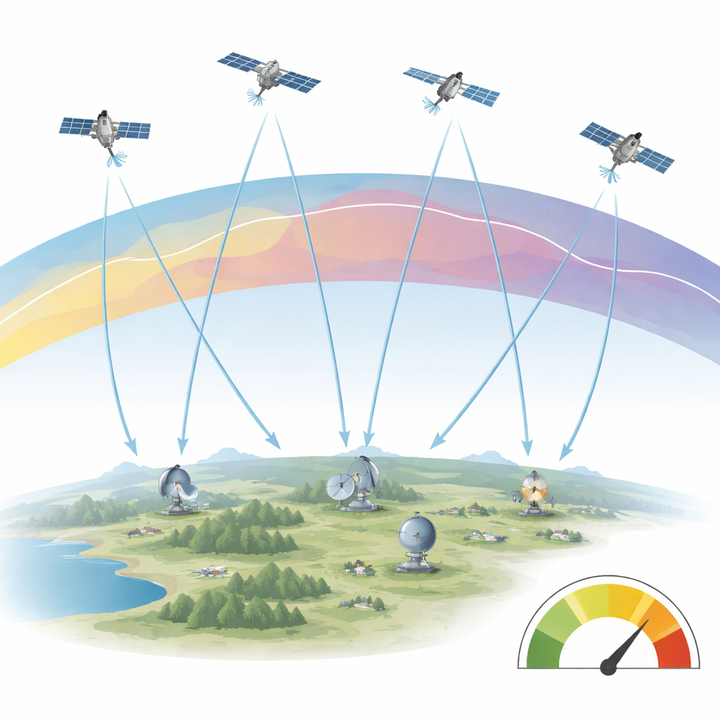
The ionosphere sits roughly 50 to 1,000 kilometers above Earth and is filled with free electrons created by solar radiation. When signals from GPS and other Global Navigation Satellite Systems (GNSS) pass through this layer, they are delayed in ways that depend on the electron content along their path. Dual-frequency receivers can remove much of the average delay, but they are still vulnerable to rapid, localized changes. These short-lived irregularities and sharp spatial gradients can quietly erode RTK reliability, slowing down the time needed to lock onto precise solutions or even pushing them into error without obvious warning.
From messy measurements to a single risk score
Existing disturbance indicators tend to look at either how quickly the ionosphere changes with time along a single path, or how sharply it varies across space, but rarely both together. The authors propose a composite estimator that blends these two perspectives into one number tailored to RTK reliability. First, they use standard dual-frequency GNSS data from a dense network of ground stations in Latvia to estimate how the ionosphere delays each signal path. From these, they compute a measure of short-term variability over 2-minute windows, capturing how jittery the ionosphere is in time. At the same time, they map those delays to a single reference height to create a “vertical” ionospheric layer and then calculate how steeply this layer changes from place to place across the region.
Letting the data define what is “disturbed”
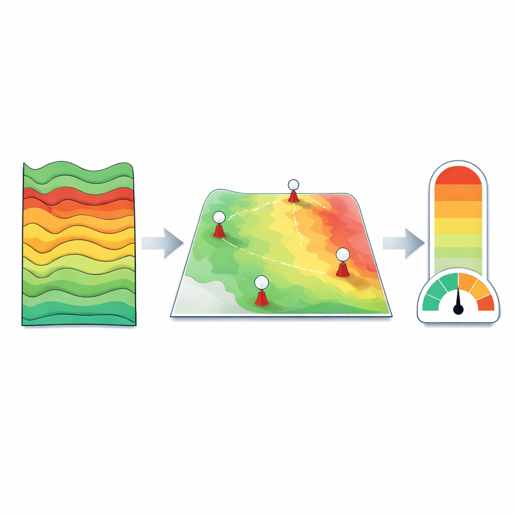
Rather than rely on fixed thresholds that might work poorly on quiet or extremely active days, the method leans on quantiles—statistics that describe the upper slices of the data distribution. For each moment in time, the approach looks at the upper 5 percent of temporal variability values across all satellites and stations to define a regional disturbance level. It does the same for the steepness of spatial gradients. Both components are then scaled using their own low and high quantiles over time, which makes the resulting values less sensitive to rare extremes and regional quirks. Finally, the two normalized components, one representing rapid time changes and the other spatial structure, are combined with equal weight into a single, dimensionless RTK risk index the authors call RTK_RISK.
Putting the new index to the test
The team checked their ionospheric estimates against several widely used global ionosphere models. While the large daily trends matched reasonably well, the regional GNSS network revealed fine-scale and rapid fluctuations that the global products smoothed out. These are precisely the variations most likely to trouble RTK. To see whether RTK_RISK really reflects positioning difficulty, the authors ran a controlled experiment using a 50-kilometer baseline between two reference stations. They processed the data with standard RTK software and compared the risk index to actual positioning errors, the success rate of integer ambiguity fixing, and a standard quality metric for solution reliability. As RTK_RISK increased, the fraction of epochs with reliable fixed solutions dropped; above a moderate risk level, the system almost never achieved fixed solutions, and horizontal position errors grew noticeably.
What this means for users of precise positioning
The study shows that a carefully constructed composite index can turn dense, complex ionospheric measurements into an intuitive risk score for users of high-precision GNSS. By combining how quickly the ionosphere changes with how uneven it is across a region, and by defining “low,” “medium,” and “high” disturbance levels directly from the data, RTK_RISK offers a practical way to flag periods when centimeter-level positioning is more likely to struggle. While the current work focuses on a mid-latitude network in Latvia and calls for further testing in other regions and sparser networks, the framework is general: it uses only standard GNSS observables and robust statistics. In effect, it gives RTK users a weather report for the ionosphere, helping them judge when to trust their most precise position solutions and when to proceed with caution.
Citation: Vallis, A., Celms, A., Zvirgzds, J. et al. A quantile-based composite ionospheric disturbance estimator for RTK positioning reliability. Sci Rep 16, 14513 (2026). https://doi.org/10.1038/s41598-026-45329-z
Keywords: ionosphere, GNSS, RTK positioning, satellite navigation, space weather