Clear Sky Science · en
Assessing inundation dynamics of conservation reserve program lands to quantify ecosystem services
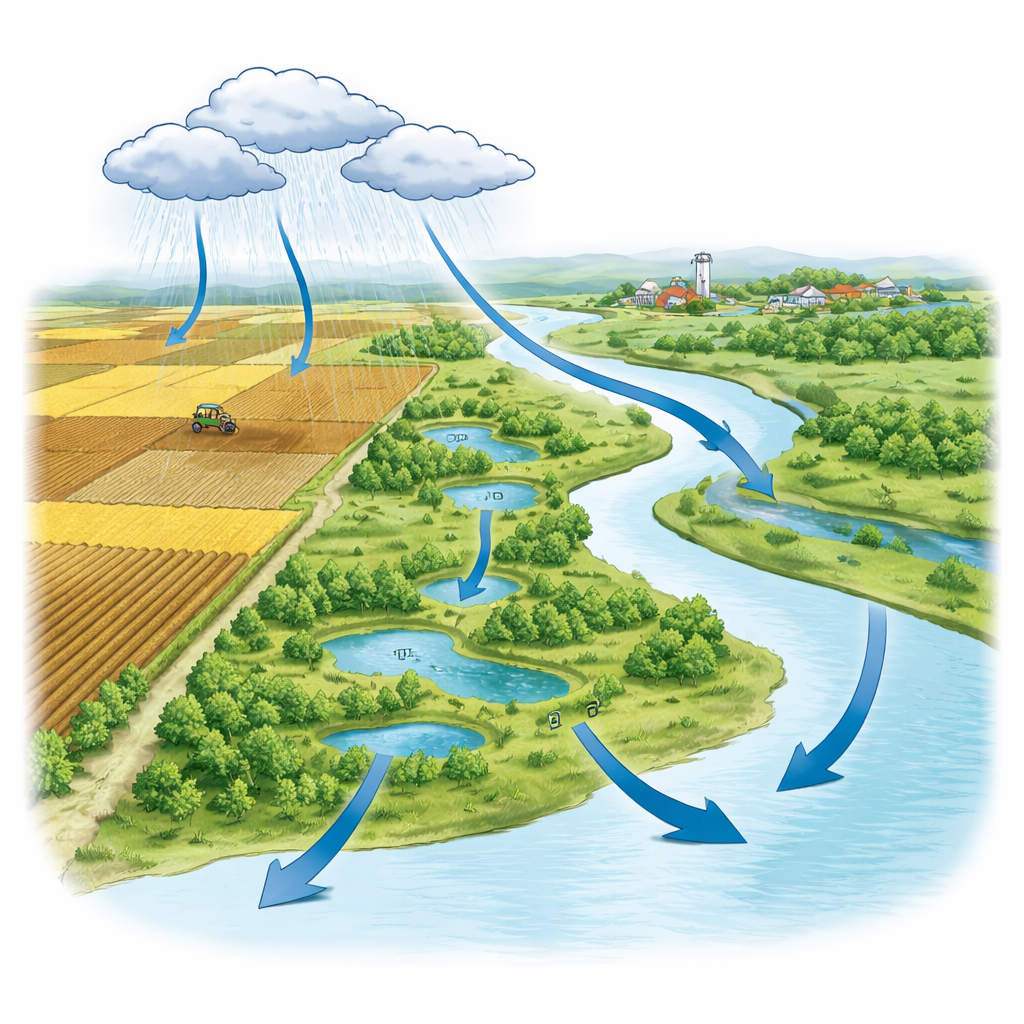
Why Wet Fields Matter to Farms and Wildlife
Across the United States, millions of acres of marginal farmland have been taken out of production and placed into the Conservation Reserve Program (CRP). These lands often look like quiet patches of grass or marsh tucked between corn and soybean fields, but they quietly slow floods, filter farm runoff, and create refuges for birds and other wildlife. This study asks a simple but important question: how wet are these lands over time, and are they really doing the protective work we expect of them? By combining modern satellites with advanced computer methods, the authors track where and when CRP lands hold water, revealing how these scattered parcels support cleaner water, safer communities, and more resilient ecosystems.
Watching Water Spread Across the Country
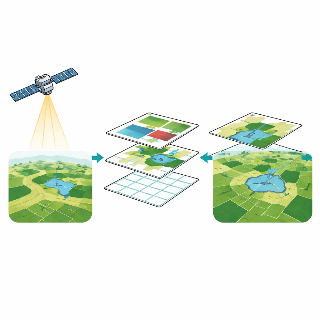
The researchers focused on more than 1.3 million CRP sites spread across all 50 states, from the Great Plains to the Mississippi River Basin and coastal lowlands. Many of these parcels include or border natural wetlands, while others sit on drier ground. Instead of sending teams into the field, the team turned to satellites that routinely photograph Earth’s surface at high resolution. They used images from the European Sentinel-2 mission, which can see details as small as 10 meters across, fine enough to pick up small ponds and narrow flooded strips in farm country.
Turning Satellite Pictures into Water Maps
To pick out water from land in each satellite scene, the study used specialized color combinations that make wet areas stand out, even when they are shallow or partly covered by plants. These “water-sensitive” views were combined with a global land-cover product called Dynamic World, which uses artificial intelligence to assign each pixel to classes such as open water, flooded vegetation, bare soil, or crops. The authors then trained three machine learning models—Support Vector Machine (SVM), Random Forest, and CART—using thousands of labeled points from known water, vegetation, soil, and built surfaces. The SVM model delivered the best balance of accuracy and stability, so it was used to generate quarterly water maps for every CRP site from 2018 through 2024.
Where and When CRP Lands Hold Water
The resulting nationwide maps reveal that water on CRP lands is far from random. Wetland-related parcels in the Midwest and the Lower Mississippi River Basin show persistent or seasonal standing water, acting like natural sponges that soak up runoff, recharge groundwater, and blunt flood peaks. Even CRP lands not originally classified as wetlands often gained new or more frequent inundation once enrolled, expanding the network of small water-holding areas within largely cultivated landscapes. Sites enrolled for more than a decade tended to have higher and more stable water presence than newer enrollments, signaling that wetland-like functions strengthen with time as vegetation and soils recover.
Clues from Soils, Historic Wetlands, and the Seasons
To understand why some CRP parcels stay wetter than others, the team compared their water maps with federal inventories of wetlands and hydric (water-loving) soils. Sites overlapping historic wetlands or hydric soils showed clearly higher and more reliable inundation, confirming that underlying landscape traits still guide where water naturally wants to pool. Statistical tests showed that CRP parcels within mapped wetlands were significantly wetter than those outside, yet CRP also increased inundated area on non-wetland lands, adding new habitat and storage zones. Seasonal patterns emerged as well: spring and summer stood out as key times of persistent or episodic flooding, especially in states such as Arkansas, the Dakotas, Louisiana, and North Carolina, when snowmelt or heavy rains fill depressions just as crops and wildlife need water most.
What This Means for People and Policy
For a layperson, the takeaway is that CRP lands are quietly doing a lot of heavy lifting. By sitting wet at the right times and in the right places, they help absorb stormwater, reduce downstream flood risks, trap sediment and farm chemicals, and provide rich habitat for migratory birds and other species. The new mapping approach offers a way to track these benefits continuously and at low cost, helping agencies decide which parcels to protect longer, where to restore wetland features, and how to adapt to a changing climate. In plain terms, the study shows that when we retire the right pieces of farmland and let them stay in conservation long enough, the land remembers how to behave like a wetland—and that memory pays off in cleaner water, safer communities, and healthier ecosystems.
Citation: Jahangeer, J., Kapoor, A., Joshi, P. et al. Assessing inundation dynamics of conservation reserve program lands to quantify ecosystem services. Sci Rep 16, 14507 (2026). https://doi.org/10.1038/s41598-026-45281-y
Keywords: Conservation Reserve Program, wetlands, remote sensing, surface water, ecosystem services