Clear Sky Science · en
Study on the influence of key parameters of sand emission on dust flux based on multi-source data
Why desert dust matters
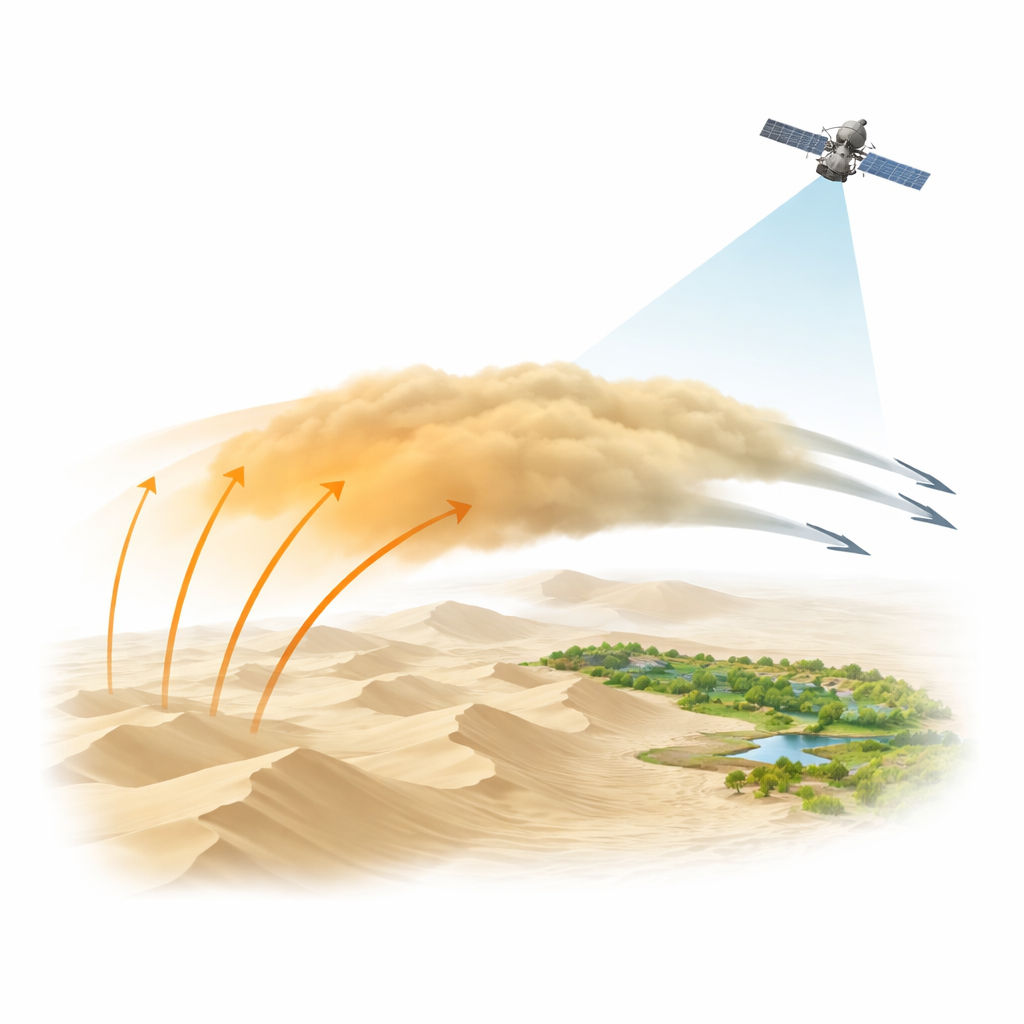
Dust storms from the world’s great deserts do far more than sting the eyes and coat cars. Tiny mineral grains swept into the air can darken ice and snow, speed up glacier melt, alter air quality thousands of kilometers away, and even nudge climate. Yet scientists still struggle to predict when and where the desert floor will “switch on” and release large amounts of dust. This study focuses on the Taklamakan Desert in western China, using both ground instruments and satellites to uncover how grain size, wind strength, and height above the ground together control the flow of dust into the atmosphere—and how well satellites can see it.
Two contrasting windows into a giant desert
The researchers worked at two carefully chosen stations. Tazhong sits deep in the desert interior among tall dunes, far from vegetation. Xiaotang lies on the northern edge, where sands grade into an oasis zone with river channels and scattered trees. At both sites, instruments on tall towers recorded wind and dust during eight major storms in 2024, from just above the surface up to 80–100 meters. Special samplers caught airborne grains at different heights, and laser measurements in the lab revealed how coarse or fine those grains were. At the same time, the team tapped satellite products that track hazy skies from space, linking local events to the broader dust plumes drifting over the region.
Small grains, big journeys
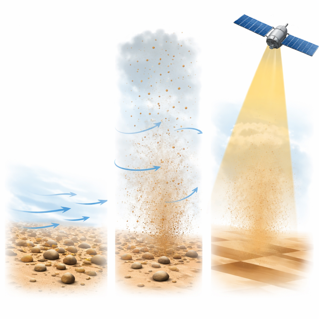
The measurements show that grain size is the master control on how dust moves. Near the ground, both sites contained a mix of particles, but higher in the air the grains became steadily finer and less abundant. Horizontal dust flow dropped sharply as grains grew larger, especially above a few meters: coarse grains simply could not stay aloft long enough to travel far. Vertical dust flow behaved similarly, with strong upward transport when fine particles dominated and rapid weakening when larger grains took over. At Tazhong, storms rich in big grains produced relatively little high-altitude dust, while events dominated by fine particles lofted material much more efficiently. This makes clear that not all sand surfaces are equally capable of feeding long-distance dust plumes; subtle shifts in grain-size makeup can change the outcome dramatically.
Wind power and invisible structure in the air
The strength of near-surface air flow—captured by a quantity related to how hard the wind “rubs” against the ground—also shaped the storms, but in a more nuanced way. At both stations, stronger surface winds drove more vigorous horizontal transport along the ground, kicking up and sweeping away particles. Yet their influence on vertical dust flow was noticeably weaker. Even under brisk winds, heavy grains tended to fall out quickly, while fine grains could linger aloft, guided by turbulence and gravity rather than by wind speed alone. Vertical profiles showed that most of the upward dust movement happened close to the surface and faded rapidly with height. In the complex dunes of the desert interior, a layer around 40 meters acted as a secondary launch zone where local topography briefly boosted large grains upward, but they still settled out quickly higher up.
What satellites really see
From orbit, sensors like MODIS and Sentinel-5P do not measure dust at a single height; they capture the total haze along the viewing path. By comparing satellite signals with tower measurements, the team found that the link between space and ground depends strongly on location. At the desert edge (Xiaotang), satellite estimates of overall haziness rose and fell in step with local dust flow and surface winds. There, the atmospheric dust column is largely built from nearby emissions, so satellites track local storms reliably. In the interior (Tazhong), some episodes showed very dusty skies from space even when surface dust movement remained modest, revealing that distant plumes passing overhead or recirculating at higher levels can dominate what satellites see. A more specialized satellite measure of how strongly the haze absorbs light matched ground dust levels very closely at both sites, but the height at which this match was strongest differed, echoing the contrasting vertical structures of the storms.
What this means for dust warnings and desert control
For non-specialists, the message is straightforward: dust storms are not just about strong winds. The size of the grains on the ground, the layering of the air above the desert, and the broader weather pattern all decide how much dust reaches the skies and how far it travels. Along the Taklamakan’s edge, satellites are powerful tools for tracking locally generated storms and issuing warnings. In the desert’s heart, they must be interpreted more carefully, because high dust seen from space may come from afar rather than from the dunes below. By teasing apart these influences with detailed measurements, the study offers a firmer physical footing for improving dust forecasts, refining satellite-based monitoring, and designing smarter strategies to manage desertification and protect people downwind.
Citation: Maihamuti, M., Huo, W., Liu, Y. et al. Study on the influence of key parameters of sand emission on dust flux based on multi-source data. Sci Rep 16, 12218 (2026). https://doi.org/10.1038/s41598-026-45242-5
Keywords: dust storms, Taklamakan Desert, remote sensing, aerosols, desertification