Clear Sky Science · en
Exploring rainfall effects on the Xingfu Dayuan Landslide in Yecheng, Xinjiang, China using time-series InSAR technology and numerical simulation
Rain, hills, and village safety
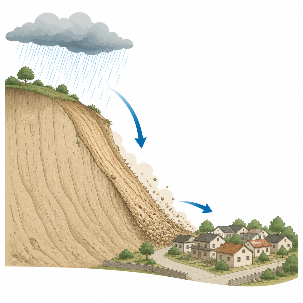
In the mountains of southern Xinjiang, China, summer rain that nourishes crops can also quietly weaken nearby hillsides built from fine, windblown soil called loess. This study looks at one such slope above the village of Xingfu Dayuan and asks a practical question: how exactly does rainfall, from light showers to cloudbursts, tip a hillside from stable to unsafe, and when is the danger greatest for the people living just below it?
Watching the hillside move from space
The researchers first used satellites to track tiny motions of the hillside over three years, from 2022 to 2024. By combining many radar images with a method known as time series InSAR, they built a movie of how the ground shifted through time. They found that the landslide is very much alive, but its motion is uneven. The middle and lower parts of the slope, especially an area the team calls HP3, are creeping downward by about one and a half centimeters each year, with total movement already beyond five centimeters. In contrast, the upper part moves less. This pattern matches what they saw on the ground: open cracks, small step like scarps, and bulging soil are clustered in the middle and lower zones where roads and houses sit dangerously close.
Seasons of freezing, thawing, and heavy rain
Satellite measurements were then lined up with local records of rain and temperature. Most rain falls between May and September, while winters are cold enough to freeze the ground. During the frozen months, the slope moves more slowly. As temperatures rise and the ground thaws, repeated freezing and thawing breaks down the loess, widens old cracks, and opens paths for water. When intense summer storms arrive, rain pours into these weakened zones, speeding up the downslope creep. The team outlined three stages: a long freeze thaw stage that quietly damages the soil, a crack growth stage where rain deepens and widens fissures, and finally an instability stage in which the weakened upper soil begins to slide over the harder rock beneath.
Simulating water seeping through the slope
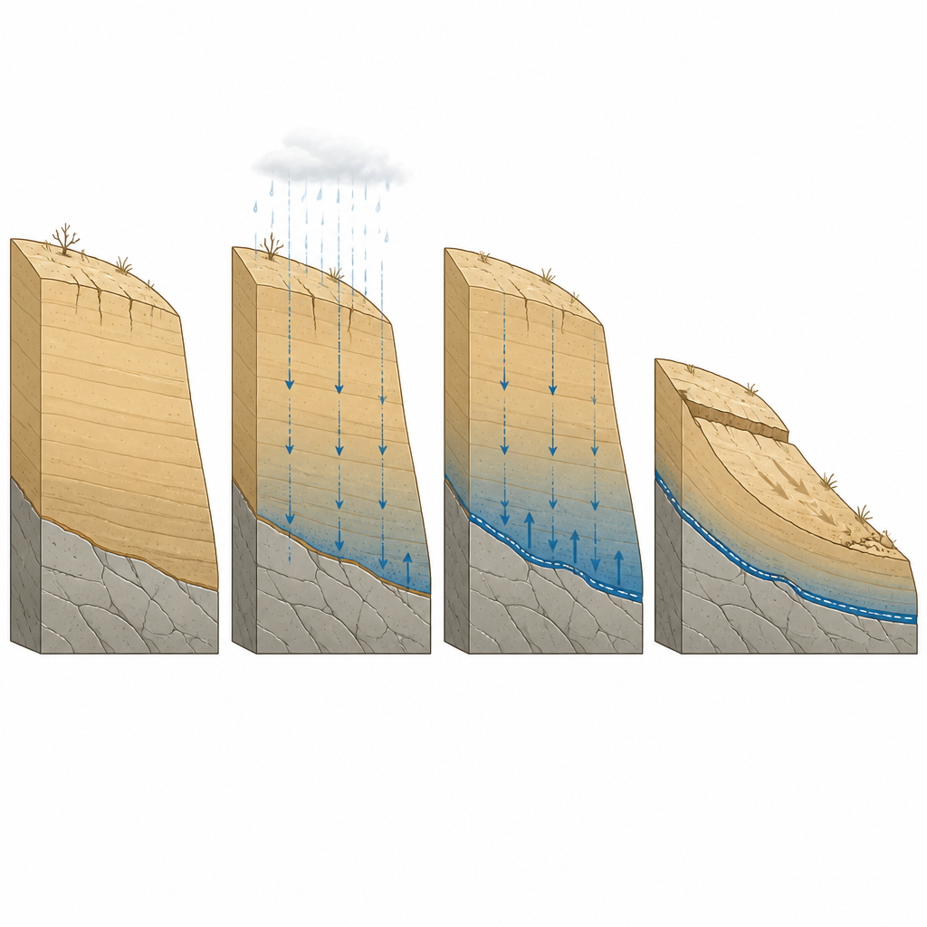
To understand what happens inside the hillside where it cannot be seen, the researchers built a computer model of the slope that tracks how rainwater seeps in, how water pressure in the pores of the soil rises, and how this reduces the soil’s strength. They tested both common and extreme rain patterns, varying how hard it rains and how long storms last. Under light but steady rain, only the top few meters of soil get wetter, and the slope remains relatively stable. Under very intense or long lasting rain, water can penetrate down as far as eight meters, raising water pressure and erasing much of the natural suction that helps hold the grains together. The model predicts that the weakest layer forms at the contact between the loose loess and the stronger rock below, matching the shallow slip zones inferred from field signs and satellite data.
Hidden delays after the storm
One of the most important findings is that the riskiest moment for the hillside does not occur at the height of the storm. Because water keeps migrating downward through the soil even after the sky clears, the internal water pressure often peaks 12 to 24 hours later. In the simulations, the overall stability of the slope keeps dropping for many hours after rainfall stops, and in an extreme rain case the slope crosses from nearly stable to unstable during this delay. For storms with the same total amount of rain, a long, gentle event turns out to be more dangerous than a short cloudburst, because slow rain has more time to soak in rather than run off the surface. This prolonged soaking keeps the near surface soil wetter for longer and makes shallow sliding more likely.
What this means for people living below
For villagers at the foot of the Xingfu Dayuan slope, the results carry a clear message. The landslide is active today, with the strongest motion in the zone closest to homes and roads. The study shows that both the intensity and the duration of rainfall, together with freeze thaw damage, work together to control when and how the hillside moves. It also shows that the danger may peak hours after the last raindrops fall, not during the storm itself. By combining satellite monitoring with physics based models, local authorities can better time warnings, focus attention on the most active parts of the slope, and design protection measures that fit the shallow, rain controlled nature of these loess landslides.
Citation: Tian, Z., Song, K., Yan, X. et al. Exploring rainfall effects on the Xingfu Dayuan Landslide in Yecheng, Xinjiang, China using time-series InSAR technology and numerical simulation. Sci Rep 16, 14876 (2026). https://doi.org/10.1038/s41598-026-45241-6
Keywords: rainfall landslide, loess slope, InSAR monitoring, slope stability, rainfall infiltration