Clear Sky Science · en
Assessing the utility of statistical downscaling for subseasonal temperature forecasts
Why forecasting local heat weeks ahead matters
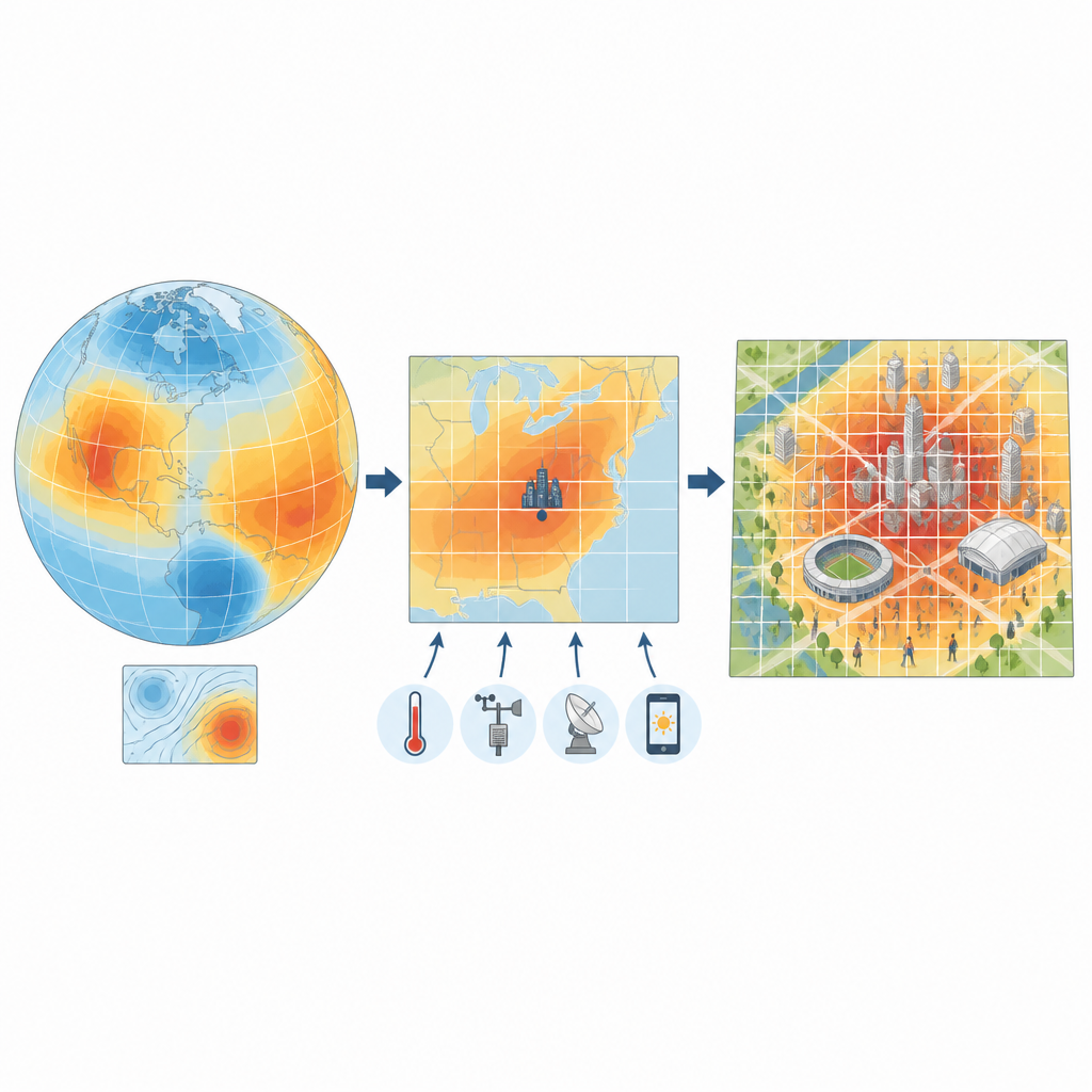
As heatwaves grow more frequent and intense, cities hosting big summer events need to know not just if it will be hot, but how hot it will feel in specific neighborhoods, and with enough warning to protect athletes, staff, and spectators. This study asks whether we can sharpen week‑ahead temperature forecasts, which are produced on very coarse global grids, into detailed local maps that are actually useful for planning around extreme heat during events like the Paris 2024 Olympic and Paralympic Games.
From global maps to neighborhood detail
Modern climate forecast systems can predict temperature weeks in advance, but they see the world in blocks around 100 kilometers wide. That blurs out the differences between a shaded park, a dense city center, and nearby countryside. The authors explore “statistical downscaling,” a family of methods that blend these coarse forecasts with detailed historical records at about 5‑kilometer resolution. Using past simulations from a US forecast model and a high‑resolution European dataset, they test whether information from the large grid can be translated into sharper local pictures without losing, and ideally improving, the original forecast skill.
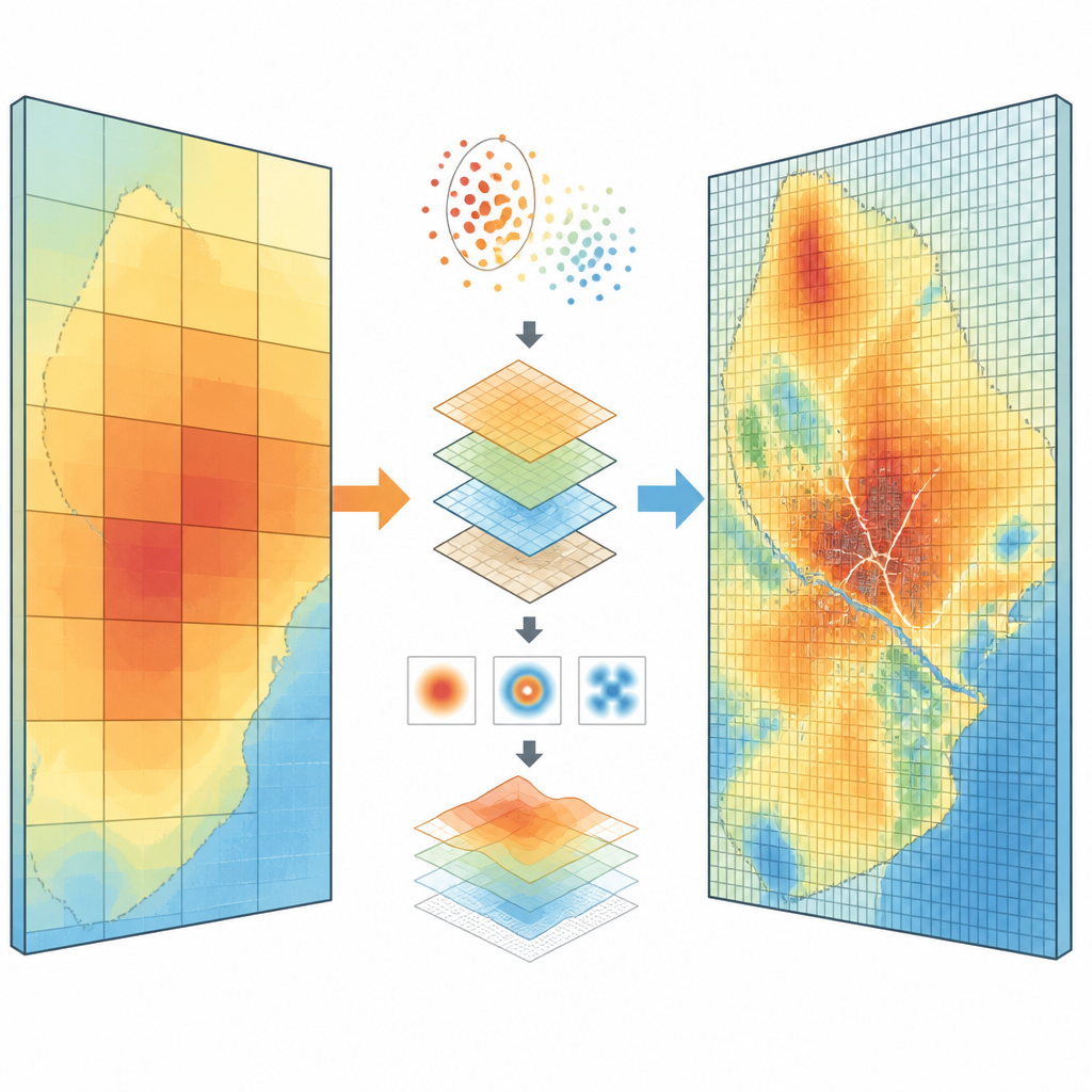
Testing many routes to a sharper forecast
The team compares 27 different ways of doing this translation, grouped into four families: simple corrections that adjust the average and spread of model forecasts, straight‑line relationships between model and local temperatures, methods that predict the odds of very hot or very cold weeks, and “analogs,” which search the archive for past days that looked similar in the broader weather pattern. They build and test these methods for three Olympic‑period weeks, and for forecasts made one to four weeks ahead. To get enough data for a robust test, they use an “extended window” around each target week, pulling in the two weeks before and after so that subtle seasonal shifts are better captured.
Following the big weather patterns
Some of the most successful methods do more than just look at local temperature. They also consider broad pressure patterns over the North Atlantic that shape summer heat in western Europe. By grouping days into recurring “weather regimes” based on these pressure maps, the methods can focus their search for past analogs on days that shared a similar large‑scale setup. When the forecast model predicts these patterns well, and when those patterns are known drivers of local heat, the downscaled forecasts can outperform both raw model output and a simple “climatology” baseline, especially for high‑end hot weeks three to four weeks ahead.
Daily detail is not always better
It is tempting to think that using daily data would give a better handle on extremes than working with weekly averages. Surprisingly, when skill is judged on weekly heat events, methods trained directly on weekly values often do better than those built on daily data and then averaged. The authors argue that at subseasonal lead times the important thing is to represent the weekly background state and its relationship to large‑scale drivers, rather than day‑to‑day noise that the model struggles to predict. Simple weekly analog methods that scan the wider region can therefore compete with, and sometimes beat, more complex designs, while also keeping computational costs modest.
What this means for planning around heat
Overall, the study finds that statistical downscaling can usually preserve the skill of coarse subseasonal forecasts when converting them to local scales, and in some cases can add extra value for extreme hot weeks. However, no single method is best in all situations: performance depends on forecast lead time, the specific week, and which aspect of extremes is being judged. Methods that tap into large‑scale weather patterns shine when those patterns are predicted well, while simple weekly analogs and neighborhood‑based regressions offer robust, low‑complexity options. For decision‑makers, the key message is that finer maps are not automatically better; the choice of downscaling method must be made carefully if local forecasts are to reliably support heat‑risk planning weeks in advance.
Citation: Duzenli, E., Ramon, J., Torralba, V. et al. Assessing the utility of statistical downscaling for subseasonal temperature forecasts. Sci Rep 16, 15127 (2026). https://doi.org/10.1038/s41598-026-45067-2
Keywords: subseasonal forecasting, heatwaves, statistical downscaling, temperature extremes, weather regimes