Clear Sky Science · en
Optimizing urban development through identification of urban fringe areas and construction of ecological security pattern
Where city and countryside meet
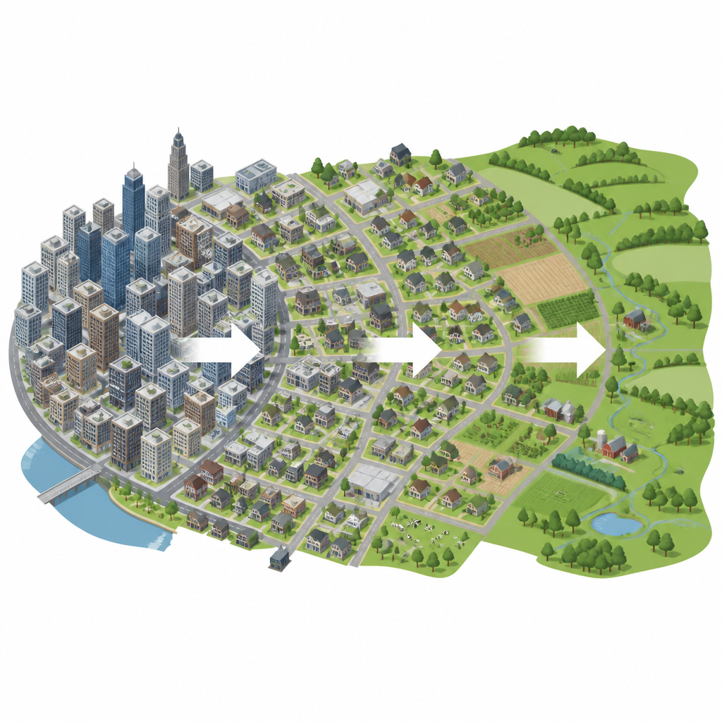
On the outer edge of big cities, busy streets give way to farm fields, rivers and wooded hills. These in-between zones are often messy, fast changing and easy to overlook. Yet they are where much of a city’s growth happens, and where nature either survives or is squeezed out. This study focuses on Beijing’s urban fringe to ask a simple question with big consequences: how can a growing city expand while still keeping healthy green spaces and wildlife corridors around it?
Why the urban edge matters
The urban fringe is the transition belt between dense city blocks and rural land. It acts like a protective buffer for the wider region, helping to store water, support wildlife and clean the air. As people move into cities and construction spreads outward, this zone experiences rapid shifts in land use, rising traffic and more pollution. If it is not planned carefully, the fringe can become a patchwork of scattered housing, wasted land and damaged ecosystems that weaken the health of the entire city.
Using city streets as a measuring grid
To understand Beijing’s fringe more precisely, the researchers turned the city’s road network into a detailed grid. Instead of laying a simple square “fishing net” over a map, they cut the city into units bounded by real roads of different types. For each unit they calculated clues to how urban it is, such as building density, vegetation cover, lights at night, population and the mix of shops and services. A statistical method turned these clues into a single urbanization score, which falls from very high in the center of Beijing to much lower toward its outskirts.
Teaching a model to find the urban fringe
With this road-based map and its urbanization scores, the team marked out where city, countryside and the in-between fringe are most likely to lie. They then trained a machine learning model to recognize these patterns, so it could classify every grid unit in Beijing as city core, rural area, mountain, or urban fringe. The model reached high accuracy and revealed that Beijing’s fringe forms a belt around the main built-up area, especially in Shunyi, Changping, Tongzhou, Daxing and Fangshan. These zones are mostly flat, dominated by farmland and hard surfaces, and cover about one eighth of the city’s land.
Finding fragile green zones and hidden pathways
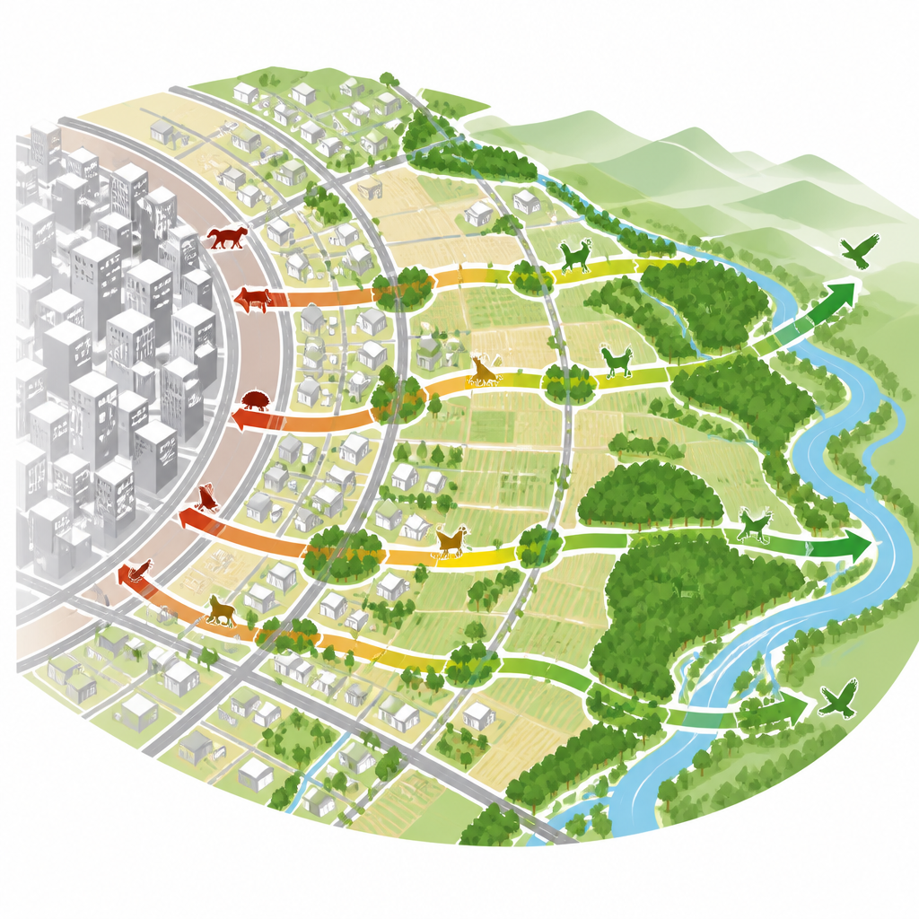
Identifying the fringe was only the first step. The authors then asked which parts of this belt are most sensitive to disturbance and most important for connecting wildlife habitats. They looked at factors like elevation, slope, distance to rivers and lakes, and land use to rate how easily these areas could be harmed. Forests and river corridors, especially along the Chaobai River and around major reservoirs, stood out as highly sensitive. Using a landscape connectivity analysis, they then pinpointed patches that both shelter nature and help link different green areas together. In total, they found 28 key “source” patches clustered near hills and waterways, linked by 37 potential ecological corridors.
Designing a safety net for nature
To see how easily plants and animals might move through the fringe, the team built a “resistance” map. Natural features like water and forest offered low resistance, while dense housing, major roads and crowded districts posed high resistance. A path-finding model traced the least resistant routes between important green patches, outlining the corridors that could keep wildlife flowing despite urban growth. The results show that the strongest network of corridors lies in the northern and southwestern fringe, while eastern and southern sections have fewer green links and higher barriers.
What this means for future cities
For non-specialists, the message is clear: the city’s outer ring is not just leftover land waiting to be filled. It is a living safety belt that can either protect Beijing’s rivers, forests and parks or cut them into isolated islands. By using real movement patterns, fine-scale data and smart modeling, this study offers city planners a clearer picture of where to guide new building, where to restore wetlands and forests, and where to leave space for wildlife to move. In simple terms, it shows how a city can grow while still breathing through a carefully planned green edge.
Citation: Zhong, Y., Zhu, X., Zhang, T. et al. Optimizing urban development through identification of urban fringe areas and construction of ecological security pattern. Sci Rep 16, 14792 (2026). https://doi.org/10.1038/s41598-026-44792-y
Keywords: urban fringe, ecological security, Beijing, green corridors, urban planning