Clear Sky Science · en
Geospatial assessment of activity concentrations of natural radionuclides and absorbed dose rates in gidan-kwano, minna, nigeria using airborne radiometric data
Why Watching Invisible Radiation Matters
All of us live in a constant drizzle of natural radiation coming from the ground and from space. Most of the time it is too weak to notice, but changes in the landscape—such as new mines, expanding cities, or large construction projects—can disturb naturally radioactive minerals in soil and rock. This study focuses on Gidan-Kwano, a fast-growing university area in Minna, Nigeria, where small-scale mining has raised questions about long-term health risks. By using instruments mounted on an aircraft, the researchers mapped how natural radiation is spread across the region and asked a simple question with big implications: is it safe to live, work, and study here?
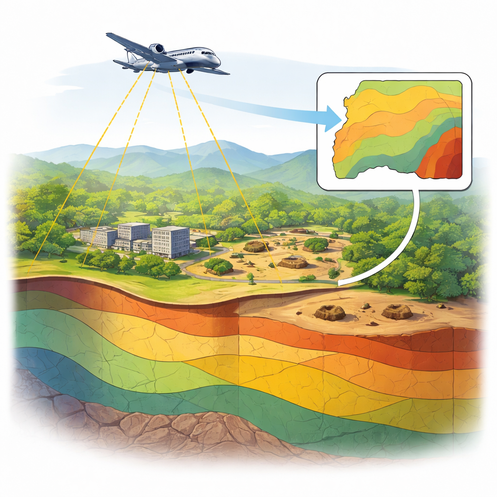
Checking the Ground from the Air
Instead of measuring radiation by walking from spot to spot with handheld instruments, the team drew on high-resolution survey data collected by the Nigerian Geological Survey Agency using a low-flying aircraft. On board, a sensitive detector picked up gamma rays—high-energy light given off by naturally occurring elements such as uranium, thorium, and potassium in the top layer of soil and rock. From these signals, the scientists estimated how much of each radioactive element is present, then converted those values into radiation dose rates, which indicate how much energy people could absorb per hour while standing at ground level.
A Landscape Shaped by Rock and Weather
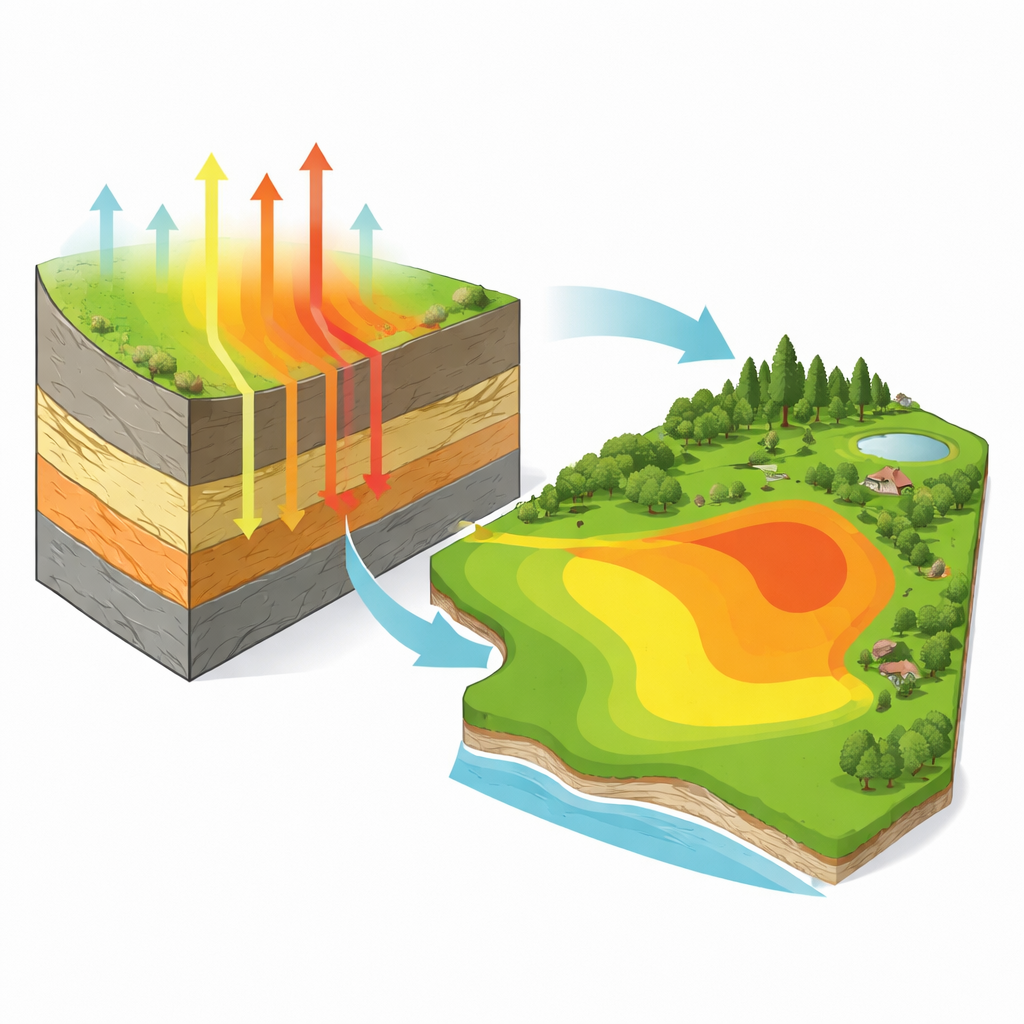
The study area includes the Federal University of Technology, Minna campus and surrounding land where informal mining has taken place. Geologically, the region is split: the north is underlain by hard crystalline rocks like granite and gneiss, while the south is dominated by softer sedimentary rocks and river deposits. Seasonal winds also play a role. Dry-season Harmattan winds can loft fine dust, potentially carrying radioactive particles over long distances, while wet-season rains tend to wash dust out of the air. By feeding the airborne data into mapping software, the researchers created color-coded contour and isodose maps that show how the activity of uranium, thorium, and potassium, and the resulting radiation doses, vary from place to place.
Patchy Hotspots, Overall Low Risk
The maps revealed clear patterns tied to the underlying geology. Potassium activity was highest over the northern and northwestern parts of the area, where granite-rich rocks are common, and lower over the sandy and alluvial soils to the south. Uranium was mostly low but showed small zones of enrichment in the northeast and near the southern boundary, likely where minerals had accumulated in certain rock layers or river sediments. Thorium was fairly even across much of the area, with a notable peak in the west, reflecting the presence of thorium-bearing minerals in basement rocks. When these three elements were combined to calculate radiation dose rates, the highest values clustered over the western and northwestern zones, echoing the transition from sedimentary ground to older, harder rocks.
Putting the Numbers into Human Terms
Although the maps show real variations, the actual dose levels were reassuring. Across Gidan-Kwano, absorbed dose rates ranged from 18 to 69 nanograys per hour, with an average of 32—well below the global reference value of 59 for natural background radiation. In other words, the typical resident or student in this area is not exposed to unusually high natural radiation compared with people elsewhere in the world. Interestingly, statistical analysis showed that potassium, despite contributing less to the absolute dose than uranium or thorium, strongly controls how dose rates change from place to place. When the team compared their airborne-based dose estimates with earlier ground measurements, the match was only modest, reflecting differences in distance from the source, small-scale variations on the ground, and the fact that aircraft measurements smooth out local details.
What This Means for People on the Ground
The study concludes that Gidan-Kwano currently faces low radiological risk from natural sources, even though certain spots have somewhat higher radiation tied to specific rock types. These results provide an important baseline before further mining or development takes place. If future activities disturb the soil and generate more dust, new measurements can be compared with this baseline to spot worrying changes early. The work also shows that airborne surveys are powerful tools for keeping an eye on radiation over large areas, helping planners and regulators protect communities while allowing responsible use of the land.
Citation: Shittu, H.O., Olarinoye, I.O., Kolo, M.T. et al. Geospatial assessment of activity concentrations of natural radionuclides and absorbed dose rates in gidan-kwano, minna, nigeria using airborne radiometric data. Sci Rep 16, 14126 (2026). https://doi.org/10.1038/s41598-026-44462-z
Keywords: natural radiation, airborne survey, uranium and thorium, environmental monitoring, mining impacts