Clear Sky Science · en
Study on the genesis mechanism of geothermal resources in the Yunkai area, South China based on geophysical data
Why underground heat matters here
Across the Yunkai mountains of South China, clusters of natural hot springs bubble to the surface, hinting at powerful heat sources hidden deep underground. In a region that is both densely populated and hungry for clean energy, understanding where this heat comes from and how it travels could turn a natural curiosity into a reliable, low‑carbon energy resource. This study uses subtle variations in Earth’s gravity field, rock samples, and computer simulations to piece together a clear picture of how geothermal resources form and where the best prospects for development lie in the Yunkai area.
A landscape shaped by faults and ancient rocks
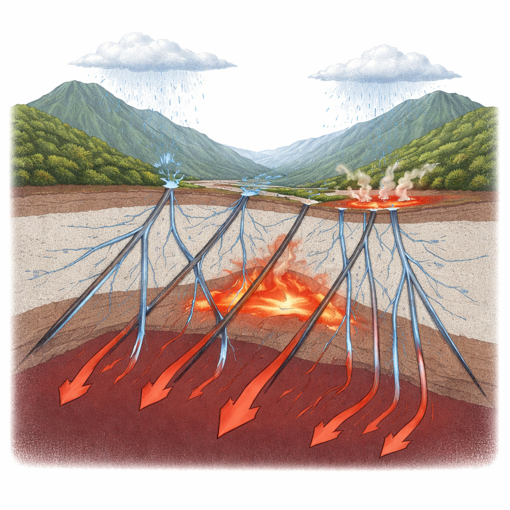
The Yunkai region sits at a geological crossroads where two major crustal blocks meet and have been squeezed, stretched, and reshaped over hundreds of millions of years. These long‑lasting tectonic forces fractured the crust with deep faults and allowed large bodies of molten rock, mainly granite, to rise and harden at depth. Today, these ancient granites lie a few to more than ten kilometers below the surface and are rich in naturally radioactive elements such as uranium, thorium, and potassium. As these elements slowly decay, they release heat, turning the granites into long‑lived underground radiators. At the same time, the region’s network of northeast‑ and northwest‑trending faults serves as a plumbing system, guiding hot fluids toward the surface and helping to localize hot springs along fault intersections.
Reading Earth’s gravity to map hidden structures
Direct drilling data in Yunkai are scarce, so the researchers turned to Earth’s gravity field to map subsurface structures. Small changes in gravity reveal contrasts in rock density, which can be analyzed in the frequency domain to estimate the depth of key layers in the crust. By separating broad, deep signals from shallower ones, and then examining how gravity changes horizontally and vertically, the team traced the edges of dense and less‑dense bodies and outlined major faults. They also applied a technique called Euler deconvolution to estimate the depths of these features. The results show that most faults reach only the upper few kilometers, but some deep‑seated faults in the southwest cut down beyond 8 kilometers. Intrusive bodies are typically rooted between 6 and 8 kilometers deep, with especially deep granite centers below 10 kilometers, probably linked to past upwelling of hot mantle material beneath the region.
Granite as a slow but powerful heat source
To understand how much heat these intrusions produce, the team compiled data from 56 granite samples across the region. Using measured contents of radioactive elements, they calculated how much heat each rock unit generates. The values are high by global standards: between about 1.9 and 6.0 microwatts per cubic meter, with an average of 3.4. Some plutons, such as the Shicun body, are especially “hot,” with average production above 5.0. Because granites tend to concentrate these elements in the upper crust, their combined effect is to boost regional heat flow well above the Chinese and global continental averages. Observations show that hot springs cluster near large granite bodies and along major faults, confirming that these radiogenic granites act as key heat sources that warm circulating groundwater and sustain the observed geothermal anomalies.
How rainwater becomes a hot spring
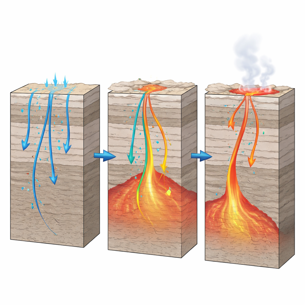
Using the mapped structures and measured rock properties, the researchers built two‑dimensional computer models of heat conduction across representative cross‑sections of the crust. They set realistic boundary temperatures and thermal conductivities, then checked their results against independent estimates of the depth where magnetic minerals lose their magnetism, a temperature around 550 °C. The modeled temperatures matched these independent depths, lending confidence to the simulations. Combining these thermal profiles with water chemistry and isotope data, the authors propose a clear cycle: rain and mountain runoff seep into the ground and follow fractures and major faults downward, sometimes to depths of several kilometers. Along the way, the water is heated by the surrounding warm crust and especially by high‑heat‑producing granite bodies. Buoyant, pressurized hot fluids then rise back up along the same or intersecting faults, mix with cooler shallow groundwater, and finally emerge as clusters of hot springs where fault zones cross and open near the surface.
Where the best geothermal prospects lie
The study concludes that the southeastern part of the Yunkai area offers particularly promising conditions for high‑temperature geothermal development. There, the models indicate that temperatures of about 150 °C can be reached at depths of roughly 4.5 kilometers or less, shallow enough to be attractive for power generation or large‑scale heating. In simple terms, the combination of deep, well‑connected faults, heat‑rich granite intrusions, and ample rainfall creates a natural underground boiler system that focuses hot water into specific zones. By showing how rainwater, rock, and deep Earth heat interact in this setting, the work provides a scientific roadmap for locating and responsibly tapping geothermal resources in Yunkai and in similar fault‑controlled regions worldwide.
Citation: Zhou, Y., Qiu, N., Zhu, C. et al. Study on the genesis mechanism of geothermal resources in the Yunkai area, South China based on geophysical data. Sci Rep 16, 13876 (2026). https://doi.org/10.1038/s41598-026-44329-3
Keywords: geothermal energy, hot springs, fault systems, granite heat production, Yunkai South China