Clear Sky Science · en
Key natural influences on groundwater storage changes in Central and Southern Arizona
Why this hidden water story matters
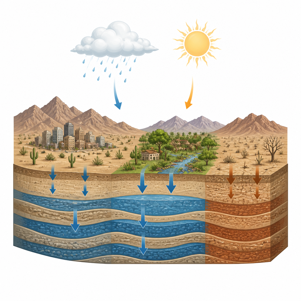
Millions of people and farms in Central and Southern Arizona depend on water we cannot see: groundwater stored in deep layers of sand and gravel. As the Colorado River faces historic shortages and the region bakes under rising temperatures, that underground reserve has become both a lifeline and a pressure point. This study asks a simple but vital question: how much of the recent drop in groundwater is due to natural swings in climate, and how much reflects the way we use and manage water? The answer matters for every community that hopes to keep taps running and crops growing in a hotter, drier future.
Watching water from space
The researchers combined two powerful tools to track underground water across Central and Southern Arizona from 2004 to 2021. First, they used NASA’s GRACE and GRACE Follow-On satellites, which sense tiny changes in Earth’s gravity as water moves around the planet. By subtracting the effects of snow, soil moisture, and surface water, the team isolated changes in groundwater storage over time. Second, they used a high-resolution computer system that simulates natural water and energy flows at the land surface, including rainfall, evaporation, runoff, and soil moisture. Together, these data sets allowed them to link what the satellites saw underground with what the climate was doing at the surface.
Different basins, different fates
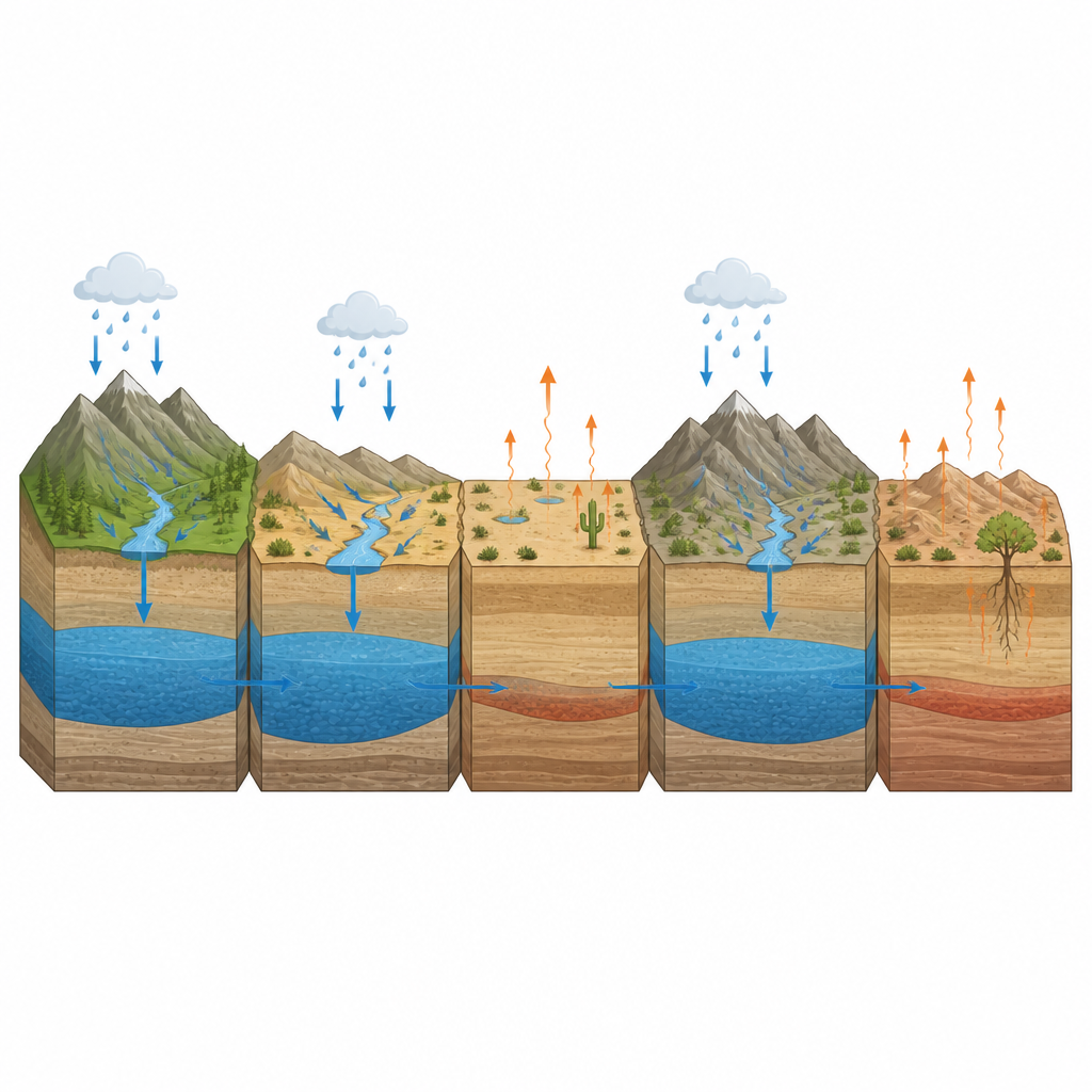
The analysis revealed a striking patchwork rather than a single regional story. In many southern and southeastern basins, groundwater levels showed strong, steady declines that were not being balanced by recharge from rain and runoff. These loss hotspots also tended to have rising temperatures and stronger signs of evaporation and plant water use, suggesting that heat-driven demand is pulling more water out of the ground and into the air. In contrast, some northern and central basins showed weaker declines or more stable conditions. There, changes in groundwater tracked more closely with natural inputs like precipitation, deep soil moisture, and slow seepage from the subsurface, hinting at greater natural recharge capacity or support from managed recharge projects.
Sorting patterns with smart statistics
To make sense of this complexity, the team used statistical methods to tease out shared modes of behavior among dozens of groundwater basins. They examined how well groundwater changes lined up with different surface variables and reduced this web of relationships to a few main patterns. One pattern captured the overall strength of the link between climate swings and groundwater. Others separated basins where recharge processes dominate from those where losses to the atmosphere or rapid runoff are more important. Using these patterns, the researchers grouped subbasins into four clusters: recharge-dominated, recharge-responsive, mixed, and loss-dominated. Loss-dominated basins, mostly in the south, showed weak natural recharge signals and strong ties to evaporation, while recharge-dominated basins in the north-central corridor responded more directly to rainfall and subsurface runoff.
Where people and climate collide
Importantly, the satellites sense all changes in underground water, whether they come from nature or from human activity such as pumping and artificial recharge. In contrast, the land-surface model only represents natural processes. Where the two disagree most strongly, such as in heavily managed areas near Phoenix and Pinal, the mismatch points to a big human fingerprint. By comparing patterns across basins, the study estimates that natural climate-driven variability explains only about 16 percent of the differences in long-term groundwater trends from place to place. Within that natural slice, evaporation, rainfall, and subsurface runoff are the biggest contributors. The rest of the variation likely reflects pumping, recharge projects, local geology, and remaining data uncertainties, underscoring how strongly people now shape groundwater outcomes.
Guiding smarter water choices
For non-specialists, the key takeaway is that not all aquifers in Central and Southern Arizona are equally vulnerable or equally resilient. Some basins enjoy better natural recharge and may be good candidates for expanded recharge projects, if those recharge zones are protected. Others are already locked into loss-dominated regimes, where high heat, low natural recharge, and heavy withdrawals combine to drive steady declines. The framework developed here does not by itself prove how much water humans have removed, but it clearly maps where climate and groundwater are tightly linked and where management choices dominate. That map can help policymakers target conservation, pumping limits, and recharge investments to the places that need them most as the Colorado River’s future becomes more uncertain.
Citation: Mohajer, B., Famiglietti, J.S., Chandanpurkar, H.A. et al. Key natural influences on groundwater storage changes in Central and Southern Arizona. Sci Rep 16, 14859 (2026). https://doi.org/10.1038/s41598-026-44132-0
Keywords: groundwater, Arizona, GRACE satellites, drought, water sustainability