Clear Sky Science · en
Projecting groundwater flood risk in a lowland karst system under future climates
Why rising underground floods matter
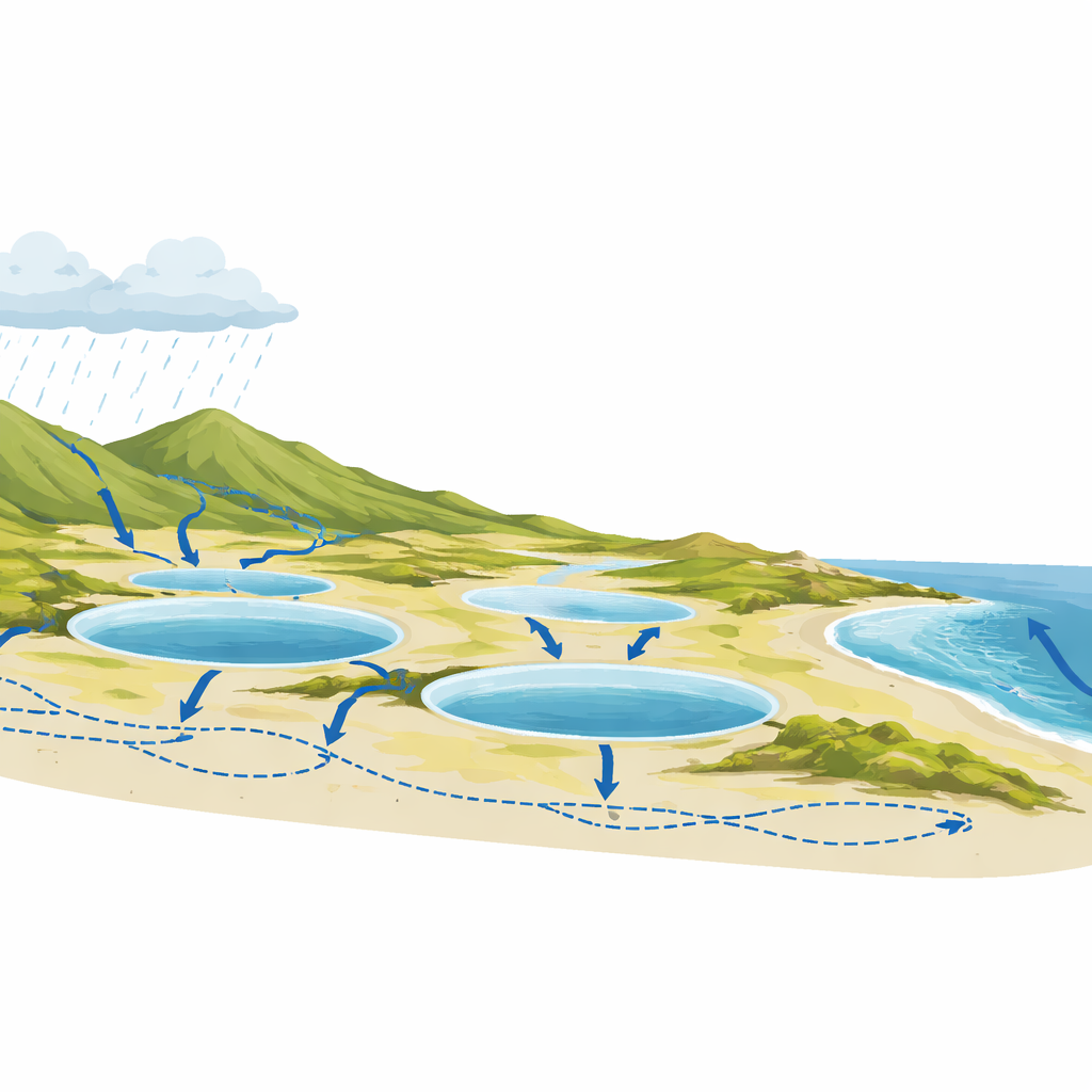
When we picture floods, we usually imagine rivers bursting their banks or storm waves crashing over sea walls. But in parts of western Ireland, floods can rise silently from below, as groundwater fills natural hollows in the limestone landscape to create temporary lakes called turloughs. This study explores how those hidden floods are likely to change as the climate warms, using advanced computer modelling to peer ahead to the end of the century and to help communities plan for a wetter future.
A landscape shaped by rock, rain and tides
The research focuses on a low-lying karst region that drains into Galway Bay. Here, rain falling on nearby hills seeps into cracks and tunnels in the underlying limestone and re-emerges in shallow depressions that periodically fill with water. These natural basins connect to the sea through the underground system, so ocean tides can subtly raise or lower groundwater levels inland. Because much of the action happens out of sight, and because water can move quickly through this maze of passages, floods are hard to predict using traditional river-based models.
Teaching a smart model to follow the water
To untangle this complexity, the authors built a machine-learning model known as a Bayesian neural network. They trained it on nearly a decade of real measurements: daily rainfall, sea-level changes at Galway Port, and the combined water volume stored across five monitored turloughs. The model learned not only how today’s rain and tide affect flooding, but also how the previous few days of wet or dry weather prime the system. Tests on data that were not used for training showed that the model reproduced observed flood volumes very accurately, although it tended to be cautious about the very largest floods, meaning its most extreme projections are likely on the conservative side.
Looking ahead under different warming paths
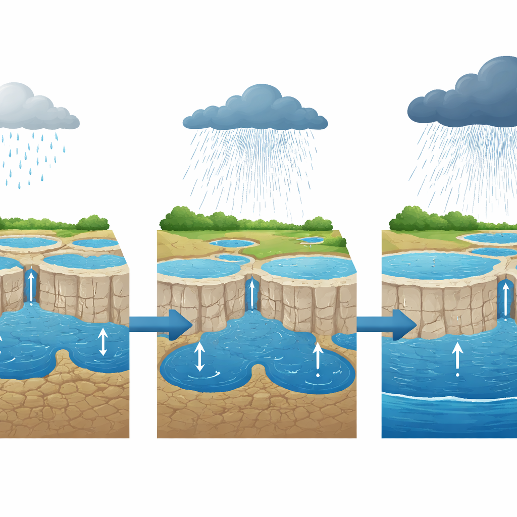
Armed with this trained model, the team fed in future rainfall projections from a suite of regional climate simulations, along with tidal conditions, for the years 2016 to 2100. They examined two greenhouse gas pathways: one in which global emissions level off (RCP 4.5), and another in which they keep rising strongly (RCP 8.5). Across eleven different climate realisations, both futures showed more groundwater flooding over time, but the high-emissions path stood out. Heavy-rain periods became wetter, the ground entered flood-prone states more often, and turlough flood volumes increased faster, especially in winter and the surrounding “shoulder” months.
How short bursts and background wetness trigger floods
The study also probed what actually drives the most damaging events. By comparing flood peaks with rainfall totals over the days and weeks before each event, the authors found that rain falling in the few days immediately beforehand matters most. Longer build-ups still play a role, but short, intense bursts on already damp ground are the key trigger. Over the decades, the high-emissions scenario produced noticeably wetter “starting conditions” before storms, so that the same kind of downpour that used to cause only minor flooding is more likely to generate large, joined-up lakes across the landscape.
Patterns in time: when sea and sky conspire
To see how different influences line up over months to decades, the team used a technique that teases out relationships across multiple time scales. Rainfall emerged as the main driver of groundwater flooding in all cases, with its grip strengthening as the climate warmed. Tidal effects were weaker but became more important in the high-emissions world, especially over multi-year periods, as higher sea levels made it harder for groundwater to drain seaward. Extreme-event analysis added another warning sign: storms that used to be expected only once in a century could occur on the order of every 16 years by late century under continued high emissions.
What this means for people and planning
For residents, farmers, and planners in lowland karst regions, the message is clear. Even without dramatic river overtopping, floods from below are likely to become deeper, more frequent, and more widespread as the planet warms, particularly if emissions remain high. The study shows that combining detailed local measurements, sophisticated machine learning, and climate projections can reveal how often dangerous groundwater floods may occur in the future. That knowledge can guide the design of roads, homes, drainage systems, and emergency plans that are robust not just for today’s climate, but for the far wetter decades that may lie ahead.
Citation: Tabbussum, R., Basu, B., Morrissey, P. et al. Projecting groundwater flood risk in a lowland karst system under future climates. Sci Rep 16, 13935 (2026). https://doi.org/10.1038/s41598-026-43701-7
Keywords: groundwater flooding, karst landscapes, climate change, flood risk, Ireland