Clear Sky Science · en
Experimental and numerical study on movement and accumulation behaviour of rock avalanche by simulating actual 3D terrain conditions
Why fast-moving rock slides matter
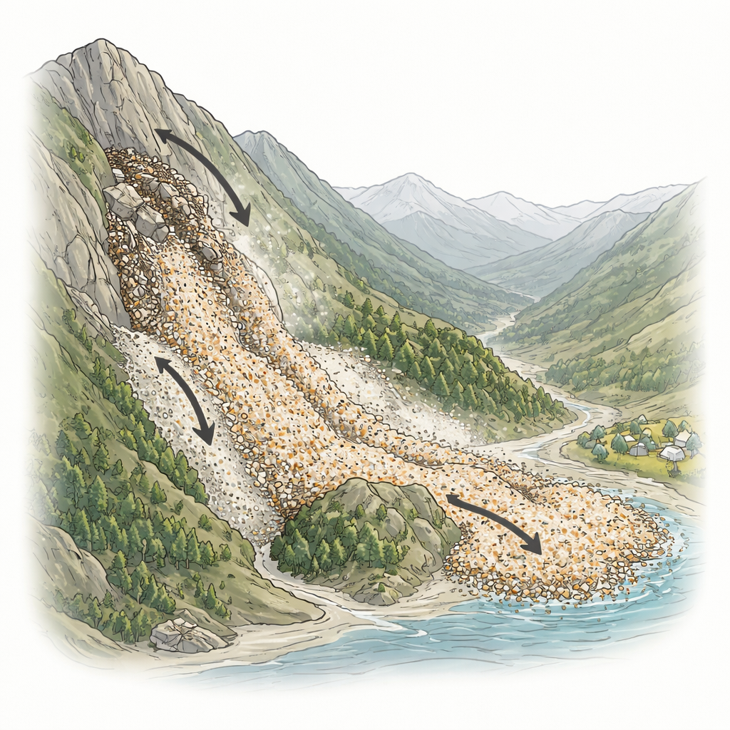
When a mountainside suddenly collapses, the falling rock can behave less like a pile of boulders and more like a rushing fluid. These rare but devastating events, called rock avalanches, can race for kilometers, bury villages in seconds, and are difficult to predict. This study looks closely at one deadly rock avalanche in southwest China and asks a practical question: how do real, three-dimensional landforms shape where all that broken rock finally goes?
Recreating a deadly slide on a lab bench
The researchers focused on a 2017 disaster near a village in Nayong County, Guizhou Province, where a huge slab of limestone broke loose from a steep mountainside and ran out more than half a kilometer, killing dozens of people. Instead of using a simple straight chute, as many earlier experiments did, they built a scaled physical model that closely copied the actual ups and downs of the real valley. Using detailed elevation data from before and after the event, they cut and assembled a three-dimensional terrain from boards, filled and smoothed it with mortar, and checked its shape with a laser scanner to keep height errors extremely small.
Rolling stones and colorful gravel
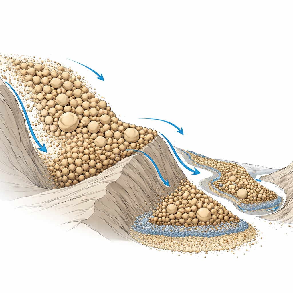
To imitate the moving debris, the team used natural limestone gravel of four different sizes, each dyed a different color. This allowed them to see how small and large pieces sorted themselves out as they flowed. They released carefully measured volumes of gravel from the modelled source area and filmed how the grains raced downslope, split around a small hill, and finally came to rest in the valley. By repeating runs with different single grain sizes, mixtures of sizes, total volumes, and one big release versus several smaller ones, they could tease apart how each factor affected the distance travelled and the final shape and thickness of the deposit.
What terrain and grain size do to a slide
The experiments showed that the shape of the ground strongly controls where the debris ends up. No matter how the material was arranged at the start, the gravel tended to settle in valleys, and all of the deposits ended up with similar outlines that wrapped around the small hill. Larger grains flowed more easily and produced longer runouts, but they also formed thinner piles. When different grain sizes were mixed together, the behavior became more subtle. Earlier straight-chute tests had suggested mixtures always move more freely than single sizes. In this realistic terrain, however, mixing did not always increase mobility. Finer grains tended to sift downward and pile up quickly when the flow met an obstacle, locking the larger grains in place and limiting how far the whole mass could travel.
How much rock and how often it falls
The amount of material released turned out to matter mainly for how big and tall the final deposit was, not for how far its front edge reached. Larger releases created thicker and wider piles, but the leading edge of the flow moved only slightly farther. By contrast, breaking the same total volume into several separate batches—mimicking a series of smaller collapses before a major one—shortened the runout noticeably. Earlier deposits at the foot of the slope acted like a barrier, causing later material to stack up higher and stop sooner. This insight is especially relevant in real mountain valleys where smaller slides often precede a catastrophic failure.
Putting numbers on a dangerous process
Because small-scale experiments cannot capture every detail of a natural disaster, the team also built a computer model of the Nayong event using specialized software that treats the rock mass as many interacting particles. They calibrated the tiny numerical grains so that, in virtual strength tests, they behaved like the real limestone from the site. The digital terrain matched the mapped valley, and the initial block of rock matched the estimated volume and grain-size spread. In the simulation, the sliding mass accelerated to almost 50 meters per second, then slowed as it crossed the small hill and spread into the valley. The timing, maximum speeds, and final deposit shape agreed well with field surveys carried out after the real avalanche, giving confidence that the combined lab-and-computer approach can reproduce such events.
What this means for people living below steep slopes
In plain terms, this work shows that the path and resting place of a rock avalanche depend as much on the fine details of the landscape and the mixture of grain sizes as on the total volume of rock. Valleys act as traps, small obstacles can split and redirect flows, and earlier small slides can both feed and partially block later ones. By using realistic terrain models to tune computer simulations, scientists can better estimate how fast and how far future rock avalanches might travel. That, in turn, can help planners map hazard zones more accurately and design safer locations for roads, houses, and infrastructure in mountainous regions.
Citation: Shi, F., Wang, Z., Zhang, X. et al. Experimental and numerical study on movement and accumulation behaviour of rock avalanche by simulating actual 3D terrain conditions. Sci Rep 16, 14346 (2026). https://doi.org/10.1038/s41598-026-43592-8
Keywords: rock avalanche, landslide hazards, mountain terrain, granular flow, numerical simulation