Clear Sky Science · en
Settlement heritage on the Coastal Peninsula: an investigation of the spatiotemporal evolution of Shandong Province via GIS
Why ancient village patterns still matter today
Imagine standing on a windswept headland of China’s Shandong Peninsula, looking inland across hills, rivers, and patchworks of fields—and knowing that people have been choosing where to live here for more than ten thousand years. This study asks a deceptively simple question: how did those choices change over time, and why? By tracing the rise, movement, and clustering of rural settlements from early prehistory to the late imperial era, the authors reveal how climate, rivers, war, trade routes, and government policies quietly reshaped one of China’s most important cultural landscapes.
A coastal crossroads of land and sea
Shandong sits between the Bohai and Yellow Seas and is famed as the homeland of Confucius. It has long been a meeting place of inland farming cultures and maritime trade. Archaeological sites here span from the Paleolithic–Neolithic transition to the dynastic period, recording early farming villages, walled towns, religious centers, and later canal and port communities. Because Shandong’s county boundaries stabilized relatively early, and its traditional villages are unusually well preserved, it offers a rare natural laboratory for following settlement change over nearly two millennia, from before the Sui dynasty up to the end of the Qing in 1912.
Reading history with digital maps
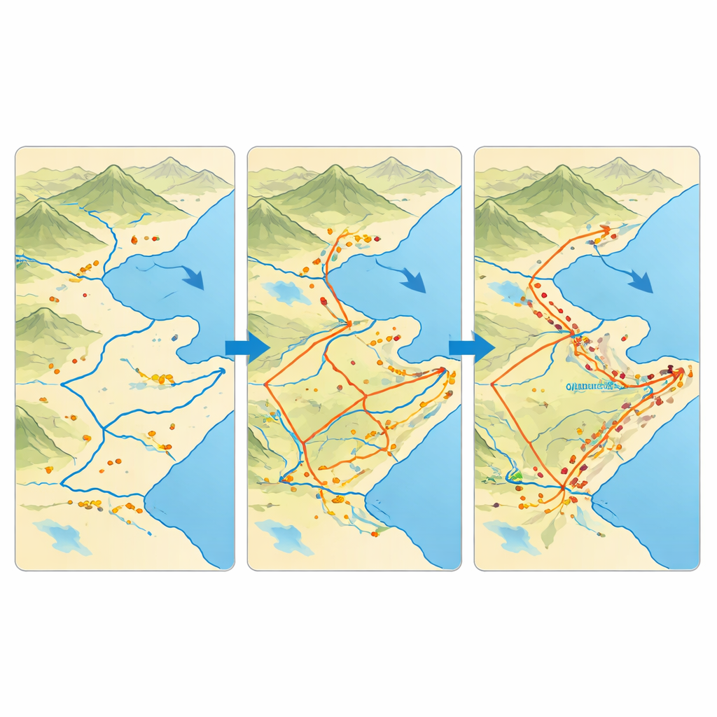
The researchers used modern mapping tools to analyze 580 historically documented settlements divided into five broad periods: pre‑Sui, Sui–Song, Yuan, Ming, and Qing. First, they calculated how close each village is to its nearest neighbor to see whether homes were scattered or clumped together. Next, they smoothed the points into “heat maps” that highlight where settlements were especially dense. Finally, they drew statistical ellipses around each period’s pattern to track the shifting “center of gravity” of village distribution and the main directions of spread. Together, these techniques allowed them to turn scattered historical records, field surveys, and satellite data into a continuous story of how the rural population filled in Shandong’s plains, hills, and coastlines.
From scattered dots to crowded belts
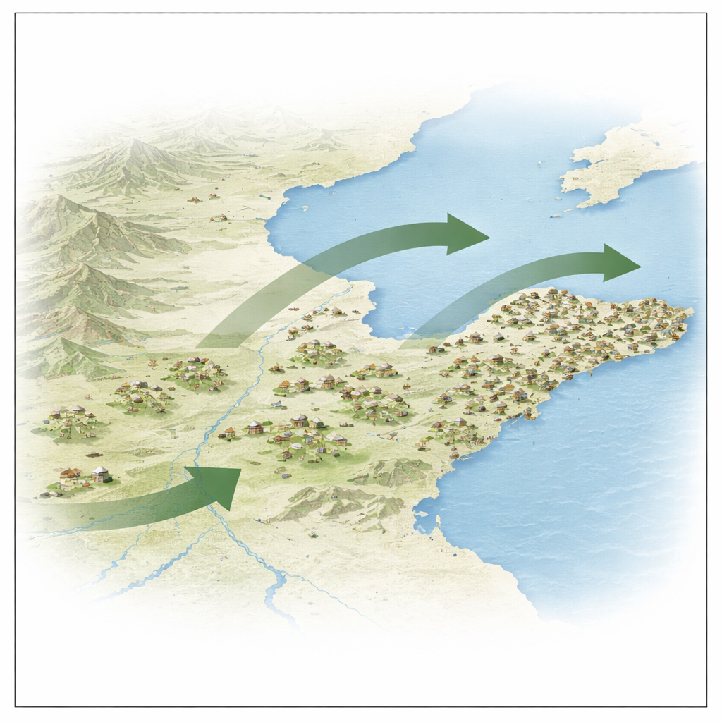
The results show that Shandong’s villages have been clustered rather than random in every period, but the strength and shape of that clustering changed markedly. Early on, settlements formed loose, low‑density points, especially along rivers in the southwest. Over time, especially after the Sui and Tang dynasties unified the region and opened canals, villages thickened into belts following fertile plains and transport corridors. By the Ming and especially the Qing period, dense multi‑core zones had emerged in southwestern and central Shandong and along the Jiaodong coast, reflecting booming agriculture, immigration waves, and the growth of canal and seaport towns. Throughout this long timeline, the overall center of settlement activity drifted from the southwest toward the northeast, mirroring shifts in flood‑prone river zones, political hubs, and new transport routes.
How people, rivers, and power reshaped the land
Behind these patterns lie powerful but familiar forces. Population booms and wartime crashes repeatedly drove people to abandon some villages and found others. Government land systems, tax rules, and state‑organized migrations—especially in the Ming, when more than a million people were resettled into Shandong—created bursts of new rural communities. Changes in the Yellow River’s course flooded some areas while building up others, pushing settlements off vulnerable floodplains and onto safer ground. The opening and later strengthening of major canals and coastal ports turned once‑quiet spots into busy trade hubs, while strategic military outposts along the coast and inland passes anchored strings of nearby villages. Together, these natural, economic, and political pressures explain why villages first scattered along rivers, then thickened into linked belts across plains and coasts.
What this long story tells us today
For a non‑specialist, the main message is that where people live is never random. Over centuries, Shandong’s rural settlements shifted from loose dots to dense networks, marching gradually from southwest to northeast as people sought safety, fertile soil, trade opportunities, and protection under changing regimes. By showing this with clear spatial tools, the study turns old chronicles and ruins into a living map of human adaptation. Understanding that long‑term map can help planners and heritage managers today: it highlights which landscapes still hold deep settlement traditions, where past disasters reshaped the countryside, and how future changes in rivers, coasts, or transport lines might once again redraw the human geography of this coastal province.
Citation: Pan, Z., Huang, Y., Guo, Q. et al. Settlement heritage on the Coastal Peninsula: an investigation of the spatiotemporal evolution of Shandong Province via GIS. Sci Rep 16, 12616 (2026). https://doi.org/10.1038/s41598-026-43557-x
Keywords: Shandong settlements, historical geography, GIS mapping, rural heritage, human-land relations