Clear Sky Science · en
An integrated edge–cloud IoT framework for resilient disaster prevention in fire detection and forest carbon assessment
Why Watching the Forest Matters
As heat waves and megafires become more common, forests are caught in a dangerous loop: hotter, drier conditions make fires more likely, and those fires in turn release huge amounts of carbon, feeding further warming. This study presents a practical, field-tested system that uses networks of sensors, small computers, and satellites to spot forest fires early, guide firefighters in real time, and measure how much carbon forests store and lose after a blaze. It is a glimpse of how digital tools may help protect both local communities and the global climate.
Seeing Trouble Before Flames Spread
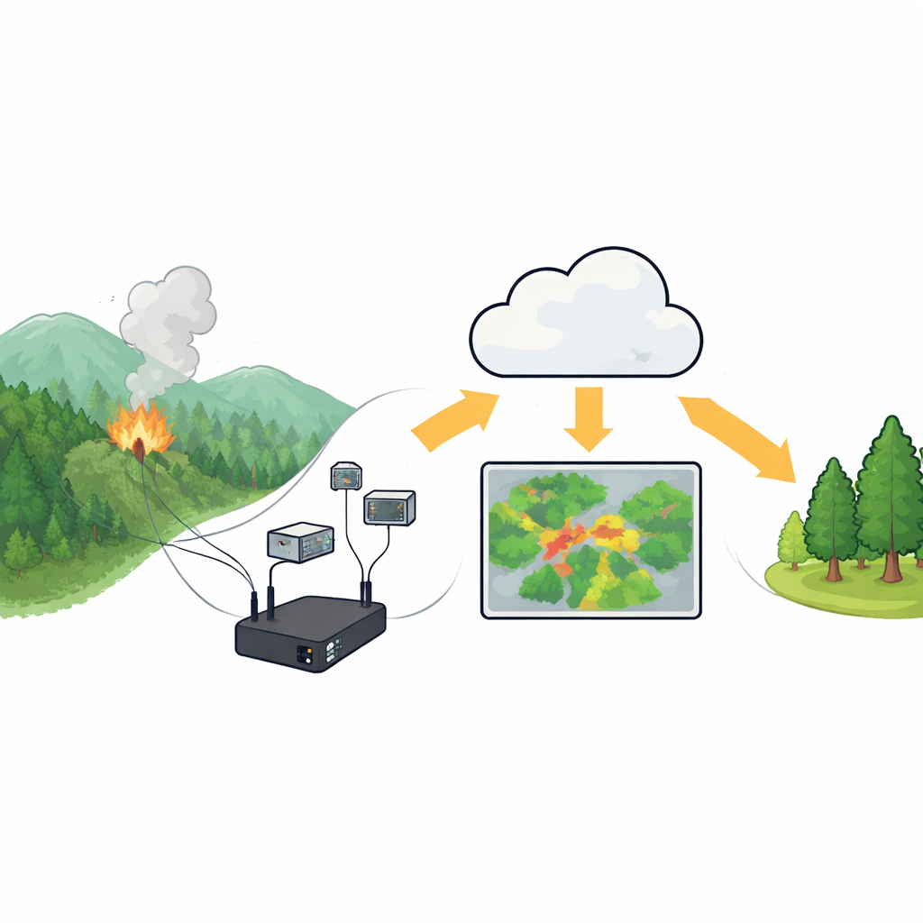
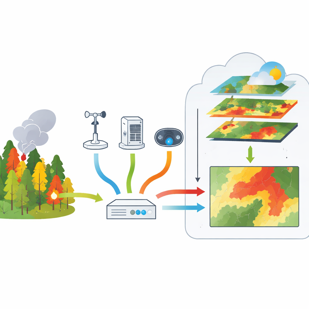
The core idea is to treat a forest like a patient under continuous checkup. On the ground, the team installed weather stations, air-quality sensors, optical cameras, and thermal imagers. These devices track temperature, humidity, wind, smoke, gases, and hot spots that might signal a fire. Small, low-power computers placed near the sensors analyze camera images on the spot, using pattern-recognition software to pick out flames, smoke, and even nearby people. By comparing what the cameras see with local weather and air measurements, the system reduces false alarms, such as mist being mistaken for smoke.
From Remote Hillside to Digital Nerve Center
All of this information must travel quickly to be useful. The system sends data and images over Wi‑Fi, wired internet, or 4G cellular networks, depending on what is available at each site. A flexible power layer keeps everything running: outdoor stations rely mainly on solar panels and batteries, while indoor or roadside units can plug into the grid, all backed by short-term battery backup. In the cloud, the researchers use standard database and dashboard tools to turn the raw streams of numbers and pictures into live charts, maps, and camera views that forest managers can see in a web browser. When danger rises, alerts and snapshots are pushed directly to phones and messaging apps so responders can act within seconds.
Bringing Satellites into the Picture
The system does more than watch for flames; it also looks at how the wider landscape is changing. The researchers tap into imagery from low‑Earth‑orbit satellites, which capture forests in several wavelengths beyond visible light. By tracking how the reflected light changes before and after a fire, they can estimate how much vegetation has dried out, where a blaze actually burned, and how severely it scorched the land. In a 2024 wildfire case in central Taiwan, satellite indicators of greenness and moisture dropped sharply after the event, and a burn‑severity map showed about 11.6 hectares affected, closely matching official reports. These same satellite tools help estimate how much carbon local forests are storing and how much may be released during a fire.
How Well the System Performs in the Field
To test their approach, the team deployed the full setup at a mountain station in Nantou County. Their image-recognition model, tuned to run on compact devices like Jetson Nano and Raspberry Pi, correctly identified flames and smoke in test images with about 85 percent average precision, and detected people in the scene with similar accuracy. A low-cost thermal camera, calibrated in the lab, measured temperatures with less than half a percent average error. The solar-powered weather station operated for a week even in shaded, humid conditions. On the user side, a web portal brought together live sensor readings, on-site video, and animated satellite views showing vegetation trends and fire risk maps over the previous months.
What This Means for Forests and the Climate
In everyday terms, this work shows that an affordable mix of ground sensors, edge computing, mobile networks, and satellites can act like an early warning and health-tracking system for forests. It can spot risky conditions, confirm real fires faster, guide where to send crews, and later measure how badly the land and its carbon stores were hit. While the current results are from a single region and need broader testing, the framework points toward smarter, more resilient fire management in remote areas—helping communities respond faster to danger while keeping vital forest carbon sinks intact.
Citation: Chen, LH., Kolhe, S.S., Hu, J. et al. An integrated edge–cloud IoT framework for resilient disaster prevention in fire detection and forest carbon assessment. Sci Rep 16, 12814 (2026). https://doi.org/10.1038/s41598-026-43053-2
Keywords: wildfire monitoring, forest carbon, Internet of Things, satellite remote sensing, edge computing