Clear Sky Science · en
Mapping and predicting groundwater accumulations using remote sensing and aeromagnetic data: a case study from Bahariya Oasis, Western Desert, Egypt
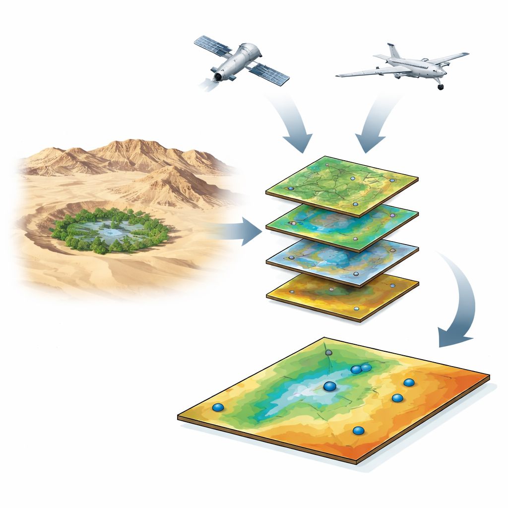
Why water hides under the desert
In Egypt’s Western Desert, a green splash called the Bahariya Oasis survives almost entirely on water stored underground. As farms expand and the climate warms, knowing where that hidden water sits—and how long it might last—has become urgent. This study shows how scientists can “see” beneath the sand by combining satellite images, aircraft-based magnetic surveys, and computer models to map the best places to find and protect groundwater in one of Egypt’s crucial desert oases.
Reading the desert from space
The researchers began by treating the land surface as a giant clue sheet. Using radar, optical, and elevation data from modern satellites, they mapped slopes, dry riverbeds, rock types, soil wetness, vegetation, and land use across Bahariya. Gentle slopes and sandy valley floors tend to let rare rainwater soak in, while steep rocky escarpments shed water quickly. Patches of moist soil and thriving crops betray places where groundwater lies close to the surface. The team also traced long, straight surface features—faults and fractures in the bedrock—that can act like underground plumbing, guiding water into storage zones or cutting it off.
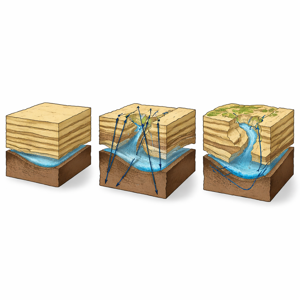
Listening to hidden rocks with magnetism
Surface clues alone cannot reveal how thick the water‑bearing layers are or how deeply the hard basement rock lies. To fill in this missing picture, the scientists reprocessed detailed aeromagnetic data, collected by aircraft measuring tiny variations in Earth’s magnetic field. Because dense, crystalline basement rocks and overlying sediments respond differently to magnetism, changes in the signal outline buried valleys and ridges. The team used advanced filtering and depth‑estimation techniques to draw a three‑dimensional sketch of the subsurface. They found that the basement drops markedly toward the south and southeast of the oasis, creating deep basins filled with thick sedimentary layers that can store large volumes of groundwater.
Blending many clues into a single water map
To turn this jumble of layers into clear guidance, the authors used a decision‑making method called the Analytic Hierarchy Process. In simple terms, they asked: which factors matter most for catching and holding water in such a dry place? Rainfall, though sparse, came first; soil moisture followed as a direct sign of near‑surface water. Slope, rock type, drainage density, vegetation, land use, fault density, and the magnetic map of basement depth were all ranked and combined in a geographic information system. Each 30‑meter patch of land received a groundwater “favorability” score, which was then grouped into zones from moderate to very high potential.
Where the desert is most promising
The resulting map paints a clear pattern. The most promising corridors for groundwater cluster in the southern and southeastern parts of Bahariya, where several conditions align: the land is relatively flat, the surface is covered by permeable sands and alluvial deposits, fractures and faults are abundant, and the magnetic data indicate a deep, sediment‑filled basin beneath. These same areas sit at the mouths of major desert valleys, where occasional flash floods concentrate and can seep downward. When the researchers compared their map to 193 real wells, they found that productive wells strongly cluster in the “very high” and “high” zones. A statistical test known as ROC‑AUC gave the model a score of 93.4%, indicating that it is highly reliable at distinguishing good from poor drilling sites.
What this means for people and planning
For decision‑makers, the study offers more than a pretty map. It provides a practical, region‑wide tool to prioritize where to drill new wells, reinforce existing supplies, and avoid wasting money on dry holes. Just as important, it shows that combining satellite remote sensing with aeromagnetic scans can reveal both the surface pathways that guide rare rainwater and the deep rock architecture that controls long‑term storage. In plain terms, Bahariya’s best chances for sustainable groundwater lie along its southern and southeastern margins, where the land, the fractures, and the deep desert basin work together to hide and hold precious water.
Citation: El-Badrawy, H.T., Abo Khashaba, S.M., Araffa, S.A.S. et al. Mapping and predicting groundwater accumulations using remote sensing and aeromagnetic data: a case study from Bahariya Oasis, Western Desert, Egypt. Sci Rep 16, 10489 (2026). https://doi.org/10.1038/s41598-026-42907-z
Keywords: groundwater, remote sensing, Bahariya Oasis, aeromagnetic, water resources