Clear Sky Science · en
Response of sediment delivery ratio to water-sediment and riverbed boundary conditions during flood events in the lower yellow river since 2000
Why this shifting riverbed story matters
The lower Yellow River in China is famous for its heavy load of mud and sand, and for the devastating floods that have shaped both its course and human history. In recent decades, giant upstream reservoirs have been built to tame those floods and trap sediment. This paper asks a deceptively simple question with big practical consequences: during floods, how much of the sediment that enters the lower river actually makes it out to the sea, and how much settles on the bed and raises flood risk? By linking that balance to both the flood itself and the changing shape of the riverbed, the authors offer tools that can guide safer levees, smarter dam operations, and more stable channels.
Following sand from dam to sea
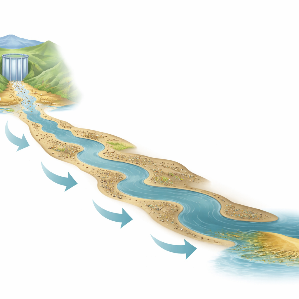
The authors focus on the Lower Yellow River reach downstream of the Xiaolangdi Reservoir, stretching from Tiexie to the coastal town of Lijin. Since Xiaolangdi began operating in 1999, it has trapped huge amounts of sediment and reshaped the balance of water and mud flowing downstream. Using records from 159 flood events between 2000 and 2023, along with hundreds of repeated cross‑section surveys of the channel, the team tracks how floods move through four main reaches and how their cross‑sections, slopes, and bed materials have evolved. Their key yardstick is the “sediment delivery ratio” – the fraction of sediment entering a reach that leaves it again. A ratio above one means the reach is eroding and exporting extra sediment; below one means it is silting up.
How the riverbed has been rebuilt
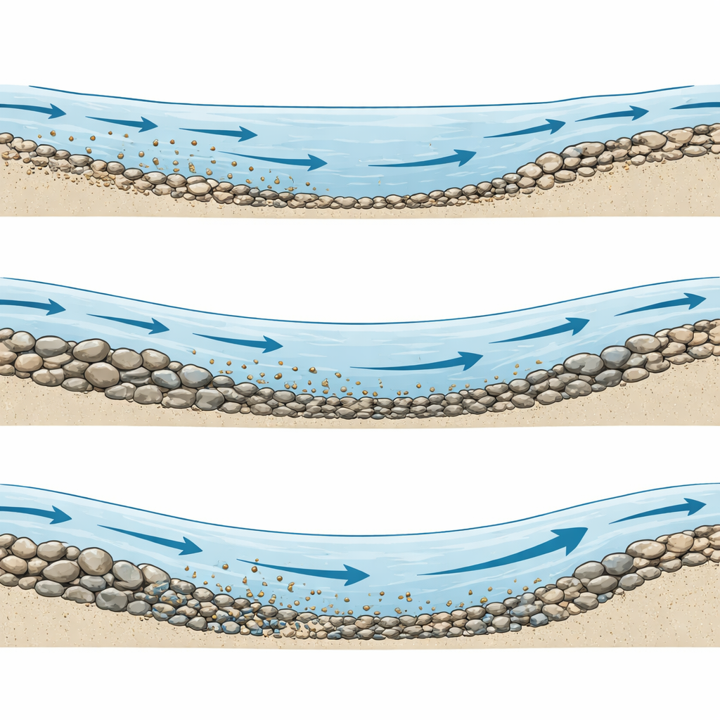
Data show that after Xiaolangdi began trapping fine material, the downstream channel initially scoured deeply: bankfull width increased by about one‑and‑a‑half times and depth roughly doubled, so the river tended toward a narrower, deeper form. At the same time, the bed surface coarsened, especially in the upstream Tiexie–Huayuankou reach closest to the dam, where typical grain size briefly increased more than threefold before partially reversing after renewed sediment releases from the reservoir after 2018. River slope also adjusted: upstream reaches became slightly steeper as they eroded, while downstream reaches flattened somewhat as sediment settled during non‑flood periods. Together, these changes altered how easily floods could pick up and move sediment along the system.
From simple ratios to a fuller picture
Previous work largely treated the sediment delivery ratio as a function of the flood itself – how much water, how much sediment, and how unevenly that water arrives. Building on classic sediment‑transport formulas, the authors first derive a theoretical expression that links delivery ratio to three flood descriptors: an “incoming sediment coefficient” (how muddy a given flow is), the change in water volume along the reach, and the incoming flow rate. They show that floods with muddier water tend to have lower delivery ratios (more sediment is left behind), while floods that gain water along the way generally carry sediment more efficiently. But this basic picture cannot fully explain the observations, especially in a river whose bed is being actively reshaped by dams.
Letting the channel itself speak
To capture that missing piece, the team extends their formula to explicitly include three attributes of the riverbed: the typical grain size on the bed surface, the ratio of channel width to depth, and the river’s slope. Using nonlinear regression on the 2000–2023 flood data, they calibrate an empirical equation for each of the four main reaches. The patterns are intuitive but now quantified: coarser bed material resists erosion and lowers sediment delivery; a wide, shallow channel moves sediment less efficiently than a narrower, deeper one; and steeper slopes promote transport. Including these boundary terms noticeably improves the match between calculated and measured delivery ratios and reduces errors in predicting how much each flood will erode or silt up different parts of the river.
Practical clues for managing a “hanging river”
Under today’s conditions, the downstream Aishan–Lijin reach, which is relatively narrow, deep, and gently sloped, turns out to have the highest sediment transport capacity: during a flood with a given mix of water and sediment, it can pass more material without silting up than the upstream reaches. The analysis also shows that, for a typical large flood of about 4,000 cubic meters per second, there is a range of sediment concentrations that keep the overall lower river roughly in balance, broadly consistent with earlier engineering guidelines. To improve performance where it is weakest, particularly upstream of Gaocun, the authors suggest narrowing the active channel so that, for the same flow, water depths and velocities increase and more sediment is carried through rather than deposited.
What the study means for people and levees
For non‑specialists, the main takeaway is that the safety and stability of the lower Yellow River cannot be managed by controlling reservoir releases alone. How much sediment a flood delivers depends not just on how muddy the water is, but on the evolving shape and roughness of the channel itself. By tying the sediment delivery ratio to both flood behavior and riverbed form, and validating their equations against two decades of real floods, the authors provide a practical framework for anticipating where the river will erode, where it will silt up, and how engineering interventions such as channel narrowing can reduce long‑term flood risk. In short, the study turns a complex moving riverbed into a more predictable partner for planners and communities along this famous “hanging river.”
Citation: Zhang, X., Zhang, M., Zhang, C. et al. Response of sediment delivery ratio to water-sediment and riverbed boundary conditions during flood events in the lower yellow river since 2000. Sci Rep 16, 12485 (2026). https://doi.org/10.1038/s41598-026-42616-7
Keywords: Yellow River, sediment transport, riverbed morphology, flood management, reservoir impacts