Clear Sky Science · en
Aeromagnetic analysis of the shear zones of Ambaji garnulite, NW India: implications for base-metal mineralization
Hidden Clues Beneath the Desert Hills
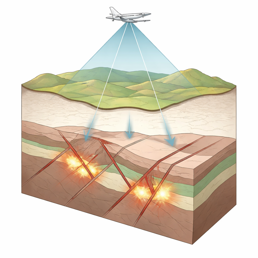
Northwestern India’s rugged hills hide more than just striking landscapes—they also conceal valuable deposits of copper, lead, and zinc that are vital for modern technology and infrastructure. This study uses sensitive measurements of Earth’s magnetic field, taken from aircraft flying a few dozen metres above the ground, to peer beneath the surface of the Ambaji region in the Aravalli–Delhi mobile belt. By turning faint magnetic ripples into a detailed underground map, the researchers show how deep cracks and slips in ancient rocks have guided metal-rich fluids and helped concentrate ore deposits, offering new clues for responsible mineral exploration.
An Ancient Collision Zone in India
The Ambaji area sits within a vast, ancient mountain belt that formed when pieces of Earth’s crust collided over a billion years ago. This belt, stretching some 800 kilometres across northwest India, is already known for its rich base-metal deposits, including world-class lead–zinc and copper mines. In the Ambaji segment, rocks that once lay deep in the crust have been pushed upward along long, ribbon-like zones of intense deformation known as shear zones. Over geological time, these zones acted as natural plumbing systems, channelling hot fluids that carried metals. Because much of this history is now buried under soil and younger sediments, traditional mapping on the ground cannot fully reveal how these structures link to the metal deposits that miners seek.
Mapping the Invisible with Airborne Magnetics
To tackle this problem, the authors analysed high-resolution aeromagnetic data collected by the Geological Survey of India in 2017–2018. As the survey aircraft flew back and forth along closely spaced lines, instruments measured tiny variations in Earth’s magnetic field caused by magnetic minerals in the rocks below. After carefully removing background trends and noise, the team applied a suite of image-enhancement techniques that sharpen the magnetic picture, much like increasing contrast and edge detection in a photograph. These processed maps reveal bands, curves, and circular patterns aligned with known faults and shear zones, as well as previously unrecognized structures. Distinct magnetic highs and lows outline contrasts between weakly magnetic sedimentary and granitic rocks and stronger, iron-rich units such as amphibolites and mafic dykes.
Peering into the Depths in Three Dimensions
Going beyond surface maps, the researchers built two kinds of computer models to estimate how different rock layers and bodies are arranged at depth. Along a 50-kilometre-long north–south slice, they adjusted the shapes and magnetic strengths of subsurface blocks until the calculated magnetic signal matched the observations. This profile suggests that granite–gneiss rocks extend to around 3 kilometres depth and are overlain by a blanket of alluvium in the south, while narrow intrusions and contrasting rock types occur in the middle of the section. In a smaller area near the village of Tkhatpura, they used full 3D inversion—dividing the subsurface into thousands of tiny cells and letting an algorithm find the distribution of magnetic material that best explains the data. This exercise highlights concentrated, moderately magnetic bodies about half a kilometre deep that are consistent with biotite–amphibolite rocks associated with sulphide mineralization.
Where Cracks, Fluids, and Metals Meet
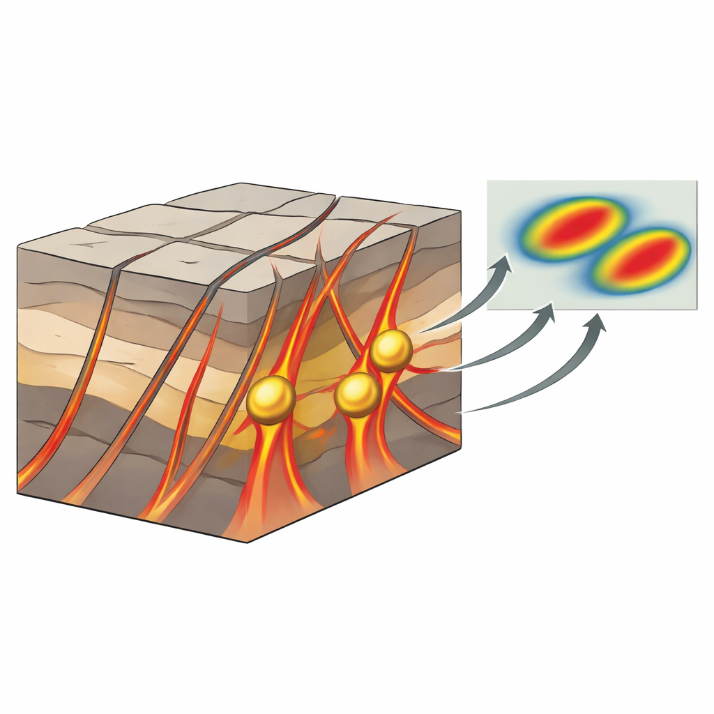
One of the most important outcomes of the study is the close match between magnetic structures and known metal occurrences. The strongest anomalies cluster where several major lineaments—long, deep-seated fractures in the crust—intersect, particularly near Tkhatpura and other nearby localities. These crossing zones likely represent especially weak areas of the crust that repeatedly opened and shifted as the ancient mountain belt evolved. Such zones are ideal channels and traps for hot, metal-bearing fluids rising from deeper levels. The magnetic data show that these structurally complex areas coincide with sharp changes in rock magnetism, pointing to a mix of intrusive bodies and altered, mineralized rocks that strengthen the case for further exploration.
Why This Matters for Finding Future Ores
For non-specialists, the key message is that subtle variations in Earth’s magnetic field can reveal where the crust was fractured, heated, and flushed with metal-rich fluids long ago. In the Ambaji shear zones, the study shows that intersecting faults and shear zones are prime locations where copper, lead, and zinc could have accumulated, and that these sites can be pinpointed even when they are buried beneath hundreds of metres of rock and sediment. By combining advanced magnetic imaging with geological knowledge, explorers can narrow their search to the most promising targets, reducing both cost and environmental impact. The work turns invisible magnetic patterns into a practical guide for understanding how Earth built its ore deposits and where we might find them today.
Citation: Seshu, D., Kumar, V.P., Rao, G.S. et al. Aeromagnetic analysis of the shear zones of Ambaji garnulite, NW India: implications for base-metal mineralization. Sci Rep 16, 12173 (2026). https://doi.org/10.1038/s41598-026-42287-4
Keywords: aeromagnetic survey, base metal deposits, shear zones, Ambaji granulite, mineral exploration