Clear Sky Science · en
High-precision prediction method for mine deformation based on GNSS RTK and stacking ensemble learning
Why watching the ground move can save lives
Modern mines quietly reshape the landscape every hour of every day. Most of this movement is slow and harmless, but sometimes slopes suddenly slip or dumps give way, threatening workers, equipment, and nearby communities. This paper shows how satellite-based positioning and advanced data analysis can track tiny shifts in the ground—down to fractions of a millimeter—and turn them into early warnings before minor sagging becomes a major disaster.
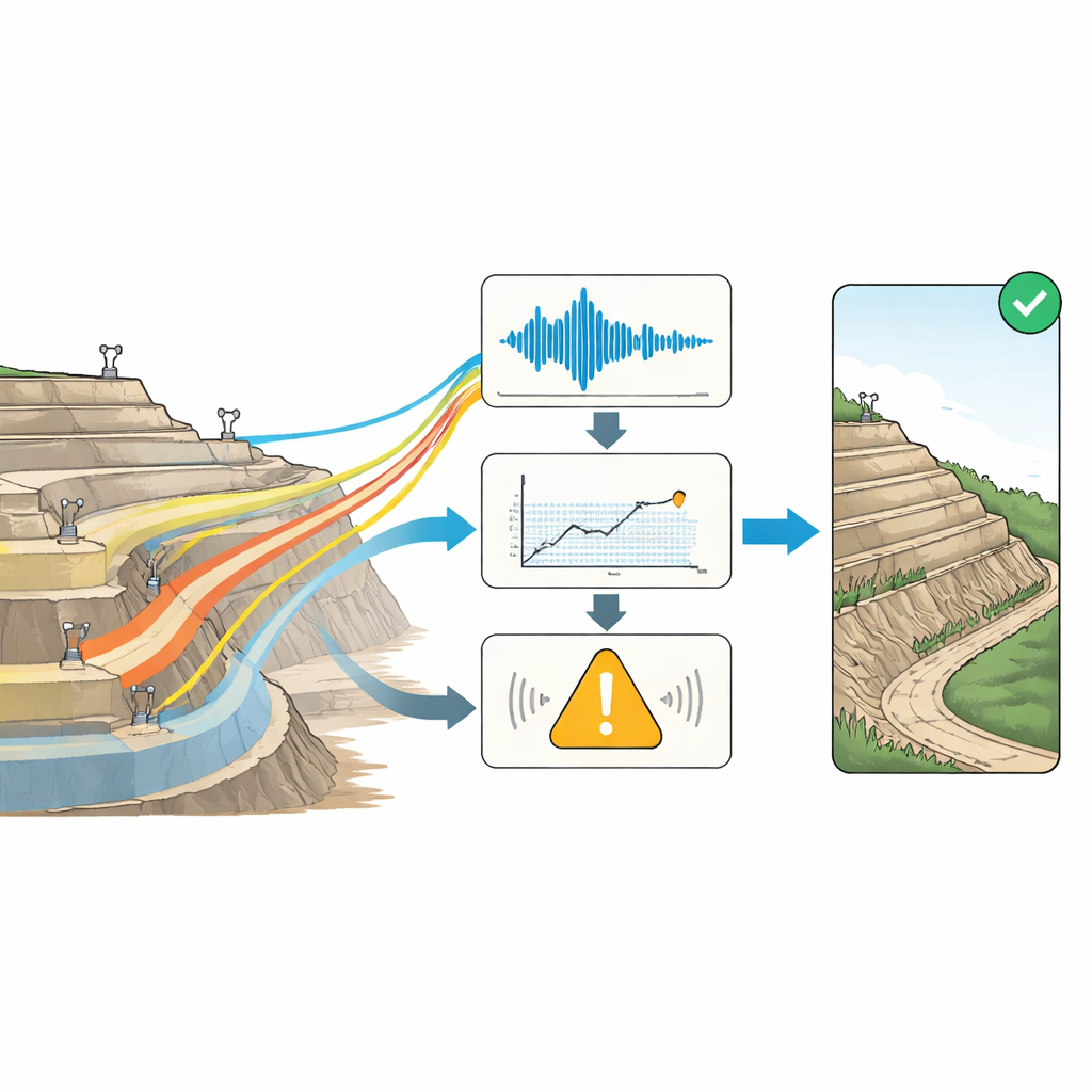
Listening to the mine with satellite signals
Instead of relying only on visual checks or occasional surveys, the authors use a network of permanent Global Navigation Satellite System (GNSS) stations around an open-pit coal mine in Xinjiang, China. These stations, working in Real-Time Kinematic (RTK) mode, continuously measure their three-dimensional position with centimeter-level accuracy every hour, day and night. Over months and years, this creates a rich time-lapse record of how each point on the mine surface slowly rises, sinks, or slides. Hidden in these data are early hints of trouble—but they are buried under a mess of interference from the atmosphere, satellite orbits, electronic noise, and blasting operations.
Cleaning the signal so real motion stands out
To turn noisy measurements into trustworthy ground motion, the team builds a “fusion filtering” pipeline that combines several noise-removal methods instead of relying on just one. First, a median filter weeds out sudden spikes caused by momentary signal loss or electrical glitches. Next, a Butterworth filter is tuned differently for quiet, stable zones and more active slopes, stripping away high-frequency jitter while keeping genuine low-frequency ground motion. A Savitzky–Golay filter then smooths the data while preserving important local bends and kinks that may signal changing behavior. Finally, an adaptive Kalman filter adjusts itself depending on how fast the ground is moving, giving more weight either to past trends or fresh observations. This stepwise process reduces scatter in the coordinate data by up to roughly a third in the vertical direction, without erasing meaningful deformation.
Teaching models to forecast tiny shifts
Once the data are cleaned, the authors shift from measurement to prediction. They convert the station coordinates into cumulative deformation—how far each point has moved since the start—and then split this motion into three parts: a long-term trend, repeating seasonal swings, and irregular leftovers. They also compute how fast the movement is changing (rate) and how quickly that speed itself is changing (acceleration). These pieces form a kind of health record for each location. Instead of betting on a single forecasting method, the researchers assemble a team of models: classic time-series tools that are good at steady trends and cycles, and modern machine-learning models that excel at complicated, nonlinear behavior. A final “referee” model learns how to weight each member of this team so the combined forecast matches reality as closely as possible.
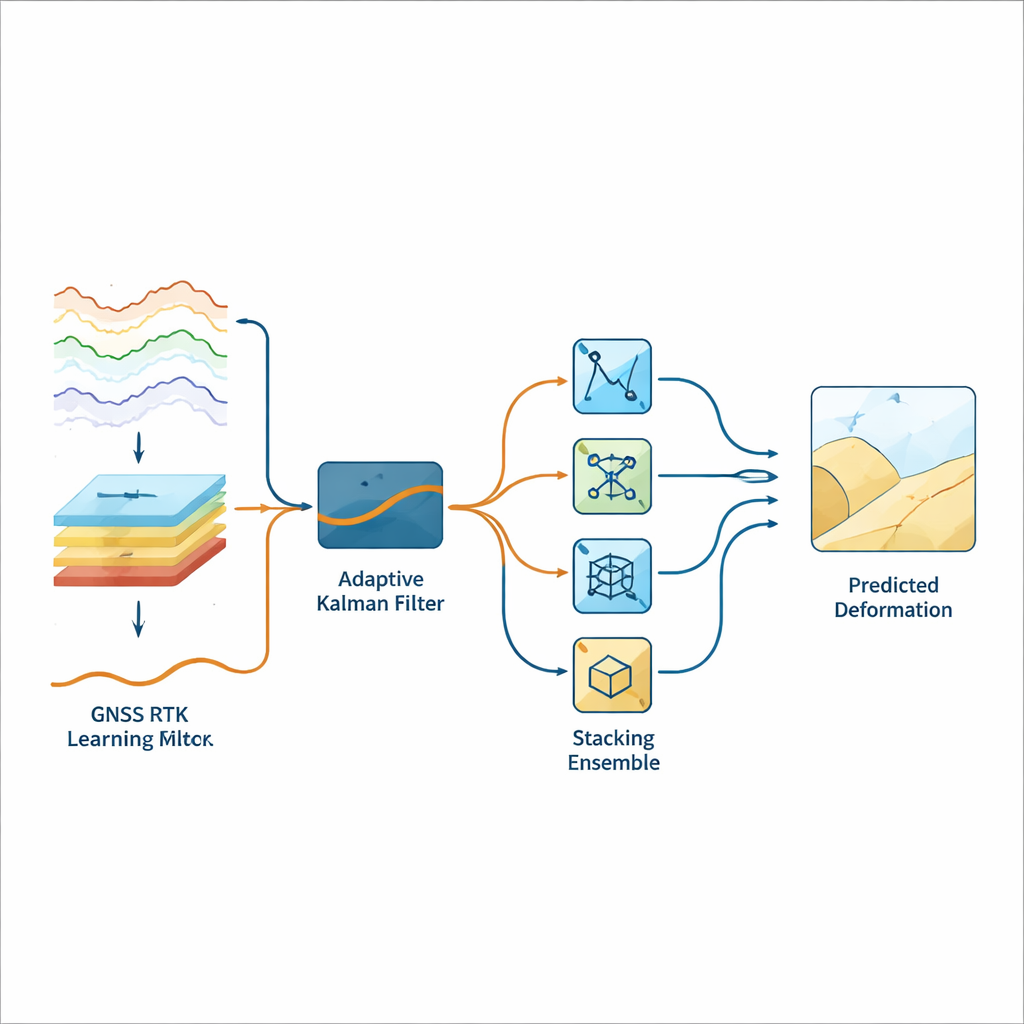
From raw numbers to reliable warnings
In tests on nearly two years of data from 19 stations, the combined approach predicts future deformation with root-mean-square errors under 0.3 millimeters, even when looking up to three days ahead. The method follows both smooth long-term subsidence and sharper changes linked to mining activities, and it remains stable when conditions vary between stations and over time. On top of the forecasts, the authors add an alert system that classifies each moment into stages—stable creep, slow acceleration, or rapid instability—based on rate and acceleration. Using a clustering algorithm and a sliding statistical window, the system automatically adjusts its thresholds so that small, harmless fluctuations do not trigger alarms, but clear departures from expected behavior do.
Turning predictions into safer mines
For a non-specialist, the key message is that this work turns subtle, hard-to-interpret satellite positioning data into a practical early-warning tool. By smartly cleaning the signal and blending several prediction methods, the authors can anticipate ground movement in high-risk zones such as inner waste dumps and steep slopes with sub-millimeter precision. This does not make the hardware more accurate than physics allows; instead, it means the remaining prediction errors, after filtering out noise and learning from past behavior, are extremely small. Such detailed foresight allows mine operators to spot dangerous trends earlier, focus inspections on the most unstable areas, and plan reinforcement or evacuation before a slow sag turns into a sudden slide.
Citation: Dong, X., Ma, R., Tian, W. et al. High-precision prediction method for mine deformation based on GNSS RTK and stacking ensemble learning. Sci Rep 16, 12277 (2026). https://doi.org/10.1038/s41598-026-41945-x
Keywords: mine deformation monitoring, GNSS RTK, landslide early warning, machine learning forecasting, open-pit mine safety