Clear Sky Science · en
An integrated multi-hazard assessment using machine learning in the complex terrains of Northern Pakistan
Why this mountain story matters
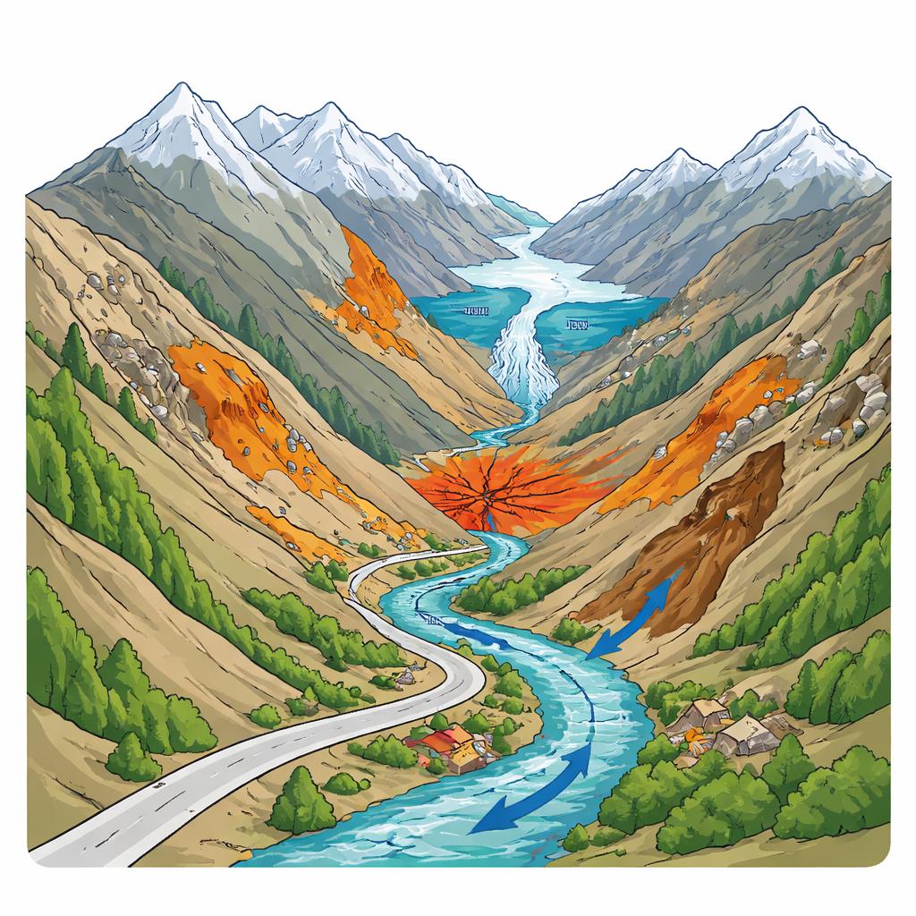
Northern Pakistan’s Hunza Valley is famous for its soaring peaks and glaciers—but it is also one of the most dangerous landscapes on Earth. Steep slopes, melting ice, violent storms, and active faults mean that villages, roads, and mega-projects are exposed to many different kinds of disasters at once. This study shows how modern data and machine learning can be combined to draw a single, easy-to-use picture of where multiple hazards overlap, helping protect people, infrastructure, and vital trade routes in this fragile high-mountain region.
A valley under many threats
The Hunza district sits in the rugged Karakoram, where river gorges cut through rock rising from about 1,800 meters to nearly 7,800 meters above sea level. Huge glaciers feed the Hunza River, which in turn supplies water and power to millions farther downstream. But the same forces that make this a powerful water tower also create danger. Heavy summer rains, rapid snow and ice melt, loose soils, and active faults combine to produce landslides, debris flows, sudden flash floods, and Glacial Lake Outburst Floods (GLOFs). Earthquakes can shake already fractured slopes, triggering chains of rockfalls and floods. Because roads, homes, and farmland are squeezed into narrow valley bottoms, even a moderate event can have severe consequences, as seen in past disasters that destroyed villages, blocked rivers, and cut the Karakoram Highway, Pakistan’s only land link to China.
From scattered maps to one big picture
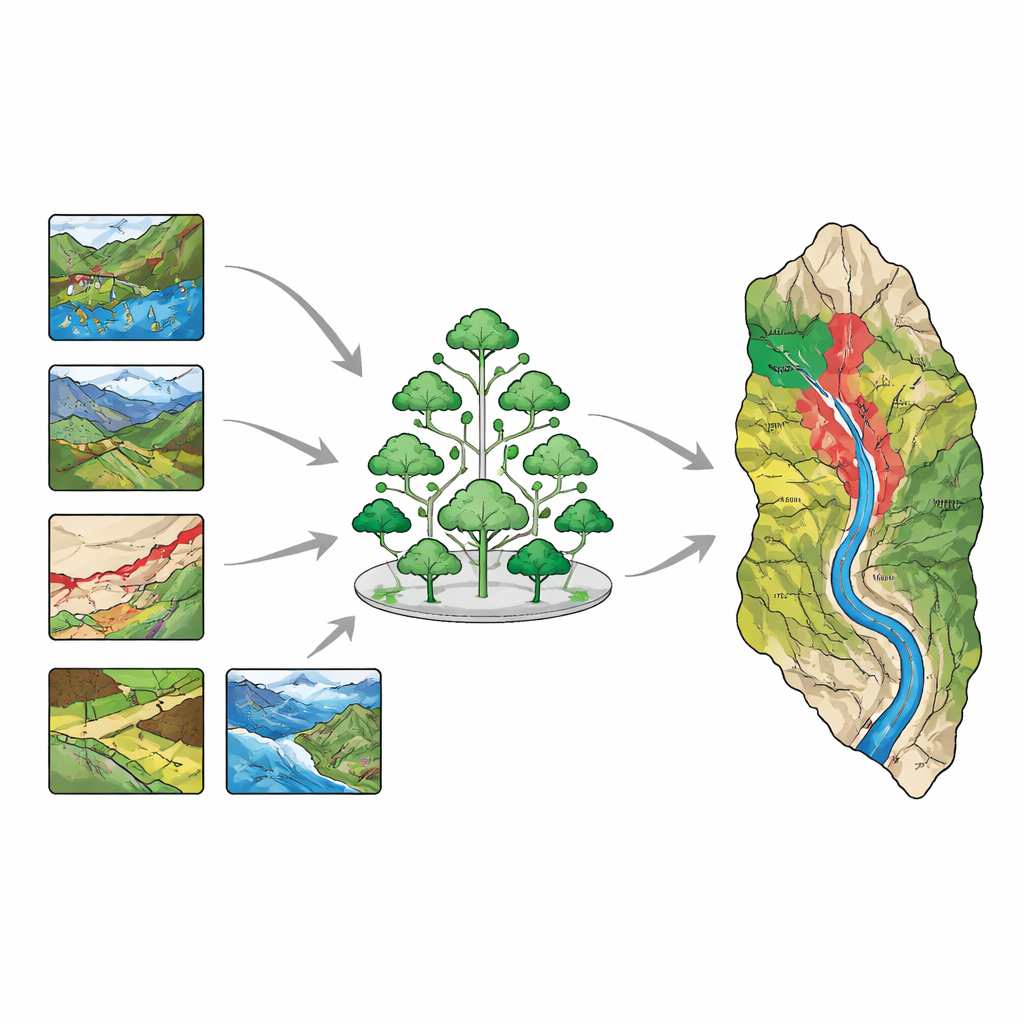
Until now, most studies looked at one hazard at a time—only landslides, or only floods, for example. That approach misses how hazards can strike together or set each other off, and it can mislead planners who must design roads, bridges, and settlements for real-world conditions. The authors set out to build an integrated “multi-hazard” view for Hunza. They gathered a wide range of information: detailed elevation data, slope and curvature of the terrain, distance to rivers and roads, rainfall patterns, land cover and vegetation, snow and glacier indicators, underlying rock types, and existing maps of glacial-lake danger and shaking intensity. In total, eighteen geo-environmental factors were considered, reflecting how water, gravity, climate, and geology interact on the ground.
Teaching a digital forest to read the land
To turn this mountain of data into meaningful guidance, the team used a machine learning method known as a forest-based classification and regression model, a practical form of the popular “random forest” approach. They first compiled inventories of where hazards have occurred—landslides, flash floods, debris flows, earthquake-prone zones, and GLOF areas—and matched these locations with the environmental conditions at each point. The algorithm then learned which combinations of slope, rainfall, rock type, vegetation, and other factors best separate hazardous spots from safer ones. By repeatedly building many decision trees on different samples and averaging their results, the model produced reliable susceptibility maps for each hazard. Statistical checks showed strong performance, meaning the model could correctly distinguish high-risk and low-risk areas more often than not.
Where the dangers pile up
Once the individual maps were created, the researchers placed them on the same scale and combined them into a single multi-hazard map. The results reveal that more than 40 percent of Hunza is exposed to at least one significant hazard, and smaller but critical portions face several at once. About one-fifth of the district is highly prone to landslides alone, while other zones are mainly threatened by flash floods or debris flows. The most alarming areas—though relatively small in area—are where seismic shaking, debris flows, landslides, and flash floods all coincide. These overlapping hot spots cluster in the central and lower parts of the valley along river corridors and the Karakoram Highway, where settlements, farmland, and major infrastructure are concentrated. Even regions classified as “low hazard” are often covered by glaciers and snow, reminding planners that future warming could shift patterns of risk.
Turning maps into safer futures
For non-specialists, the key message is straightforward: in a landscape like Hunza, no single hazard tells the whole story. This study demonstrates that by combining satellite data, field observations, expert judgment, and machine learning, it is possible to create clear maps that show where multiple threats overlap and where protective action is most urgent. While the work focuses on susceptibility—the likelihood that natural processes could produce damaging events—it offers a powerful foundation for smarter land-use decisions, safer road and dam placement, and targeted early-warning and evacuation planning. As climate change continues to intensify extreme weather and speed up glacier melt, such integrated, data-driven tools will be essential for helping mountain communities in Pakistan and around the world adapt and thrive.
Citation: Khan, M.I., Shafique, M., Khattak, G.A. et al. An integrated multi-hazard assessment using machine learning in the complex terrains of Northern Pakistan. Sci Rep 16, 11499 (2026). https://doi.org/10.1038/s41598-026-41029-w
Keywords: multi-hazard mapping, mountain disasters, machine learning, Hunza Valley, disaster risk reduction