Clear Sky Science · en
Assessing InSAR observability of landslides interfering with bridges
Why this matters for roads and railways
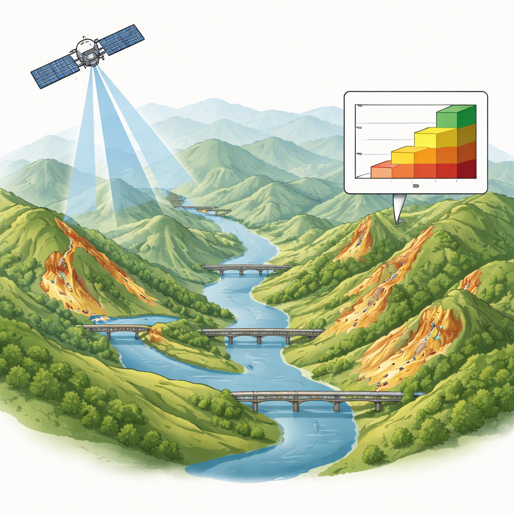
Landslides are a quiet but constant threat to the roads and rail lines that keep modern life moving. Many bridges stand on or near unstable hillsides where slow ground movements can, over time, weaken foundations and structural elements. This study asks a very practical question: when can satellites actually see these dangerous ground shifts well enough to help protect bridges, and when are the slopes effectively invisible from space?
Watching the ground from space
The researchers focus on a technique called satellite radar interferometry, which can measure tiny changes in the Earth’s surface by comparing repeated radar images taken from orbit. Instead of relying on local instruments placed on a few structures, this method can scan entire regions regularly, day or night and in almost any weather. That makes it a powerful candidate for tracking landslides that might be disturbing nearby bridges. But the method has limits: steep topography, dense vegetation, and how the slope faces the satellite can all hide or distort the signal, meaning not every landslide can be reliably seen.
Two hilly regions under the microscope
To explore these limits, the team studied two mountainous regions of the Italian Apennines: Emilia-Romagna and Umbria. Both areas are crisscrossed by thousands of bridges and affected by tens of thousands of mapped landslides. The authors combined a detailed national landslide inventory with open satellite deformation data from the European Ground Motion Service. Around each bridge they drew a 100‑meter zone and selected only the landslides overlapping these zones, isolating the cases most relevant for real infrastructure risk. This provided a large, realistic sample of slopes that could potentially threaten bridges.
How clearly can satellites see landslides?
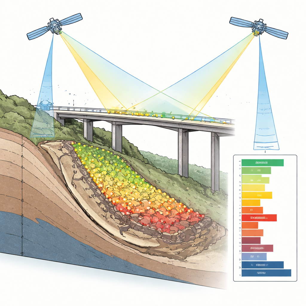
Next, the researchers divided each landslide into a grid of small squares and checked how many contained a stable radar “target,” such as bare rock or built surfaces, that could be tracked over time. From this they created a coverage index ranging from “not covered” to “well covered,” a direct measure of how observable each landslide is in practice. They then compared this visibility with basic landscape features such as the type of landslide, how steep the slope is, and which direction it faces, and evaluated images from both of the satellite’s viewing directions (ascending and descending orbits) separately.
What controls visibility and what the satellites reveal
The study shows that most landslides near bridges are poorly observed or not observed at all, underlining that satellite data are powerful but far from complete. Slow-moving slides, which are common in clay-rich hills, are the easiest to monitor, while sudden rockfalls and debris flows are rarely captured. Slopes with moderate steepness, roughly between 10° and 20°, offer the best balance: they are active enough to move measurably, yet not so steep that radar signals are lost in shadow or distortion. Aspect, or the direction a slope faces, matters less on its own but can help or hinder visibility when combined with other factors. When coverage is good, the satellite data reveal that many landslides deform in a patchy way, with some parts moving faster than others, and they allow the authors to estimate whether a landslide is currently active or quiet.
Bridges move too, but not always like the ground
By comparing typical ground motion beneath a landslide with motion measured on nearby bridges, the researchers found no simple rule linking the two. In some places, the bridge appears to deform more than the surrounding slope; in others, the ground moves more than the structure. This mismatch reflects a mix of influences: how the bridge is founded, exactly where it sits relative to the most active part of the landslide, and other effects such as settlement or temperature changes. Rather than treating any difference as proof of damage, the authors argue that such patterns should flag bridges and slopes that deserve closer, site-specific investigation.
What this means for safer infrastructure
The study provides a practical framework for knowing when satellite monitoring can reliably track landslides that threaten bridges, and when it cannot. It shows that combining both satellite viewing directions, focusing on certain types of landslides and slope angles, and interpreting bridge movements within their wider landscape context can greatly improve how we screen large regions for risk. In this way, satellite data do not replace on-the-ground inspections and engineering studies, but they help authorities prioritize where those efforts are most urgently needed to keep vital transport links safe.
Citation: Cernuto, E., Salciarini, D., Ubertini, F. et al. Assessing InSAR observability of landslides interfering with bridges. Sci Rep 16, 11530 (2026). https://doi.org/10.1038/s41598-026-41011-6
Keywords: landslides, bridges, satellite monitoring, InSAR, infrastructure risk