Clear Sky Science · en
Modeling progressive failure in steep rock slopes using the combined finite-discrete element method
Why shaky mountain walls matter
High, rocky canyon walls may look solid, but under the right conditions they can suddenly give way, sending millions of tons of rock crashing downslope. For people living downstream of big dams or driving along mountain highways, understanding when such slopes might fail is a matter of safety, planning, and cost. This study explores a new way to digitally "stress‑test" steep rock slopes so engineers can see not just if a hillside is unsafe, but exactly how and when it might break apart.
Hidden weaknesses in towering cliffs
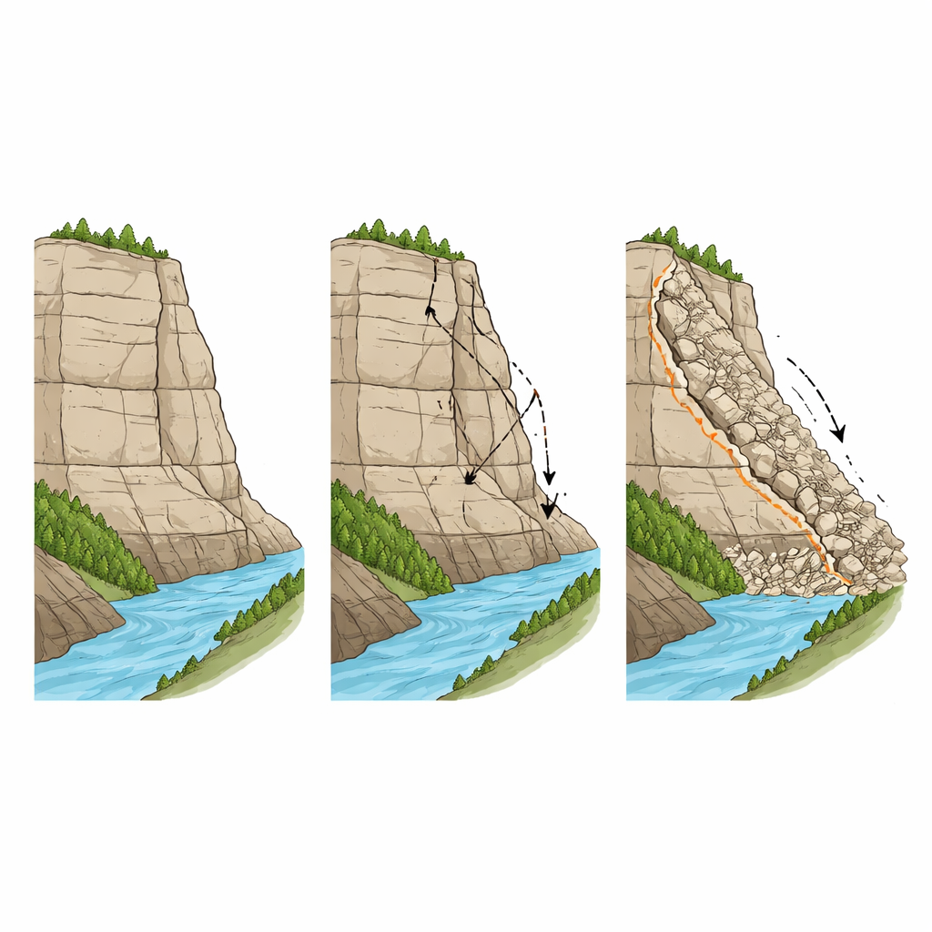
Mountain slopes are rarely made of uniform, flawless rock. Layers of sandstone and slate, old fractures, and weathered zones create a patchwork of strong and weak bands. In western China, especially along the deeply cut canyons of the upper Lancang River, hydropower projects are being built directly into such steep walls. Although these slopes may deform slowly under their own weight, they can fail catastrophically if cracks link up along vulnerable layers. Traditional engineering tools can estimate an overall safety margin, but they do not fully capture how small cracks start at the slope’s base, grow upward, and finally release a moving mass of rock.
Limits of older prediction tools
Engineers have long used three main types of computer methods to check slope stability. One, the limit equilibrium method, balances driving and resisting forces along an assumed sliding surface; it is fast but requires guessing the shape of that surface in advance and only describes the instant of failure. A second, the finite element method, follows how solid rock deforms, but struggles to represent the sudden appearance and growth of cracks. The third, the discrete element method, represents the slope as separate blocks that can move and collide, but it cannot describe the earlier stage when the rock still behaves as a continuous mass. None of these methods alone can smoothly follow a slope from apparently intact rock to scattered boulders in the valley floor.
A digital slope that breaks realistically
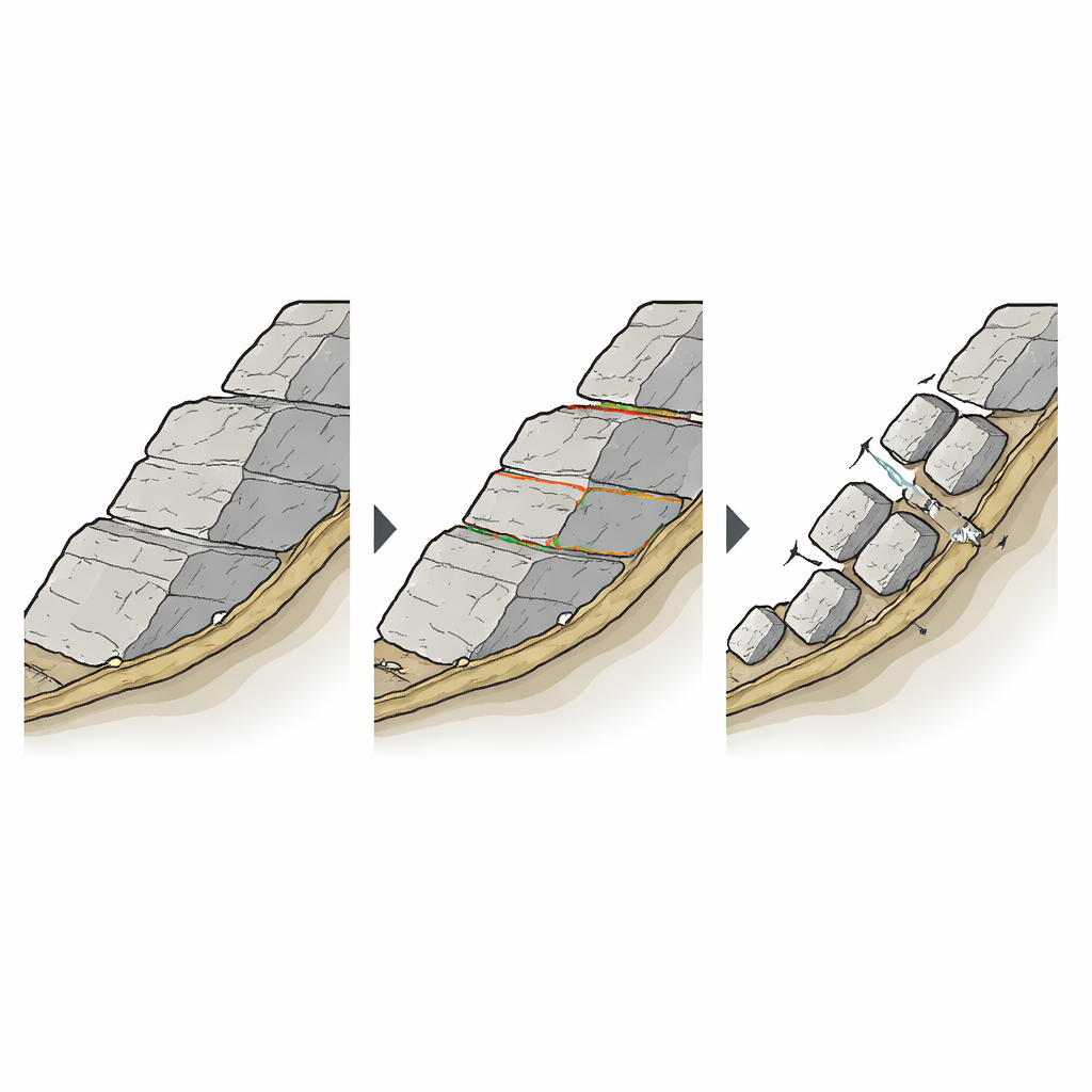
The authors combine the strengths of these approaches in a framework called the finite–discrete element method, or FDEM, and pair it with a "gravity increase" strategy. In their virtual slope, the rock is represented as many small solid pieces bonded together along invisible joints. As simulated stresses rise, these bonds can weaken and break, turning continuous rock into separate blocks that slide and collide. Instead of guessing a failure surface, the model slowly increases the effective pull of gravity until the slope shows a sudden jump in movement and kinetic energy. The gravity level at that point gives a safety factor, while the evolving pattern of cracks and motion shows exactly how failure unfolds.
Putting the method to the test in a real canyon
To see whether this digital slope behaves like the real world, the team modeled a 796‑meter‑high rock slope beside a hydropower station on the upper Lancang River. They built a simplified cross‑section that included different weathering zones and a key fault, then used measured rock properties to set the model parameters. As gravity was gradually amplified, the simulation reproduced a realistic sequence: first, tiny cracks formed near the foot of the slope in the most weathered rock; these cracks joined into a continuous weak band; then a large rock mass slid along this band, broke into blocks, and came to rest as a wide deposit in the valley. The distances traveled, depths of cracking, and final debris width all closely matched field observations, with differences generally under 20 percent.
Checking against standard methods
The researchers compared their new framework with the widely used limit equilibrium and discrete element methods by computing how stable the same slope appeared in each case. All three approaches gave similar safety factors and agreed on the general position of the main sliding surface along the weak, strongly weathered layer. The key difference was that the new FDEM–gravity approach did more than confirm whether the slope was marginally stable. It also revealed the timing of first movement, the role of the fault in triggering secondary collapses from higher up, and how blocks interacted and fragmented on their way downslope—details that are crucial for designing reinforcements and planning monitoring systems.
What this means for safer mountain projects
The study concludes that this combined modeling framework can reliably track the full life story of a landslide, from the first hairline cracks to the final pile of rubble. For the Lancang River slope, the computed safety factor suggests the rock wall is only just stable under current conditions, implying that extra support and careful excavation are needed. More broadly, the method offers engineers a way to pinpoint where early damage is likely to start, where to place anchors and monitoring instruments, and how future triggers like earthquakes or heavy rain might change the picture. Although current simulations are two‑dimensional and computationally demanding, extending them to three dimensions and adding realistic triggers could make them a powerful part of long‑term safety management in steep mountain regions.
Citation: Xu, J., Deng, Z., Feng, Y. et al. Modeling progressive failure in steep rock slopes using the combined finite-discrete element method. Sci Rep 16, 11180 (2026). https://doi.org/10.1038/s41598-026-40966-w
Keywords: landslides, rock slope stability, numerical modeling, hydropower dams, gravitational failure