Clear Sky Science · en
An adaptive autoregressive integration model for multi-variate time series analysis of extreme climate events
Why drying summers matter to all of us
Across the globe, hotter and drier summers are stressing crops, shrinking water supplies, and destabilizing ecosystems. Yet the weather records behind these events are messy: thousands of stations, many variables, and patterns that change over time. This paper introduces a new way to read that tangled climate data so that emerging droughts can be spotted earlier and more reliably, helping farmers, planners, and communities prepare before disaster strikes.
Following many weather signals at once
Instead of looking at one number at a time—say, rainfall or temperature—the authors work with multivariate time series, long chains of measurements where many climate variables are tracked together day after day. This richer view can capture how heat, rain, and other factors interact to create risks such as severe drought. But it also makes the analysis much harder. Traditional statistical tools and even many modern machine‑learning methods struggle when relationships between variables change over time, when the data jump around with sudden extremes, and when we have only a few examples of the worst events.
A smarter way to forecast tomorrow from today
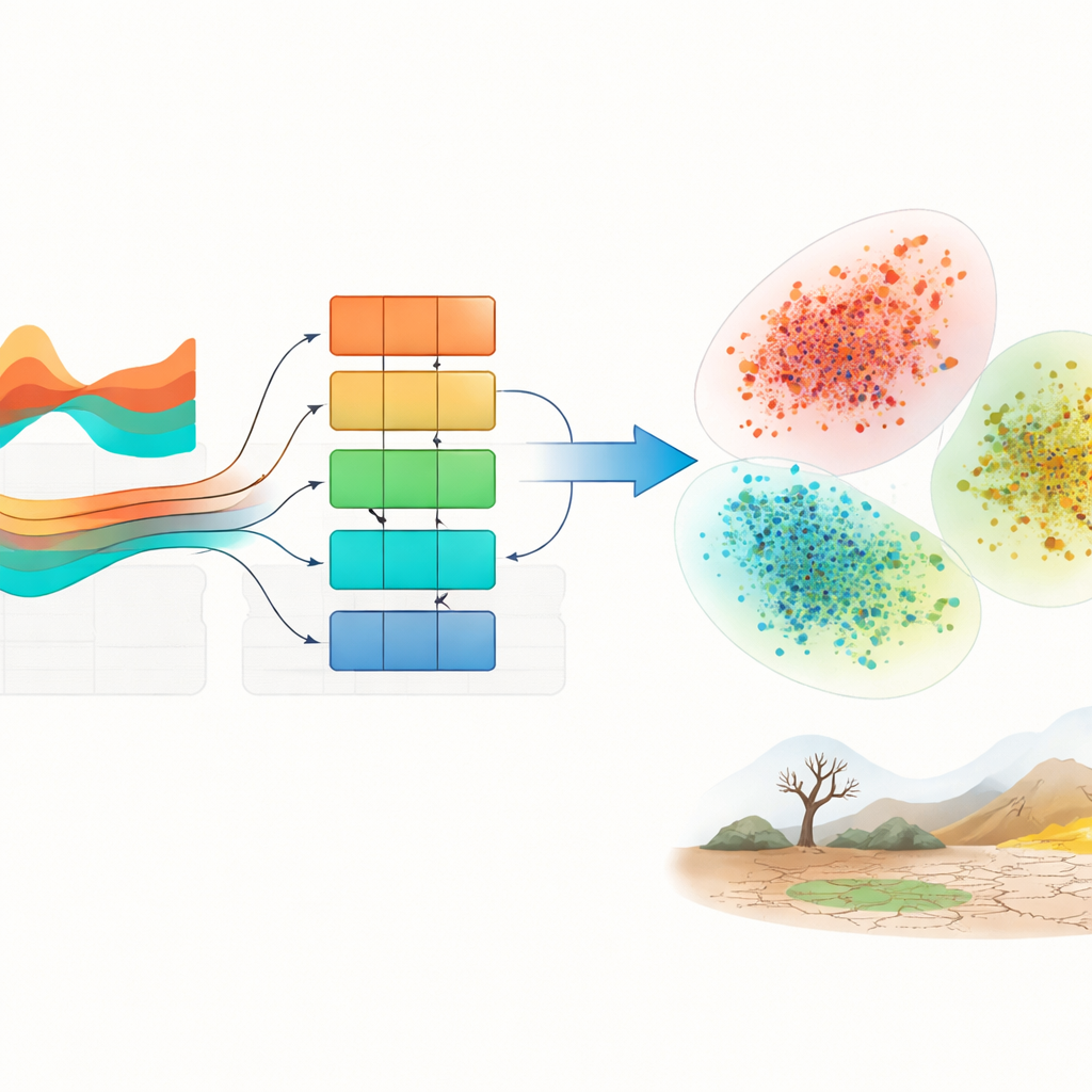
The core of the new system, called MVformer, is a forecasting engine designed to handle these restless climate records. It builds on Transformer neural networks, which excel at finding long‑range patterns, and adds an "adaptive" forecasting module that learns in stages. During training, the model sometimes sees the true past values and sometimes must rely on its own earlier predictions, gradually teaching it to stand on its own feet. At the same time, a volatility‑focused network learns how quickly and wildly the variables can swing, so the system does not smooth over sharp events like heat waves, flash floods, or sudden dry spells.
From predictions to hidden drought patterns
Rather than stopping at a forecast, MVformer blends predicted future weather with recent history into a single, richer picture of what the coming weeks may look like. This fused record is passed through an encoder that turns it into a compact set of features summarizing both space and time. Because labeled examples of true droughts are rare, the system then teaches itself: it groups these features into clusters and treats them as provisional labels, such as "extreme dry" or "near normal," based on simple thresholds like low rainfall. A separate decision module learns from these pseudo‑labels, refining its sense of which combinations of temperature and precipitation signal dangerous drying conditions.
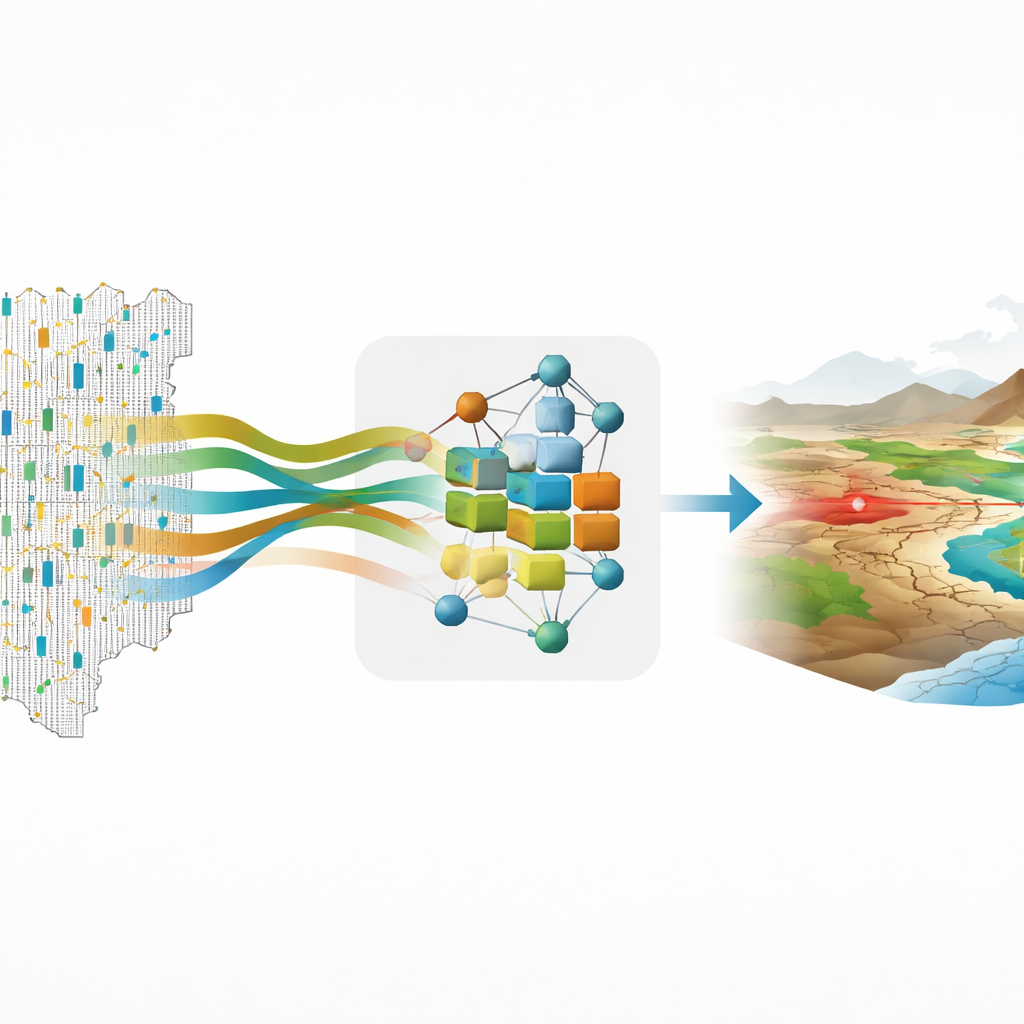
Putting the method to the test over China
To see how well MVformer works in practice, the researchers analyzed three summers of data from 2,415 weather stations spread across China, tracking daily maximum temperature and precipitation over 276 days each year. They first cleaned the data, fixing missing values and removing obvious sensor errors, then examined how heat and rainfall varied over time and space. Temperatures were relatively stable, while rainfall was highly erratic, with some stations drenched and others nearly dry on the same day. Against several top‑tier forecasting models, MVformer delivered the most accurate predictions, with smaller errors and better handling of extreme swings. When the authors inspected how the model grouped climate patterns, its clusters were much tighter and more distinct than those produced by standard methods, making it easier to pick out regions facing serious drought risk.
What this means for drought warning
In plain terms, MVformer acts like a climate early‑warning lens that both looks ahead and organizes complex weather histories into meaningful risk categories. By learning from limited data and by paying special attention to volatility—the sudden jumps and lulls that define real‑world weather—it produces sharper forecasts and clearer maps of where extreme dryness is likely to emerge. While the approach is computationally demanding and has so far been tested over only a few years of data, it offers a promising foundation for smarter drought alerts and more resilient agricultural planning as climate change continues to push weather to new extremes.
Citation: Xin, N., Su, J. & Hasan, M.M. An adaptive autoregressive integration model for multi-variate time series analysis of extreme climate events. Sci Rep 16, 12090 (2026). https://doi.org/10.1038/s41598-026-40558-8
Keywords: drought forecasting, climate time series, extreme weather, machine learning, environmental monitoring