Clear Sky Science · en
Evaluation of radar-based precipitation estimates during a flood event using rain gauge validation
Why better rain tracking matters
When intense rain falls over mountains, the difference between a close call and a deadly flood can be measured in just a few millimeters of water. Emergency planners rely heavily on weather radar to see where the rain is and how hard it is falling, but traditional radar estimates can be badly off in rugged terrain. This study explores how a newer type of radar, which looks at raindrops in two directions at once, can sharpen those estimates during a real flood in southwestern Poland, offering more trustworthy data for flood warnings and water management.
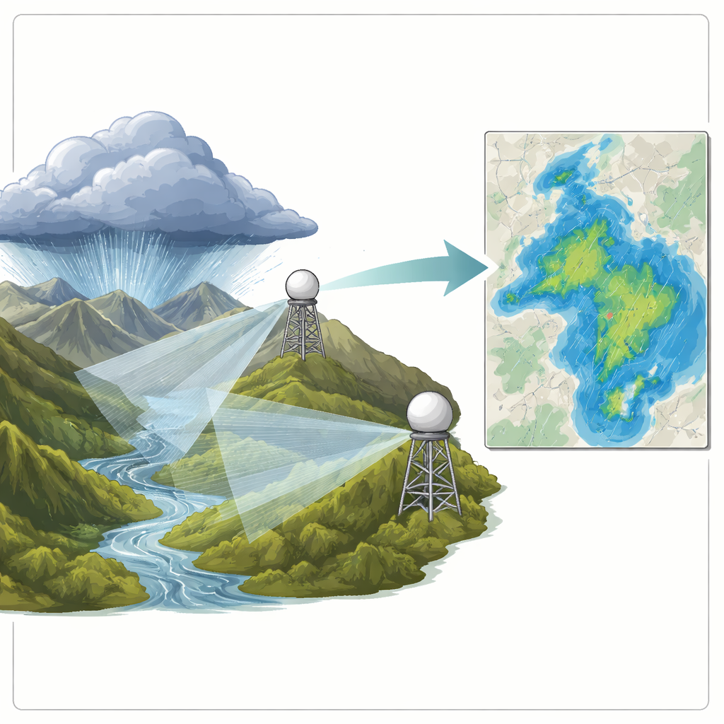
Seeing storms from the sky and from the ground
The researchers focused on a severe flood event linked to a Genoa low-pressure system in September 2024 that drenched a mountainous part of the Sudetes. They combined data from two national weather radars with measurements from 21 ground-based rain gauges scattered across valleys and slopes. While rain gauges give very accurate readings at single points, radar provides a continuous picture over a wide region. By comparing the two, the team could test how well different radar techniques captured the true amount of rainfall hour by hour across this complex landscape.
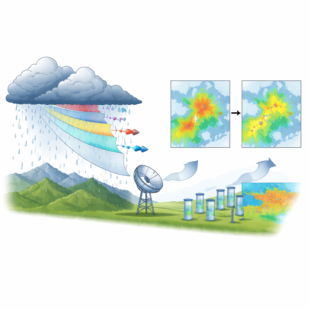
Old rules versus new radar clues
Conventional radar methods use simple, long-established formulas that convert how strongly raindrops reflect radar pulses into an estimated rainfall rate. These formulas, developed decades ago for flatter regions, treat all raindrops as if they behaved the same everywhere. Modern dual-polarization radars, however, send and receive signals in both horizontal and vertical directions, revealing information about the size and shape of raindrops. The team tested three classic formulas alongside three newer ones that also use this extra polarimetric signal. They evaluated all six methods at several heights above the ground, reflecting how radar beams slice through different layers of a storm.
Mountains, missed rain, and smarter formulas
The comparison showed that radar in mountainous areas systematically underestimated how much rain actually reached the ground, especially at higher-altitude stations and in deep valleys where the radar beam can be partly blocked or forced to scan too high above the main rain layer. Nonetheless, the polarimetric methods that incorporated the dual-direction signal clearly did better. One of the new formulas, called ZDR3, cut the average systematic error by about two-thirds compared with the standard operational method, while also reducing overall estimation error. This improvement held across different radar heights, suggesting that the new approach is robust even when the viewing angle and sampling layer change.
Two radars, one flood, many lessons
Using two radars instead of one also improved reliability. Overlapping beams helped fill in blind spots caused by mountain ridges and allowed the researchers to cross-check where errors were largest. They found that the radar located farther from the study area sometimes produced more accurate rainfall estimates than the nearer one, simply because its beam intersected the key rain-producing layers more cleanly. Maps of error patterns revealed hotspots of underestimation in the steepest terrain and better performance in gentler areas and where coverage from both radars overlapped. These insights highlight that radar placement and beam path can matter as much as distance.
What this means for flood warning
For non-specialists, the main message is that not all radar rain maps are created equal, and that using the extra information available from modern dual-polarization radars can substantially improve them. Although the study examined a single, extreme storm, the authors show that carefully tuned polarimetric formulas can bring radar estimates much closer to what real gauges measure on the ground, even in challenging mountain regions. Better alignment between radar and gauges means more dependable inputs for flood models, landslide forecasts, and crisis management systems. In practical terms, this work suggests that upgrading the way we interpret existing radar signals could translate directly into more accurate and timely warnings when the next big storm arrives.
Citation: Dzwonkowski, K., Winnicki, I., Pietrek, S. et al. Evaluation of radar-based precipitation estimates during a flood event using rain gauge validation. Sci Rep 16, 11174 (2026). https://doi.org/10.1038/s41598-026-40456-z
Keywords: weather radar, flood forecasting, mountain rainfall, dual-polarization, precipitation estimation