Clear Sky Science · en
A physics-guided machine learning framework for enhancing dust storm visibility prediction in arid and semi-arid regions
Why dust storms and clear vision matter
For people living and working in deserts, a sudden dust storm can turn a clear horizon into a brown wall in minutes, disrupting flights, closing highways, and threatening health. Yet predicting exactly when and how badly visibility will drop has remained stubbornly difficult. This study tackles that problem in China’s Kumtag Desert by blending physical understanding of how dust behaves with modern machine-learning tools, aiming to give forecasters more reliable, longer-lasting warnings of dangerous low-visibility events.
Seeing through the dust
Traditional weather models simulate winds, temperature, and dust across the globe, but they struggle close to the ground where people actually experience a storm. Near-surface winds, turbulence, and dust lifting are hard to capture, so these models often underestimate how intense a storm will be or miss important thresholds, such as when visibility falls below a kilometer. On the other side, purely data-driven algorithms can learn patterns from past observations and often do well for short-term, local forecasts. However, they tend to fail in three critical ways: they underplay rare extremes, lose skill when applied to new places or longer time spans, and behave like inscrutable “black boxes” that are hard to trust during high-stakes events.
Blending physics with smart algorithms
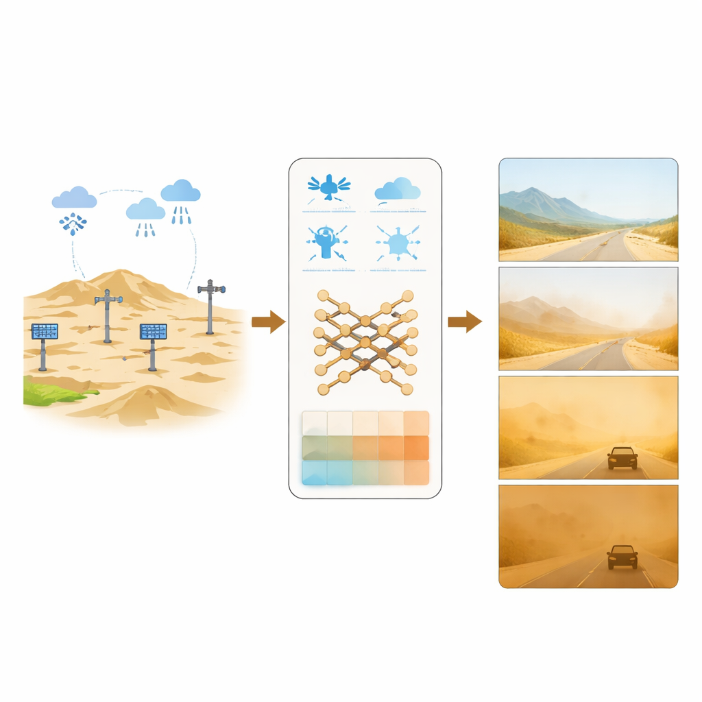
To overcome these limits, the authors built a physics-guided machine learning framework that post-processes forecasts from the European Centre for Medium-Range Weather Forecasts (ECMWF). Instead of feeding the algorithm raw model outputs alone, they add a library of hand-crafted features that represent key stages of the dust life cycle: when dust is lifted from the surface, how it mixes vertically in the lower atmosphere, how it is carried by winds over long distances, and how rain removes it. These features encode well-established relationships, such as the minimum wind stress needed to make sand grains hop and the role of atmospheric stability in trapping dust near the surface. The model then predicts visibility as one of five ordered grades, from very low to very high, matching how weather services issue warnings.
Turning desert data into usable warnings
The study focuses on four automatic weather stations scattered across the Kumtag Desert, a hyper-arid landscape dominated by shifting dunes. From 2020 to late 2022, instruments recorded wind, temperature, pressure, and visibility every minute, later grouped into three-hour blocks to align with ECMWF forecasts. The team carefully filtered out cases where fog, haze, or rain—not dust—was the main cause of poor visibility, using humidity and precipitation thresholds. Because truly severe low-visibility dust events were rare—less than 8% of all samples—they used a targeted resampling technique to boost these critical cases during training, while leaving validation and test data untouched so that performance would reflect real-world conditions.
How the physics-guided model performs
The authors trained separate models to predict visibility for three time windows: 0–24 hours, 24–48 hours, and 48–72 hours ahead. Overall, the physics-guided approach reduced typical visibility grade errors by about 6–10% and maintained better agreement with observations than both raw ECMWF output and data-only machine-learning baselines. The benefits of adding physics were modest for day-ahead forecasts, when the original weather model still carries strong information from its initial conditions. But as the forecast horizon extended beyond 24 hours and the raw signal weakened, the physically informed model clearly pulled ahead, particularly in catching significant drops in visibility during notable dust events in early 2022.

Peering inside the black box
To understand why the model behaved as it did, the researchers used an explanation technique that measures how much each input feature influences the final prediction. They found that indicators of atmospheric stability and vertical mixing dominated across all time scales, while long-range transport features were especially important on the first day of a forecast. Closer to the event, surface processes such as friction velocity—how strongly the wind tugs on the ground—and low-level jets played a stronger role; at longer leads, mid-level temperature structure and mixing controlled the outcome. When the team deliberately removed the physics-based features, performance degraded markedly beyond 24 hours, confirming that these physically meaningful descriptors act as anchors that keep the model from drifting into unrealistic scenarios.
What this means for people on the ground
In plain terms, this work shows that teaching a machine-learning system about the rules of dust—how it gets kicked up, mixed, carried, and washed out—makes visibility forecasts in deserts more reliable, especially several days ahead when traditional tools grow uncertain. The framework not only improves average accuracy but also offers interpretable clues about why a given low-visibility warning is issued, tying it to recognizable patterns like trapped dust under a shallow mixing layer or a strengthening desert jet. This physics-guided approach could be adapted to other dusty regions and, more broadly, offers a blueprint for building environmental prediction tools that are both smarter and more physically honest.
Citation: Xu, C., Zhang, H., Luo, K. et al. A physics-guided machine learning framework for enhancing dust storm visibility prediction in arid and semi-arid regions. Sci Rep 16, 11824 (2026). https://doi.org/10.1038/s41598-026-39766-z
Keywords: dust storm visibility, physics-guided machine learning, desert weather forecasting, aerosol transport, environmental prediction