Clear Sky Science · en
Analysis of the performance of a virtual gauge-based method in hydrological modeling of basins with no precipitation stations
Why better rain maps matter
Floods often strike hardest in places that lack even basic weather instruments. Many river basins around the world have no rain gauges inside them, so engineers must guess how much water is falling from storms using crude averages from faraway stations. This study asks a simple but vital question: can we use satellite and model-based rainfall maps, combined in a smart way, to "fill in the blanks" and make flood forecasts more reliable where no gauges exist at all?
Looking for storms without local instruments
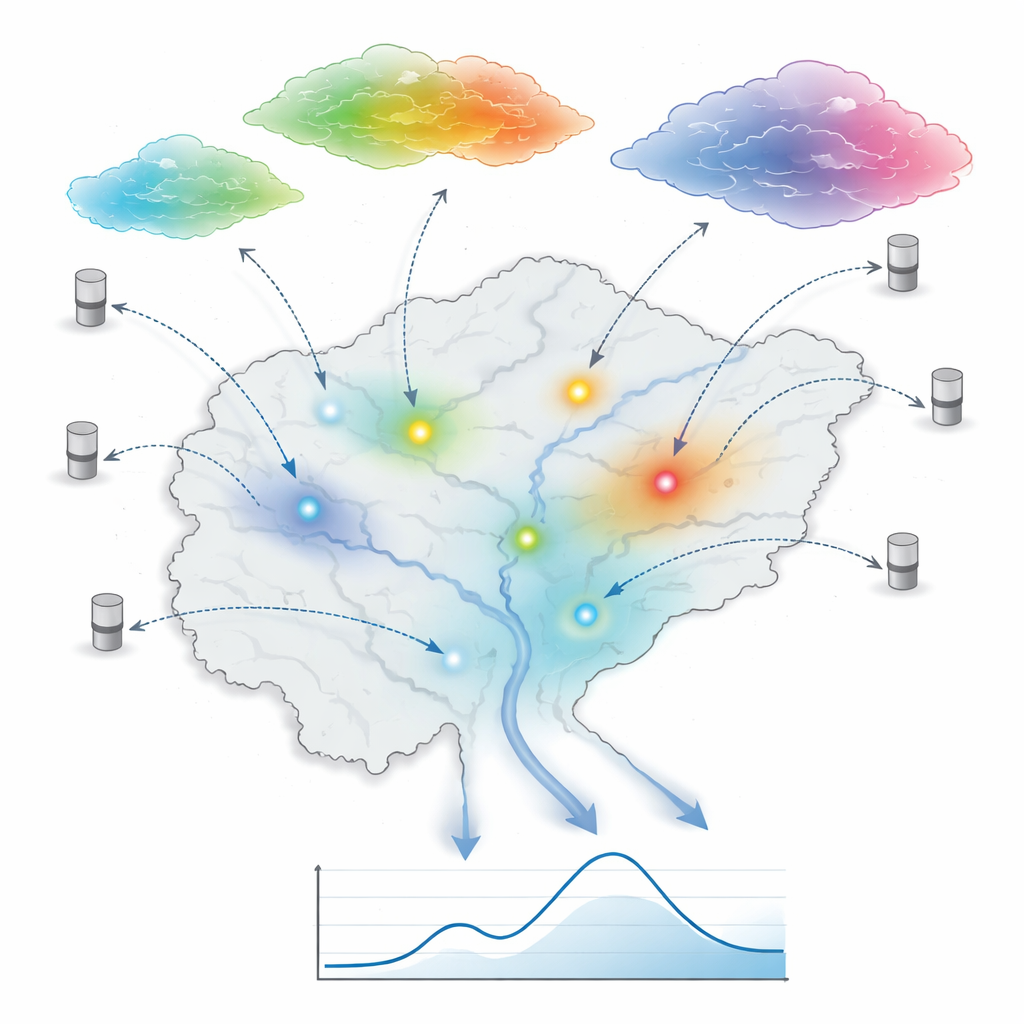
The researchers focused on the Xiaoergou Basin in northeastern China, a 16,761-square-kilometer area with no rain gauges inside its borders. Only a handful of gauges sit in neighboring basins around it. Yet this region experiences intense summer rains and floods from May to September. The team collected 10 years of data (2010–2019): river flow at the basin outlet, rainfall from 22 surrounding gauges, evaporation from three nearby stations, and six different gridded rainfall products based on satellites and weather models. Together, these sources offer plenty of information, but not in the right places. The challenge was to turn this patchwork into a realistic picture of where and how hard it rained over the ungauged basin on each day.
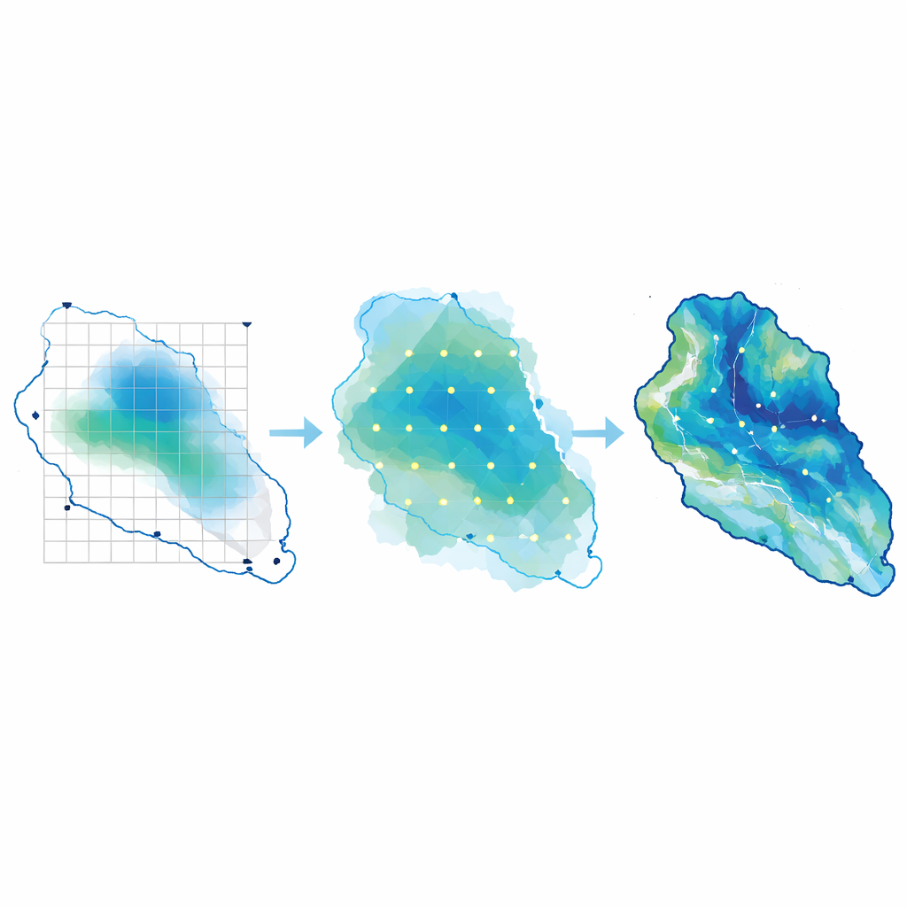
Creating invisible rain gauges
To tackle this problem, the authors used a technique called the virtual gauge-based method. Instead of accepting the sparse gauge network as fixed, they allow additional, purely computational “gauges” to be placed inside the basin wherever the multi-source rainfall products consistently point to important features such as storm centers or dry spots. A machine-learning model (a random forest) learns from the relationship between real gauges and the various rainfall products, then estimates how much rain would have fallen at each virtual gauge. Finally, actual and virtual gauges together are blended with a standard interpolation method to build a detailed rainfall map and a single basin-wide average value for each day.
Putting the method to the test
The key test is not how pretty the rainfall map looks, but how well it drives a flood model. The team compared two approaches. In the control approach, rainfall over the Xiaoergou Basin was estimated only from the surrounding gauges using a classic geometric technique known as the Thiessen polygon method, which effectively assumes that each gauge stands in for a large nearby area. In the new approach, the virtual gauge method fused the six satellite and model rainfall products with the sparse gauges to build a richer daily rainfall field. Both rainfall inputs were then fed into a widely used hydrological model that simulates how rain becomes runoff in soil and rivers. Model parameters were carefully tuned with a modern optimization algorithm and then tested on independent flood events.
Sharper floods from sharper rainfall
The simulations revealed clear benefits of the virtual gauges. When driven by rainfall from the new method, the flood model reproduced both the volume and timing of floods more accurately than when it relied on the sparse-gauge method alone. In the calibration period, the combined accuracy score for the virtual gauge approach was much higher, and errors in total flood volume were cut roughly in half. In the validation period on unseen events, the virtual gauge rainfall still led to better overall performance, especially in predicting when flood peaks would occur. Event-by-event analysis showed that the method adapted its virtual gauges: in some storms it strengthened rainfall centers that the outer gauges missed, while in others it toned down overestimated rain, reducing exaggerated peak flows.
What this means for flood-prone regions
In plain terms, this study shows that it is possible to "see" storms more clearly in basins with no instruments by combining satellite data, weather models, and nearby gauges in an intelligent way. The virtual gauge method does not simply average all sources everywhere; it selectively adds information where it matters most, then checks success through how well river flows are reproduced. Although the approach still depends on the quality of the input products and has so far been tested in one basin, the results suggest a promising path: with thoughtful data fusion, communities in poorly monitored regions could gain more trustworthy flood forecasts, even before new physical gauges are installed.
Citation: Dou, Y., Liu, X., Liu, X. et al. Analysis of the performance of a virtual gauge-based method in hydrological modeling of basins with no precipitation stations. Sci Rep 16, 11952 (2026). https://doi.org/10.1038/s41598-026-39531-2
Keywords: flood forecasting, rainfall estimation, satellite precipitation, ungauged basins, hydrological modeling