Clear Sky Science · en
Integrating multi-spectral remote sensing and machine learning for quantifying and mapping heavy metal contamination in the Tarim River Basin, China
Why hidden metals in desert rivers matter
In one of the driest corners of China, millions of people depend on soils and rivers that quietly collect traces of toxic metals. This study looks at the Tarim River Basin in southern Xinjiang and asks a practical question: can we use satellites and smart computer models to keep watch over heavy metal pollution across this vast, hard-to-reach landscape, and what does that pollution mean for human health, especially for children?
A fragile lifeline in a growing region
The Tarim River Basin is China’s largest inland river system, running through deserts but supporting farms, towns, and more than 11 million residents. As economic growth, irrigation, and industry have expanded, the basin’s soils and waters have begun to accumulate heavy metals such as arsenic, cadmium, lead, copper, and zinc. Unlike many organic chemicals, these metals do not break down; they can travel long distances in wind and water, settle into farmland, and slowly move through food and water supplies. Traditional field monitoring is costly and sparse in such a huge area, making it hard for officials to see where problems are emerging or how risks are changing over time.
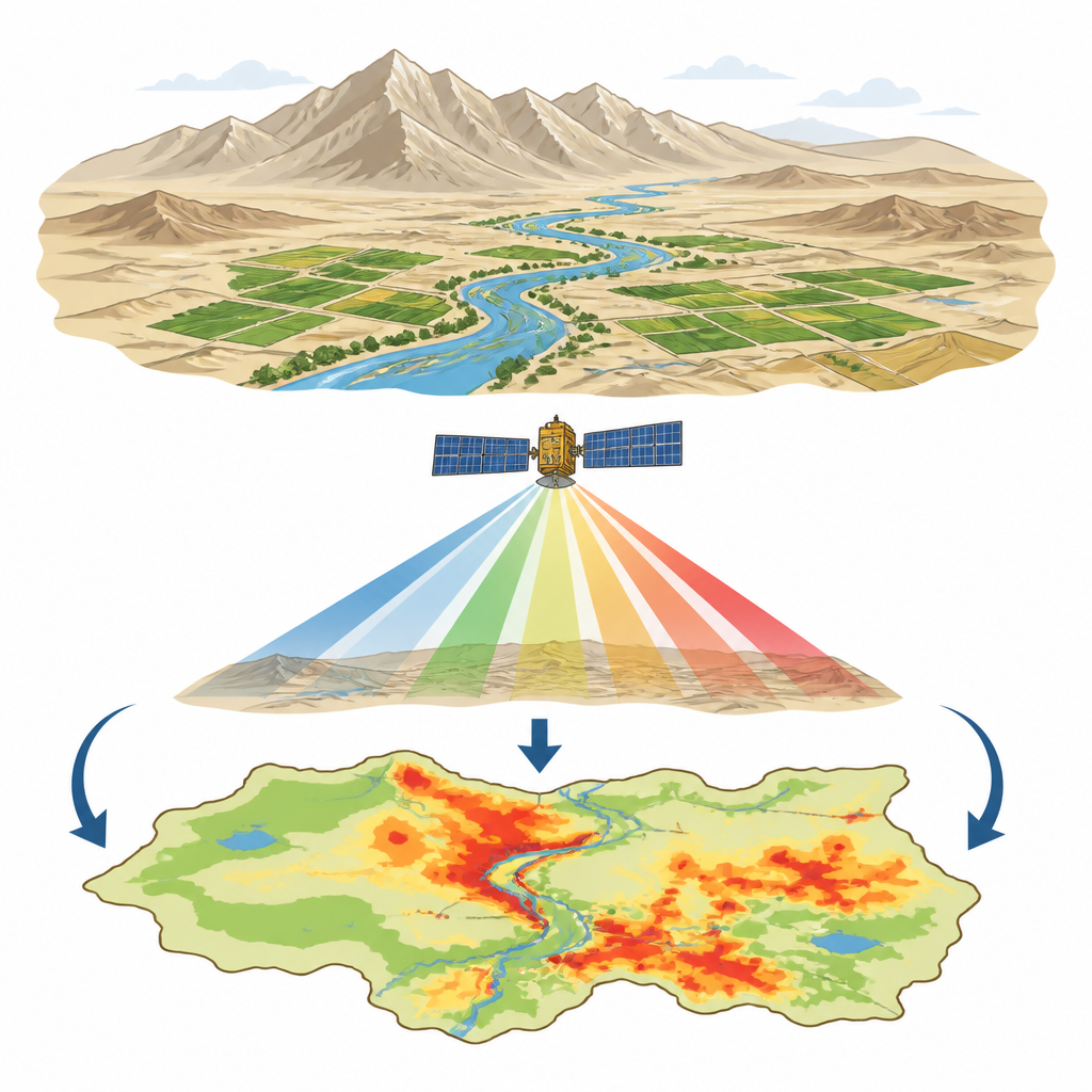
Watching pollution from space
To tackle this blind spot, the researchers combined ground measurements from earlier studies with fresh views from Europe’s Sentinel-2A satellite. They gathered metal readings for ten soil sites and nine water sites across the basin, then linked each site to the exact mix of colors recorded by the satellite over that spot. Using a machine learning technique called random forest regression, they trained computer models to recognize how subtle differences in surface color relate to different metal levels in soil and river water. After careful testing, they applied these models to every pixel in the satellite images, creating 60-meter-resolution maps that show estimated concentrations of each metal across the whole basin.
Where the metals build up
The resulting maps reveal distinct patterns. In soil, total heavy metal levels were moderate overall, but arsenic and cadmium often rose above natural background values, especially in parts of Aksu and Hotan. Copper and lead tended to cluster in central and southeastern areas, while zinc was more common in the east. In rivers, metal levels were generally below Chinese water quality standards, although cadmium crossed safety thresholds in a small fraction of river stretches. Statistical analyses suggest that much of the copper, lead, and zinc in soils comes from natural rock and soil processes, while arsenic and cadmium are more strongly linked to farming inputs and other human activities. In rivers, the pattern points to a mix of airborne dust, water flow, and local pollution sources.
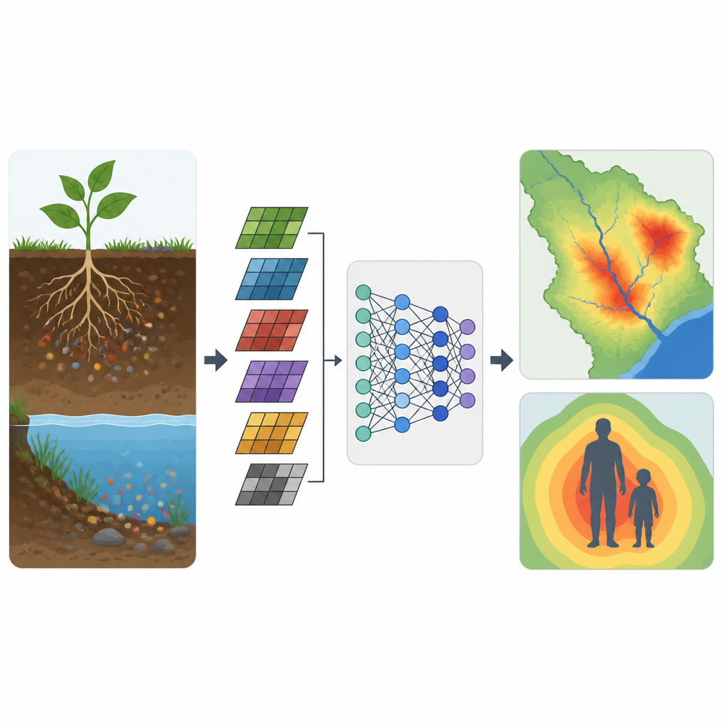
What this means for people’s health
Numbers on a map matter most when translated into health terms. Using a United States Environmental Protection Agency method, the team estimated how adults and children might take in these metals by swallowing soil or water, breathing dust, or getting particles on their skin. They found that eating or drinking was by far the main route of exposure. For adults, overall non-cancer health risks stayed below commonly used safety thresholds. For children, however, about one in ten soil samples implied a level of long-term exposure that could be concerning. Arsenic and cadmium stood out as the main contributors to potential cancer risk, with some locations exceeding widely used risk benchmarks, especially in parts of Hotan, Kashgar, and Aksu.
Steps toward safer soils and rivers
The study concludes that satellite data combined with machine learning can provide a cost-effective early warning system for heavy metal hotspots in large, dry river basins. While most areas in the Tarim Basin are not severely polluted, localized build-ups of arsenic and cadmium pose long-term concerns, particularly for children. The authors recommend regular satellite-based monitoring, tighter control of farm chemicals and industrial releases, targeted clean-up in the most affected areas, child health screening, and use of nature-based methods such as vegetated buffer strips and wetlands. Together, these measures could significantly cut heavy metal risks by 2035 while supporting regional development and broader sustainability goals.
Citation: Zhao, Y., Mu, Y., Luo, P. et al. Integrating multi-spectral remote sensing and machine learning for quantifying and mapping heavy metal contamination in the Tarim River Basin, China. Sci Rep 16, 15413 (2026). https://doi.org/10.1038/s41598-026-38887-9
Keywords: Tarim River Basin, heavy metal pollution, remote sensing, health risk assessment, machine learning