Clear Sky Science · en
Near space hyperspectral interferometric imaging image quality assessment with a physically grounded dataset
Watching Earth from the Edge of Space
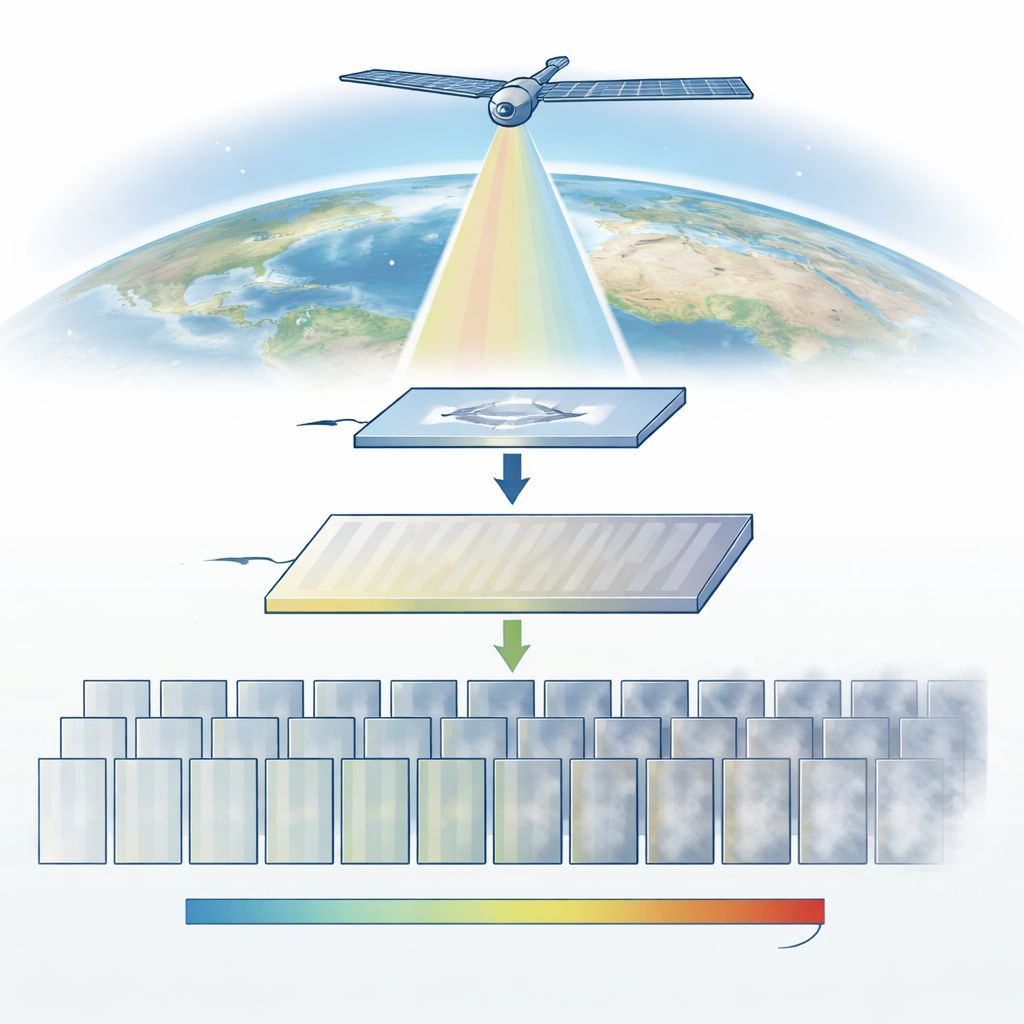
High above airplanes but far below satellites lies a little-known region called near space. Instruments operating here give scientists exquisitely detailed views of greenhouse gases, winds, and heat flow in the atmosphere. But these instruments don’t produce familiar photographs; they record delicate interference patterns whose quality is easily spoiled by tiny mechanical or electronic flaws. This paper introduces NSIQ, the first image-quality benchmark built specifically for this challenging kind of data, paving the way for more trustworthy climate and weather measurements.
Why Special Images Need Special Tests
Most modern tools that judge whether an image looks “good” or “bad” were trained on everyday scenes—people, buildings, landscapes snapped with consumer cameras. Those benchmarks have fueled impressive progress in image quality assessment, the field that links digital signals to human visual judgments. Yet the strange, stripe-like patterns produced by near-space interferometric instruments behave very differently from vacation photos. Their quality depends on subtle physical effects in the optics and sensors, not on typical problems like blur or compression artifacts. When off-the-shelf quality algorithms are applied to these scientific images, their assumptions break down and their scores no longer match what domain experts see.
Building a Physically Honest Testbed
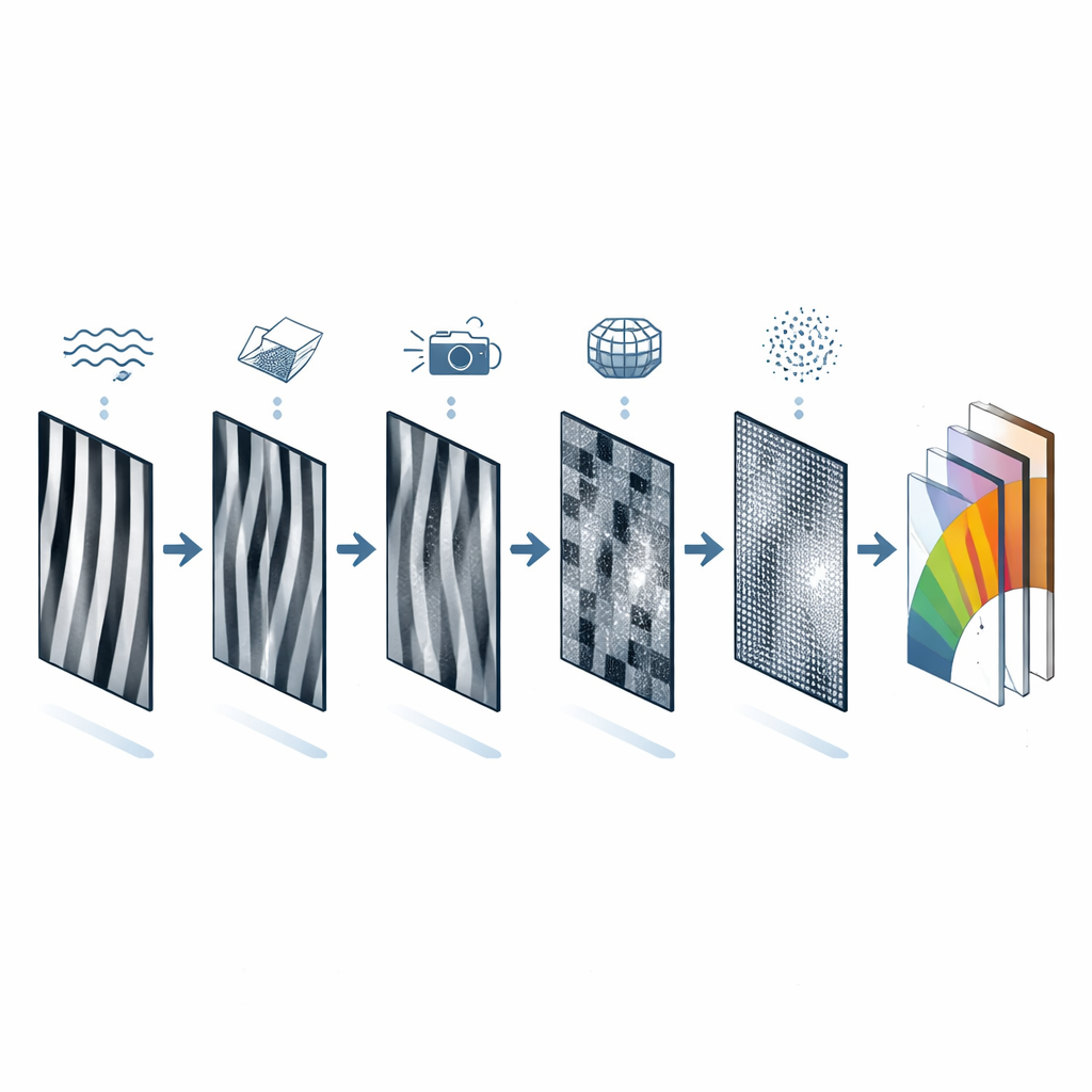
To tackle this gap, the authors created NSIQ, a carefully designed collection of 201 grayscale interferometric images that mimic what near-space instruments would actually record. Instead of sprinkling on generic digital noise, they start from a physics-based simulation of the instrument’s optics and then inject six realistic types of degradation: misaligned optical angles, tiny vibrations, uneven detector pixels, electrical readout noise, sampling limitations, and phase errors that warp the interference fringes themselves. Each degradation is varied from barely noticeable to severe, yielding a spectrum of image quality that reflects the true working conditions of near-space hardware.
Blending Human Judgment with Hard Numbers
Crucially, NSIQ does not rely on physics alone. For every simulated image, 27 experts in interferometric imaging scored what they saw, focusing on fringe clarity, how cleanly the patterns are modulated, and overall visual trustworthiness. These human opinions were combined with normalized physical parameters that quantify how badly the instrument settings were disturbed. A single hybrid quality value is computed from both ingredients, so each image carries a label that is grounded in the instrument’s behavior yet aligned with human perception. This dual view makes the dataset useful both for practical monitoring and for testing theories about what “quality” means in scientific imagery.
Putting Existing Methods to the Test
With NSIQ in hand, the authors subjected 14 leading image-quality algorithms—some that compare to a clean reference, others that work blindly—to a rigorous trial. Models that shine on natural photos stumbled badly here: their correlations with expert scores dropped, their prediction curves fluctuated wildly, and some nearly lost meaningful contact with human judgments. Even advanced deep-learning systems tuned for natural distortions struggled with the complex, physics-driven artifacts in these interferometric patterns. The results underline that simply training on more everyday pictures is not enough; algorithms must be redesigned to account for the unique, spatially uneven distortions that arise from real optical and electronic hardware.
What This Means for Watching Our Planet
By releasing NSIQ as an open resource, the authors provide a needed proving ground for future image-quality tools tailored to near-space observations. Their findings show that current methods cannot reliably track when these highly specialized images are good enough for climate and atmospheric science. In plain terms, NSIQ helps separate crisp, trustworthy fringe patterns from those quietly corrupted by subtle mechanical shakes or sensor quirks. Better quality assessment built on this benchmark could make remote sensing more robust, helping ensure that long-term records of greenhouse gases, winds, and energy flows truly reflect changes in Earth’s system rather than hidden flaws in the cameras watching from the edge of space.
Citation: Jiang, C., Tong, C. & Ma, Z. Near space hyperspectral interferometric imaging image quality assessment with a physically grounded dataset. Sci Rep 16, 8641 (2026). https://doi.org/10.1038/s41598-026-38036-2
Keywords: remote sensing, image quality, atmospheric observation, hyperspectral imaging, near space