Clear Sky Science · en
Forecasting groundwater level changes using machine learning techniques in Tazerbo area, Al Kufra Basin, southeast Libya
Why future groundwater matters here
In some of the driest parts of the world, underground water is the only thing keeping farms, towns, and industries alive. In southeast Libya, huge wellfields tap a deep desert aquifer to send water north to coastal cities. This article explains how scientists used modern computer tools to look ahead and see how these hidden water reserves might change over the next two decades under different pumping plans, helping decision makers avoid severe shortages and land damage.
The desert aquifer behind Libya’s water lifeline
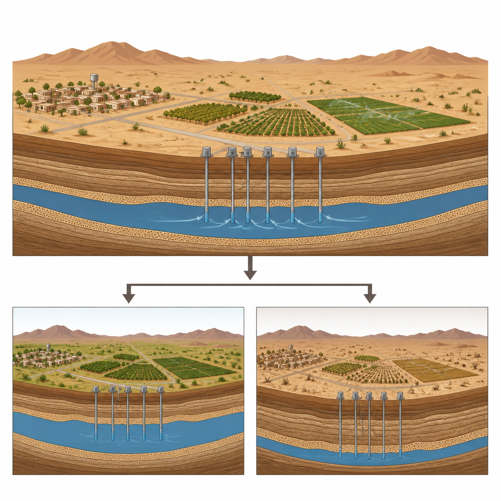
The study focuses on the Tazerbo wellfield in the Al Kufra Basin, one of the key sources for Libya’s Man-Made River Project, which pipes fossil groundwater from the Sahara to distant cities. The region receives very little rain and experiences intense heat, so the deep Nubian Sandstone Aquifer acts like a bank account of ancient water. Since large-scale pumping began in 2004, more than a hundred production wells have withdrawn up to about one million cubic meters of water each day at times. This heavy use has already lowered groundwater levels by as much as 16 meters in parts of the field and contributed to land subsidence, raising concerns about how long this water lifeline can last.
Turning well records into a learning problem
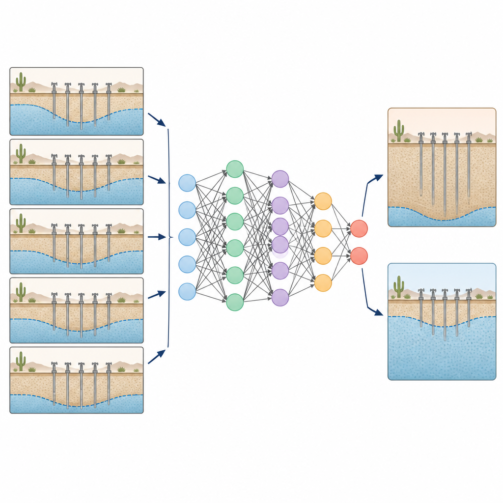
To explore the aquifer’s future, the researchers gathered twenty years of annual groundwater level measurements from fourteen monitoring wells around Tazerbo, along with records of how much water was pumped each day. They also compiled basic information about the wells and aquifer, such as rock thickness and how easily water moves through it. Instead of trying to model every physical detail of underground flow, they treated the problem as a time series: how does the water level at a well respond over time to past levels and to changes in pumping? This setup is well suited to machine learning methods that can uncover patterns in data without needing every physical process to be specified in advance.
How the machine learns to see ahead
The team tested several advanced statistical and machine learning tools, including types of Gaussian process regression and a recurrent neural network called Long Short-Term Memory. They checked how well each method could reproduce known water levels using standard yardsticks such as the match between predicted and observed values and the size of typical errors. The clear winner was a special type of time series neural network known as a Nonlinear Autoregressive Exogenous model, or NARX, which takes in both past water levels and pumping amounts. With a relatively simple structure, this network was able to match the history of all fourteen wells with very high accuracy. A detailed sensitivity analysis showed that the model drew on different combinations of inputs at different wells, suggesting it was capturing meaningful cause-and-effect patterns rather than simply memorizing the data.
Two different futures for the same aquifer
Once trained and checked, the NARX model was used to look forward to 2030 and 2040 under two pumping plans. In the first plan, the current lower withdrawal rate of about 255,000 cubic meters per day is kept in place. In that case, the model projects relatively modest extra drawdown, mainly in the northern part of the field: around 2 meters of additional decline by 2030 compared with 2024, and roughly another 1.6 meters by 2040. Some wells to the south might even see a slight rebound, likely reflecting the local aquifer structure. In stark contrast, the second plan assumes pumping is increased to 400,000 cubic meters per day.
What the results mean for water managers
Under the higher pumping plan, the model predicts very large drops in groundwater levels, exceeding 50 meters in the southeastern and southwestern parts of the wellfield by 2030 and remaining strongly depressed by 2040. Past experience in Tazerbo already shows that aggressive pumping can trigger sudden declines, which are partly reversible when extraction is reduced. The new forecasts support this picture and underline how sensitive the aquifer is to long-term overuse. For a lay reader, the message is clear: keeping withdrawals closer to present reduced levels helps stretch this finite water reserve over more years, while ramping pumping back up risks steep declines, land subsidence, and greater stress on communities that depend on this hidden water. The study shows that carefully tuned machine learning tools can become practical guides for planning sustainable water use in some of the world’s most water-scarce regions.
Citation: El Fallah, O.A., Abou El-Magd, L.M., El Kammar, M.M. et al. Forecasting groundwater level changes using machine learning techniques in Tazerbo area, Al Kufra Basin, southeast Libya. Sci Rep 16, 15383 (2026). https://doi.org/10.1038/s41598-026-37337-w
Keywords: groundwater forecasting, machine learning, Libya aquifer, water management, NARX neural network