Clear Sky Science · en
Integrating 3D structural modelling and seismic interpretation to optimize hydrocarbon development in the Early Miocene Nukhul Formation, October Oil Field, Gulf of Suez, Egypt
Why this buried landscape matters
Deep beneath the Gulf of Suez in Egypt lies a maze of broken rock layers that quietly feeds one of the country’s oldest oil fields. This paper shows how scientists combined modern imaging tools and decades of drilling data to redraw the underground map of the October Oil Field, focusing on a little‑used rock unit called the Nukhul Formation. Their refined three‑dimensional picture reveals hidden pockets of oil, explains why some wells produce mostly water, and points to safer, cheaper spots for new drilling.
A hidden layer in a crowded oil field
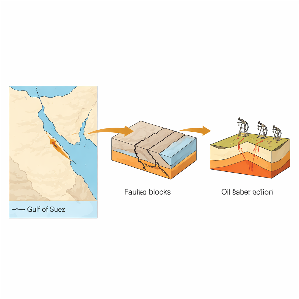
The Gulf of Suez is a classic “rift” basin—Earth’s crust has been stretched and broken into tilted blocks bounded by steep faults. Several rock layers there have long been tapped for oil, but the Early Miocene Nukhul Formation, sandwiched between older and younger units, remained relatively underexplored. Earlier models of this formation were built in the 1990s and early 2010s, when only sparse well logs and lower‑quality seismic surveys were available. As new wells were drilled and better seismic images acquired, puzzling results emerged: some wells performed better or worse than predicted, hinting that the old structural map of the field was too simple.
Building a 3D picture from scattered clues
To tackle this, the authors assembled nearly everything known about the subsurface: 20 seismic lines, detailed electrical logs from five key wells, core samples, microscopic fossil data for dating layers, pressure and production histories, and older company interpretations. Using specialized software, they tied well data to seismic reflections, converted seismic travel times into true depths, and carefully traced faults and layer boundaries through the volume. Quality checks at each step—such as comparing predicted depths to actual well hits and adjusting velocity models—helped keep the 3D model geologically realistic rather than just a computer fit.
Faults that divide, seal, and store oil
The refined model shows that the Nukhul Formation is cut mainly by two large faults, labeled F1 and F2, which slice the field into separate structural “rooms,” or compartments. The Nukhul itself is split into four stacked members, K1 through K4, made of sandier reservoir beds and tighter limestone‑marl layers. Where movement along F2 pushes an upper sand‑rich K4 zone against low‑permeability limestone and marl, the fault behaves like a sideways seal. Oil migrating upward becomes trapped on the high side of the fault in an attic zone, while the low‑permeability rocks on the other side prevent it from leaking away. Production data and pressure behavior match this picture of partially sealed compartments connected along some directions but blocked across others.
From map to drilling plan
Armed with this sharper structural framework, the team redrew contour maps on the Nukhul and neighboring formations and cut geological cross‑sections through key wells. These views highlight crest‑like “attic” areas where reservoir sands sit safely above the oil–water contact yet have never been drilled, often because earlier models overlooked the subtle bend in the layers or mis‑positioned the faults. The authors identify several promising infill targets that could be reached by sidetracking existing wells rather than building new platforms, a strategy that keeps costs low. Because the updated model also clarifies where water is likely to invade first, engineers can design completions and monitoring programs to delay water breakthrough and adjust injection or production if the field behaves differently than expected.
What this means for energy and beyond
In plain terms, this study shows that redrawing the underground “blueprint” of an old oil field can unlock fresh life from rocks thought to be nearly exhausted. By weaving together seismic images, well measurements, rock samples, and flow histories into a single 3D model, the researchers were able to pinpoint overlooked oil pockets, understand how faults help or hinder flow, and propose a drilling plan that could add several thousand barrels of oil per day with relatively modest investment. The same approach can be applied to other faulted basins around the world, improving how we manage mature fields and providing a more reliable picture of what still lies hidden in the subsurface.
Citation: Khattab, M.A., Radwan, A.E., El-Anbaawy, M.I. et al. Integrating 3D structural modelling and seismic interpretation to optimize hydrocarbon development in the Early Miocene Nukhul Formation, October Oil Field, Gulf of Suez, Egypt. Sci Rep 16, 7956 (2026). https://doi.org/10.1038/s41598-025-29859-6
Keywords: Gulf of Suez, 3D structural modeling, fault-controlled reservoirs, Nukhul Formation, attic oil targets