Clear Sky Science · en
An aerial color image anomaly dataset for search missions in complex forested terrain
Why tiny clues in big forests matter
When someone goes missing in the woods, the smallest detail on the ground can hold the answer: a scrap of cloth, a tarp, or a makeshift shelter partly hidden under leaves. This article describes how a tragic manhunt in a German forest led to the creation of a large, open image dataset designed to help computers and people find such faint visual hints in dense woodland. The work sits at the crossroads of crime investigation, search and rescue, and artificial intelligence, and it shows both the promise and present limits of using aerial cameras and algorithms to spot what does not belong in nature.
A tragic case in a difficult landscape
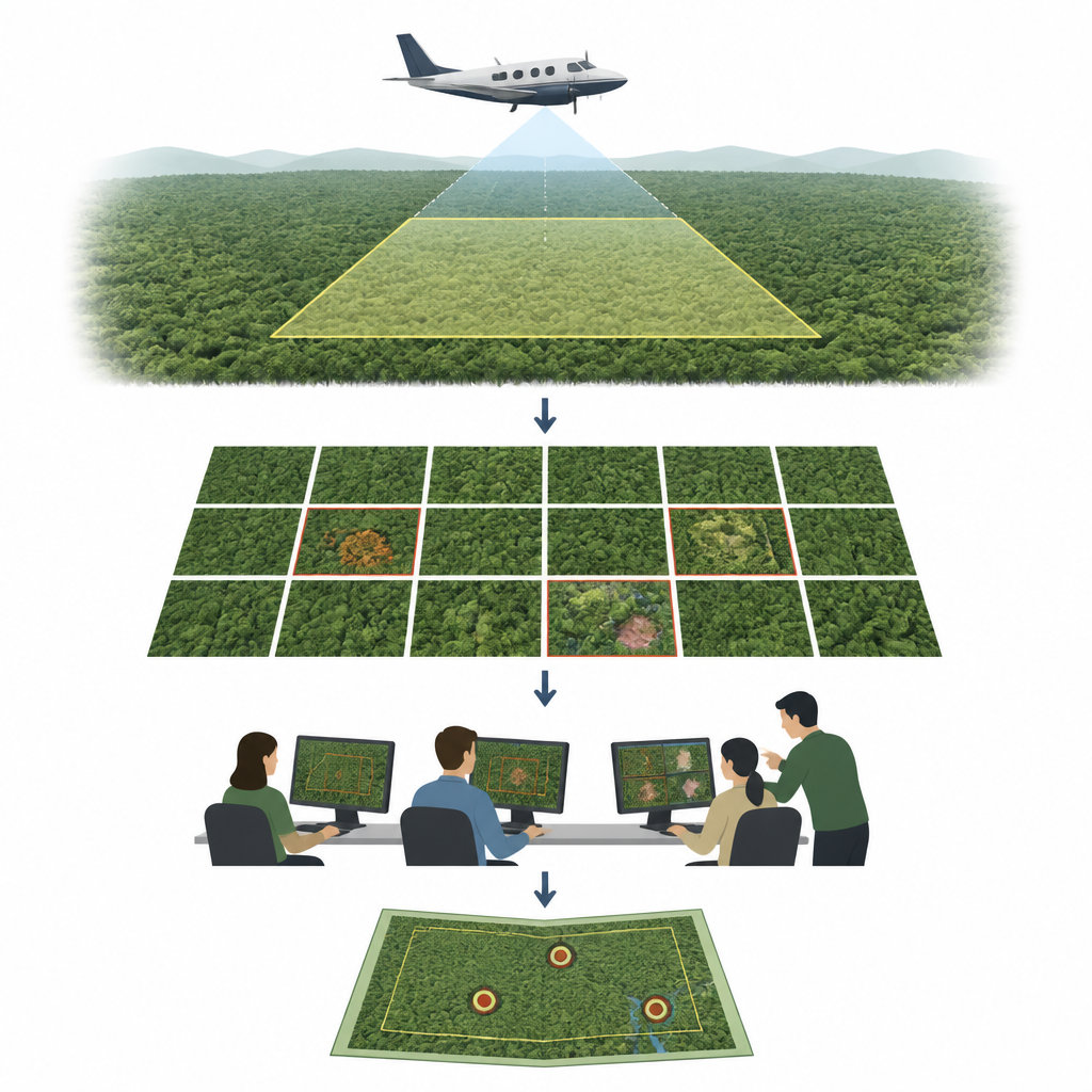
The story begins with a family murder in the village of Weitefeld in April 2025. Police believed the suspect had escaped into a surrounding forest that stretches across roughly 60 square kilometers. Hundreds of officers, helicopters, drones, and divers searched for weeks, but thick vegetation and the sheer size of the area defeated conventional efforts. To extend the search, a research aircraft equipped with a specialized camera system flew over a 25 square kilometer section, focusing on a 10 square kilometer priority zone. The plane recorded more than 30,000 high resolution color images, each sharp enough to resolve features just a few centimeters across, in the hope of spotting objects or shelters that might signal human remains.
Turning thousands of photos into a shared search
Despite the sharp imagery, fully automatic detection was unrealistic. Many potential clues would appear as tiny patches only a few pixels wide and were often hidden under branches and shadows. Instead of relying solely on software, the team launched an online crowd effort. Using a custom web viewer, 160 volunteers from the police and several universities inspected 10,659 images. They could zoom, pan, adjust brightness, and switch between the original photo and a computer generated color mask that highlighted suspicious tones. Volunteers marked anything that looked out of place in a forest, from bright items on the ground to possible hiding spots, and classified them as potential objects, shelters, persons, or unknown. Their reports guided follow up checks on the ground by police teams.
What the dataset contains
The crowd effort produced 405 distinct findings. Police judged 238 of them as relevant and visited all of these locations in person, documenting what they actually found. The discoveries ranged from old barrels and trash bags to tarps, huts, and hunting stands, and occasionally people or traces of human activity. Using mapping techniques, the researchers then projected each labeled finding onto every image where it appeared from different angles and with different amounts of cover from leaves and branches. This process yielded 34,424 labeled anomaly instances spread across the 10,659 priority zone images, along with nearly 20,000 additional unlabeled images from nearby regions. All data, plus the annotation tools and an interactive map, are openly available so that others can inspect the same forest, add new labels, or download image batches for their own algorithms.
How current computer methods fall short
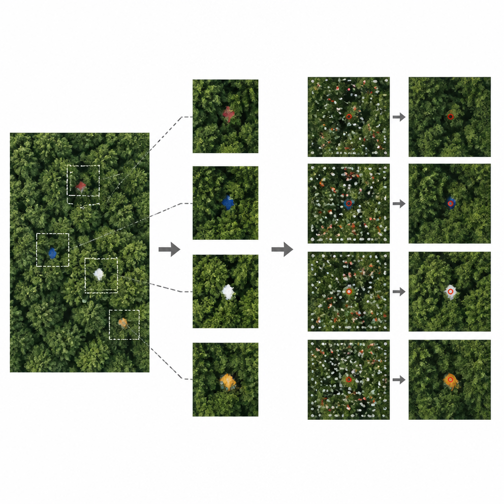
To show how demanding this kind of forest search is, the authors tested several popular anomaly detection methods, including deep learning systems and simpler models based on color statistics. These tools assign each pixel or region a score that reflects how unusual it looks compared with its surroundings, and then decide whether it is an anomaly. On this dataset, the deep learning methods found only a small fraction of true anomalies, and the simpler methods produced too many false alarms scattered over each image. Dense foliage, motion blur from the moving aircraft, and the fact that many clues occupy only a few pixels all worked against the algorithms. When the team tried a modern object detection network trained directly on the labeled data, it also failed, confirming that standard person or object recognition does not work reliably when most of the target is hidden.
What this means for future forest searches
In the end, the search flight narrowly missed the suspect, whose body was later found just outside the scanned area. Yet the operation left behind a rare and carefully documented collection of real search images, human labels, and police confirmations. For lay readers, the main message is that spotting a small man-made object from the air in a cluttered forest is far harder for computers than for people, especially when only fragments are visible. By sharing this dataset and tools freely, the authors aim to help researchers build smarter systems that take into account wider context, such as patterns across many trees and views, rather than only local pixels. Better algorithms trained on such realistic data could one day support faster, more reliable search and rescue missions and help investigators read vital clues hidden in the canopy.
Citation: Amala Arokia Nathan, R.J., Gessner, M., Özkan, N. et al. An aerial color image anomaly dataset for search missions in complex forested terrain. Sci Data 13, 747 (2026). https://doi.org/10.1038/s41597-026-07101-w
Keywords: aerial imagery, anomaly detection, search and rescue, forested terrain, crowdsourcing