Clear Sky Science · en
An AI-ready remote sensing dataset for high-resolution forest disturbance mapping
Why damaged forests matter to everyone
Across Europe, forests are under growing pressure from drought, storms, insects, and logging. These changes can unfold in small patches that are hard to spot from the ground, yet they influence everything from hiking landscapes to carbon storage and local climate. This study introduces a new open dataset that turns ultra-detailed aerial photographs of German forests into fuel for artificial intelligence, making it far easier to detect where, how, and why forests are being damaged.
Seeing forests from above in fine detail
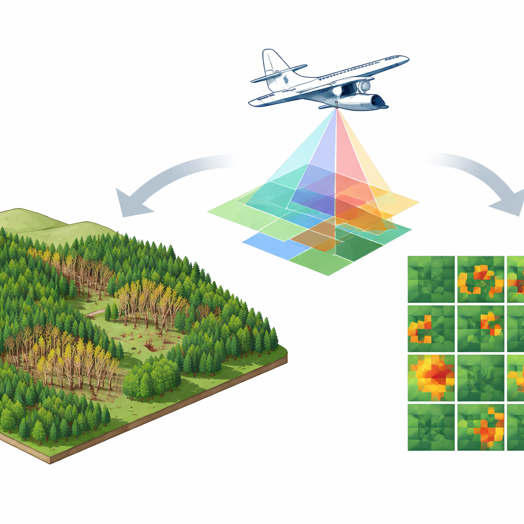
The work centers on Rhineland-Palatinate, a heavily forested state in western Germany that has seen severe tree decline in recent decades, especially among spruce. Instead of relying on common satellite images that blur the land surface into 10–30 meter pixels, the authors use aerial photos with a resolution of just 20 centimeters—sharp enough to distinguish individual tree crowns and narrow clearings. Each large aerial scene is cut into standardized 100-by-100-meter tiles, forming a collection of about 17,500 image patches. This fine-grained view allows small, irregular disturbance patches, often missed by coarser sensors, to be mapped with much greater precision.
Adding invisible colors and forest height
The dataset does more than store regular color photos. Each tile carries five layers of information: red, green, blue, near-infrared light, and an estimate of object height. Near-infrared reveals how vigorously vegetation is photosynthesizing, making stressed or dead trees stand out from healthy ones. The height layer, created by combining digital surface and ground elevation models, shows how tall objects are, helping distinguish standing trees from clear-cut areas or fallen trunks. Together, these layers capture both the “color” and “shape” of the forest canopy, giving AI models the clues they need to tell different disturbance types apart.
Turning expert knowledge into training data
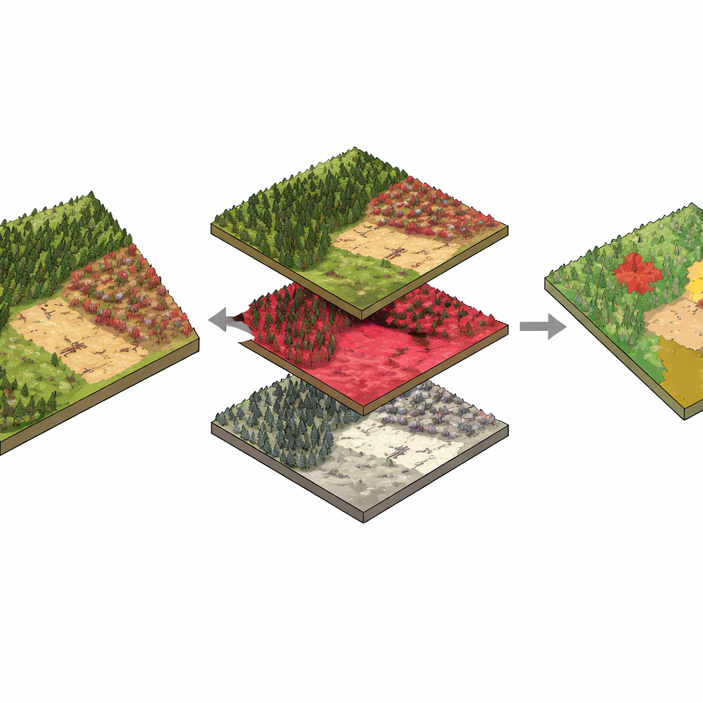
High-quality training data is the bottleneck for many AI projects, and forest monitoring is no exception. To label the imagery, the team blended on-the-ground disturbance records from a national park and a statewide reporting system with careful visual interpretation. In a first step, rangers’ field observations were translated into detailed disturbance polygons by hand. Next, a modern computer vision model was fine-tuned to help refine the often rough disturbance outlines in the broader regional database, snapping them to the actual damaged areas visible in the imagery. Specialists then reviewed thousands of tiles using a custom web tool, correcting boundaries, classes, and missed patches. The result is a set of segmentation masks that mark each pixel as bark beetle damage, clear-cut, windthrow, or background, with an expert acceptance rate above 90 percent.
How well AI can read the forest
To show what the dataset can do, the authors trained a popular deep learning architecture to segment disturbance types automatically. Using all five channels, the model correctly classified about 88 percent of pixels, performing especially well for clear-cuts and bark beetle damage. An additional experiment systematically removed input channels to see which mattered most. Dropping the near-infrared or height layers caused the largest drop in performance, especially for detecting dead or logged stands and tangled windthrow. This confirms that combining spectral cues with 3D structure is key to recognizing subtle differences in how trees die or are removed.
What this means for future forest watch
For non-specialists, the main takeaway is that the study delivers a carefully curated, openly available training ground for AI systems that “read” forests from above. By pairing sharp aerial views with trusted disturbance labels, it makes it easier for researchers, agencies, and even conservation groups to build and compare automated tools for tracking forest health. While the dataset is rooted in one German state, its design—and the code released alongside it—offers a template for similar efforts elsewhere. In the long run, resources like this can help society notice and respond to forest trouble earlier, at scales from a single stand to an entire region.
Citation: Rodríguez-Paulino, E., Stoffels, J., Schlerf, M. et al. An AI-ready remote sensing dataset for high-resolution forest disturbance mapping. Sci Data 13, 490 (2026). https://doi.org/10.1038/s41597-026-07084-8
Keywords: forest disturbance, remote sensing, aerial imagery, deep learning, bark beetle