Clear Sky Science · en
High-Resolution Downscaled CMIP6 Projections dataset of Key Climate Variables for Senegal
Why this climate story matters for daily life
Senegal, like much of West Africa, depends heavily on rainfall to grow food and support livelihoods. Yet farmers, planners, and energy managers often lack detailed, trustworthy information about how rain, heat, and sunlight may change in specific places over the coming decades. This article presents a new high‑resolution climate dataset for Senegal that sharpens the blurry view from global climate models into something local, practical, and ready to use.
Turning global climate models into local insight
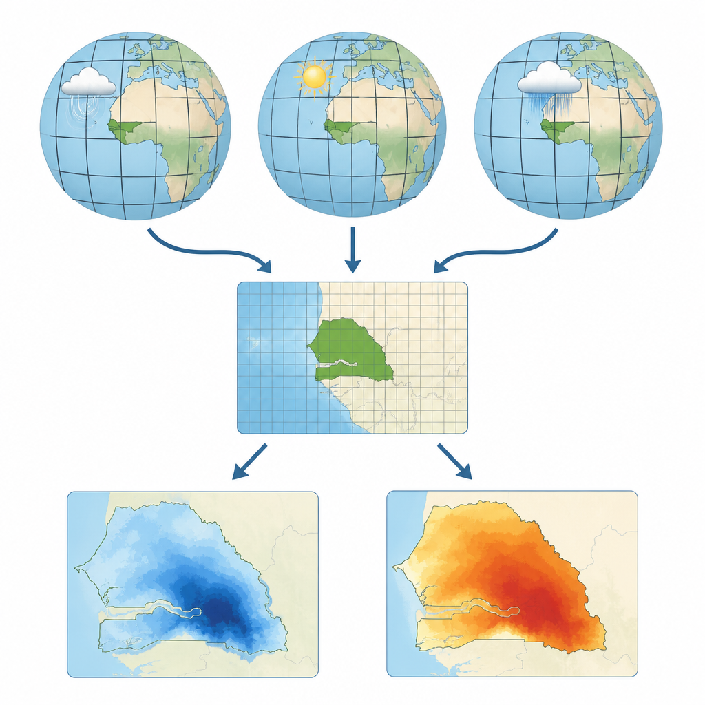
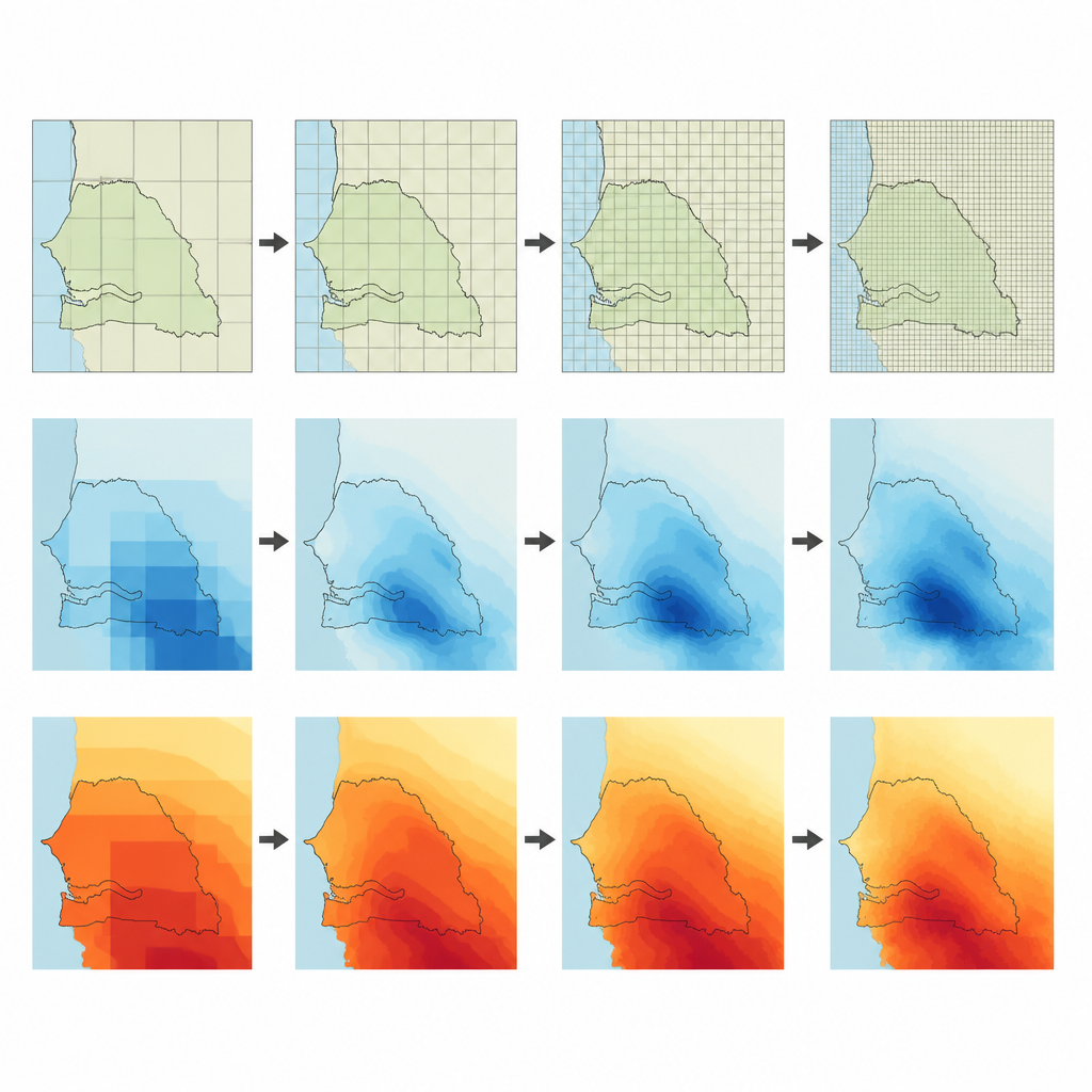
Most climate projections come from global models that divide the planet into large grid boxes, often hundreds of kilometers wide. These models are crucial to understand overall warming trends, but they struggle with local features such as the West African monsoon and coastal effects that shape Senegal’s climate. As a result, they can misrepresent how much it rains, how hot it gets, or how sunlight varies from place to place. The authors tackle this problem by “downscaling” results from 19 of the latest CMIP6 climate models to a much finer grid over Senegal, about four kilometers on a side, and by correcting systematic errors using local observations.
How the data were built and checked
To anchor the projections in reality, the team first assembled detailed observation‑based datasets for rainfall, temperature, and solar radiation. Rainfall comes from a blend of satellite estimates and ground stations; temperatures from a high‑resolution global product chosen after testing against multiple alternatives; and solar radiation from sunshine duration measured at weather stations and converted using standard physical formulas. All of these were placed on the same fine grid covering Senegal. Then, using a statistical method called the Cumulative Distribution Function transform, model outputs were adjusted so that their day‑to‑day behavior matches the observed climate at each grid point while still preserving the long‑term climate change signal from the original models.
Making sure the numbers can be trusted
Building a dataset is only half the task; proving that it works is just as important. The authors performed rigorous technical checks to ensure that files, formats, and metadata follow community standards so that researchers can easily read and combine the data. They also carried out value checks, comparing the corrected model outputs with observations over recent decades. Before correction, many models either rained too much or too little, underestimated intense downpours, miscounted dry spells, or misrepresented temperature patterns and solar radiation. After correction, typical rainfall and temperature biases shrank sharply, seasonal cycles fell much closer to observed values, and measures of extremes such as very hot days or heavy rain events lined up more realistically with real‑world records.
What the projections say about Senegal’s future
The dataset spans the period from 1850 to 2100 and includes three different futures for greenhouse gas emissions, ranging from strong cuts to continued growth. Across all scenarios, Senegal warms, with the strongest rise in the highest‑emissions pathway, where average temperatures could be more than six degrees Celsius above late‑20th‑century levels by the end of the century. Rainfall changes are less uniform across models, but many suggest fewer rainy days, more frequent dry spells, and a greater share of rain falling in intense or extreme events, especially later in the century and under higher emissions. Solar radiation patterns also become more accurately represented, which matters for planning solar power and understanding crop water needs.
From research numbers to real‑world choices
For a non‑specialist, the main message is that this work turns coarse global projections into a detailed, locally tuned picture of future climate for Senegal. Instead of guessing from global averages, farmers, water managers, urban planners, and energy developers can now explore daily projections of rain, heat, and sunlight at a resolution fine enough to match fields, watersheds, and city districts. While the dataset cannot remove all uncertainty and does not guarantee how any single year will behave, it offers a credible, carefully tested foundation for exploring risks and designing adaptation strategies that fit the realities on the ground.
Citation: Mbengue, A., Sultan, B., Lguensat, R. et al. High-Resolution Downscaled CMIP6 Projections dataset of Key Climate Variables for Senegal. Sci Data 13, 723 (2026). https://doi.org/10.1038/s41597-026-07059-9
Keywords: Senegal climate, downscaled CMIP6, rainfall projections, temperature change, West Africa