Clear Sky Science · en
BDSet: A First-ever BDS Satellite-based PPP Augmentation Dataset Since 2023
Bringing Space-Grade Accuracy to Everyday Navigation
From finding the fastest driving route to steering cargo ships far from shore, our lives increasingly depend on satellite navigation. Yet most devices still rely on basic signals that can be off by several meters. This paper introduces BDSet, the first long-term, open dataset built around China’s BeiDou high-precision service, which tightens those errors to the decimeter level or better. By making three years of detailed correction data publicly available, the authors aim to unlock new research and applications in positioning, Earth science, and even weather forecasting.

A New Window into High-Precision Satellite Positioning
Modern navigation satellites do more than broadcast their own positions. For truly precise location, users also need correction data that accounts for small errors in satellite orbits, clock timing, and signal biases. BeiDou’s PPP-B2b service sends these corrections directly over satellite links, so users at sea or in remote regions can benefit without ground internet. Until now, however, researchers lacked a unified, long-running record of these correction messages. BDSet fills that gap with a carefully organized archive of BeiDou PPP-B2b “augmentation” data starting from January 2023, captured continuously from a rooftop station in Wuhan, China.
From Raw Radio Signals to Ready-to-Use Products
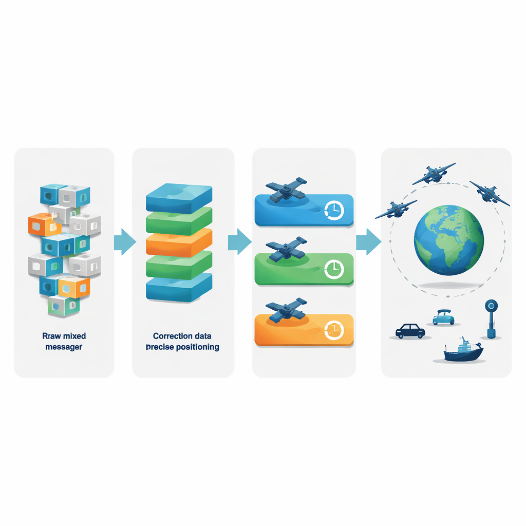
The heart of BDSet is a four-step data pipeline that turns raw radio messages into precise positioning products. At the first level, the team stores the untouched binary data from a commercial BeiDou/GPS receiver, which contains both correction messages and standard satellite broadcasts in a chip-specific format. At the second level, they extract and repackage the correction messages to match the official BeiDou signal specification, so that different receivers and software can interpret them consistently. The third level decodes these standardized messages into human- and machine-readable correction values, such as how much a satellite’s orbit or clock should be adjusted. Finally, at the fourth level, the authors combine these corrections with broadcast satellite information to reconstruct high-precision satellite positions, clocks, and signal biases that can be plugged directly into positioning, navigation, and timing solutions.
Three Years of Big Data from Space
BDSet is large enough to capture how the BeiDou high-precision service behaves over different seasons and operational phases. For the years 2023–2025, the dataset totals about 142.7 gigabytes and includes more than 255 million correction messages from four geostationary BeiDou satellites. The authors document how many messages are received each day, how often different message types appear, and how quickly the corrections arrive after they are generated. They find that once the system and receiver firmware were stable, the reconstructed orbit products are nearly complete on most days, with data coverage close to 100% at the intended 48-second sampling interval.
Checking Accuracy Across the Global Network
To verify that BDSet’s highest-level products are trustworthy, the team compares their reconstructed orbits and clocks against rapid reference solutions produced by an independent geoscience center. For both BeiDou and GPS satellites, typical orbit errors are on the order of a few decimeters, and clock variations are stable to fractions of a nanosecond, consistent with or better than earlier studies. The authors also map out the geographic coverage of the corrections, showing that the service focuses on a broad region spanning much of Asia and adjacent oceans. This confirms that the dataset reliably reflects how the live BeiDou PPP-B2b service supports users over time.
Opening the Door to Future Applications
By making BDSet and its supporting code openly available, the authors offer a shared foundation for many fields. Navigation researchers can test new algorithms for cars, ships, and smartphones under realistic conditions, including signal interruptions and urban obstacles. Earth scientists and meteorologists can mine the long time series for patterns related to tectonic motion, atmospheric water vapor, or extreme weather. Data scientists can treat BDSet as a rich, labeled dataset for training artificial intelligence models that predict or enhance satellite corrections. In simple terms, this work turns a complex stream of space-borne signals into a well-structured resource that others can build on to make positioning more accurate, more reliable, and more widely accessible.
Citation: Ouyang, C., Shi, J., Hou, C. et al. BDSet: A First-ever BDS Satellite-based PPP Augmentation Dataset Since 2023. Sci Data 13, 644 (2026). https://doi.org/10.1038/s41597-026-07032-6
Keywords: BeiDou PPP-B2b, satellite navigation data, precise point positioning, GNSS augmentation, geospatial datasets