Clear Sky Science · en
Comprehensive uncrewed aerial system data for Amazon rainforest at Tiputini Biodiversity Station, Ecuador
A New Aerial Window into the Amazon
The Amazon rainforest is often called the lungs of the planet, but much of its structure and hidden life is still poorly mapped. This study introduces a new way to see that world in remarkable detail: by flying sophisticated camera- and laser-equipped drones over one of the most biodiverse sites on Earth, the Tiputini Biodiversity Station in Ecuador, and then making all of that finely detailed data freely available to everyone.
Why Mapping This Forest Matters
Although the Amazon covers a vast area and hosts roughly a tenth of Earth’s known species, it is difficult to study up close. Thick canopy, seasonal floods, and the sheer remoteness of many locations make it hard to collect on-the-ground measurements over large regions. Satellites have transformed our view of the forest, revealing deforestation, regrowth, and broad shifts in biomass and climate feedbacks. But even the best public satellite images smooth over the intricate mix of tree crowns, vines, clearings, and wetlands that define local habitats, and laser measurements from space arrive only at scattered points. As a result, scientists lack continuous, high‑resolution views of how individual trees and patches of forest are arranged, especially across different habitat types.
Drones Survey a Hidden Hotspot
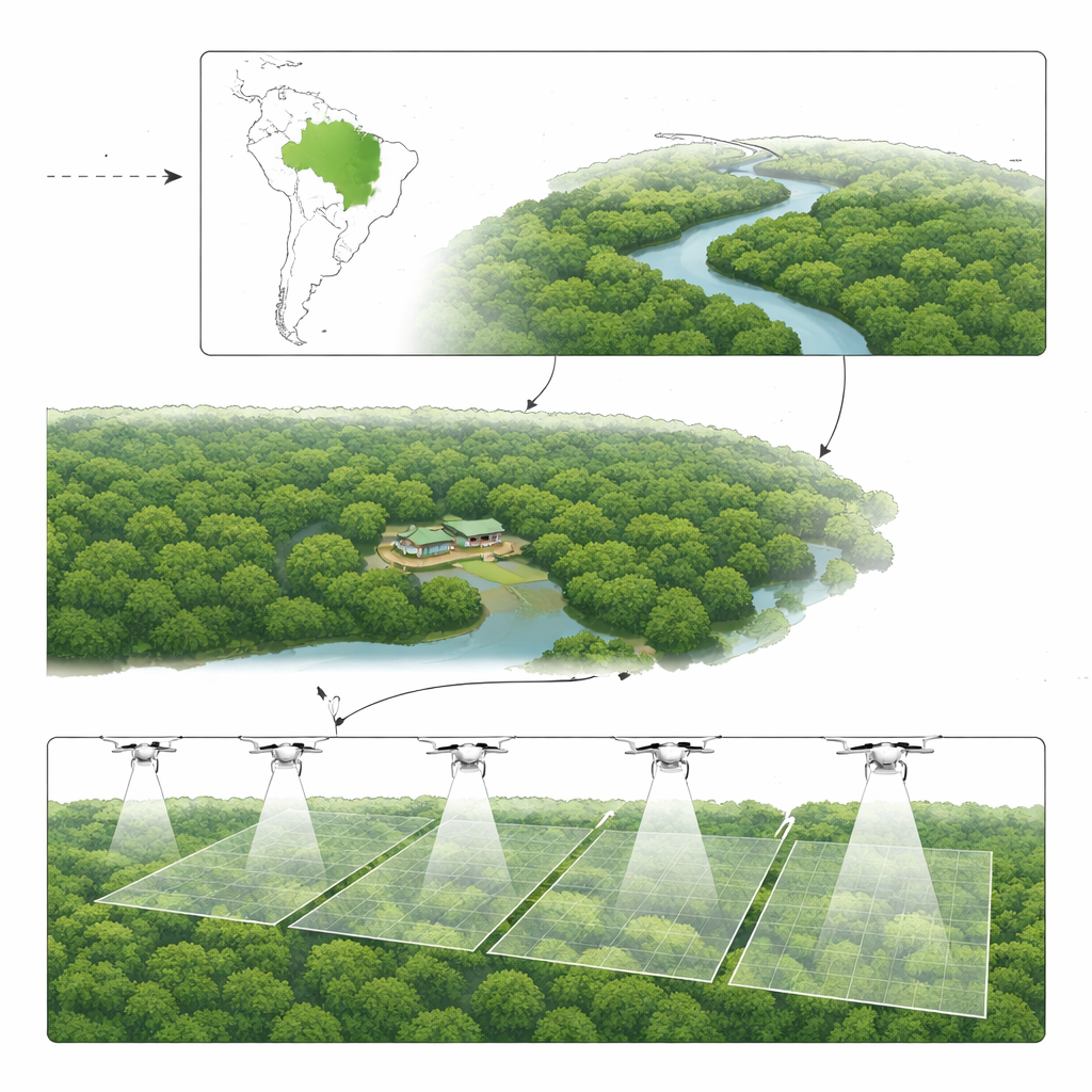
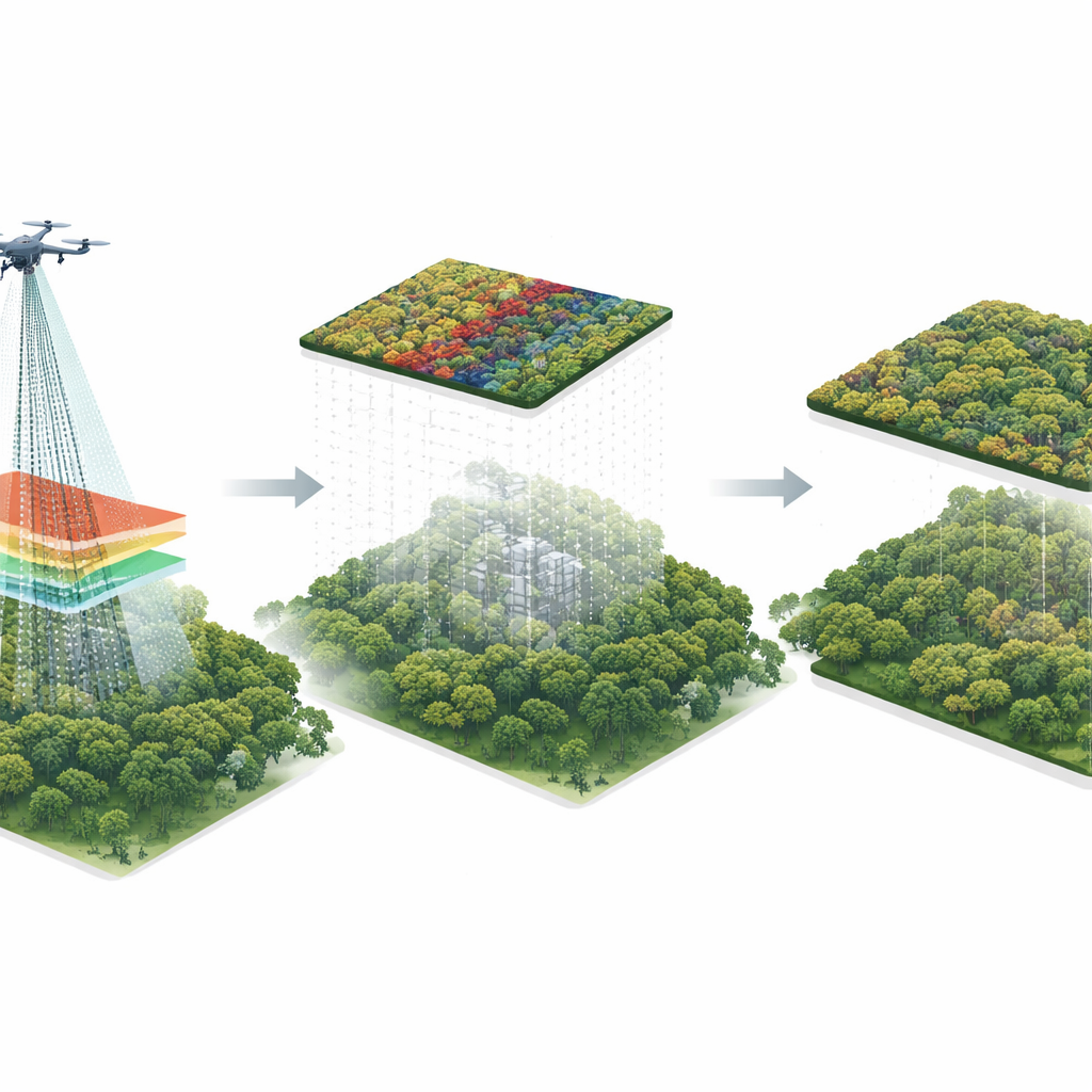
To close this gap, the researchers carried out a coordinated drone campaign over 712 hectares—more than 700 soccer fields—around the Tiputini Biodiversity Station, a remote field site in the Yasuní Biosphere Reserve. This area includes tall unflooded forest, seasonally flooded stands along the Tiputini River, palm swamps, and natural regrowth zones, making it a microcosm of the wider Amazon. Over four days, two types of uncrewed aerial systems were flown in overlapping strips across five subregions. One drone carried a multispectral camera that records both normal color images and near‑infrared light, which is especially sensitive to vegetation health. The other carried a laser scanner (lidar) that sends pulses of light down through the canopy and measures how long they take to bounce back, building a three‑dimensional picture of trees and terrain.
From Raw Flights to Seamless Maps
Collecting the data was only half the challenge. In a dense rainforest, satellite navigation signals are often weak, and the team could not place painted targets on the ground for precise alignment because the terrain was too rugged and much of the forest floor is hidden from view. Instead, they carefully post‑processed the navigation data from temporary base stations and the drones themselves, using a technique called kinematic correction to sharpen positions after the flights. Powerful graphics‑processor workstations then stitched more than ten thousand overlapping images into a single, continuous mosaic with five‑centimeter pixels—fine enough to distinguish individual tree crowns. A similar effort turned billions of laser returns into a dense cloud of 3D points, from which the team derived detailed models of the ground surface, the tops of the canopy, and the height of the forest above the ground at every quarter‑meter cell.
Checking Accuracy and Sharing the Treasure
Because there are no permanent survey markers at Tiputini, the team could not measure absolute position errors down to the centimeter. Instead, they checked the internal consistency of the data. They compared overlapping laser strips, estimated small horizontal and vertical shifts, and then gently nudged each subregion into alignment. They also compared the color imagery and laser‑based height maps to make sure the crowns visible from above lined up with the tallest points in 3D. In most places, the mismatch was just a few tens of centimeters—tiny compared to the size of a tree crown. All final products are stored in cloud‑friendly formats that allow users to stream just the pieces they need, and the authors have also released the original flight data and processing scripts so that others can test new methods or re‑process the information as techniques improve.
A Foundation for Future Forest Discoveries
For non‑specialists, the key outcome is simple: this project turns a patch of Amazon rainforest into one of the best‑mapped tropical forests on the planet, and it does so in a way that anyone can use. Researchers can now track individual tree crowns, measure forest height and gaps, estimate stored carbon, and relate these patterns to animals, microbes, and climate over time. Because the data are open and carefully documented, they provide a baseline for future drone flights, satellite missions, and climate studies, helping scientists understand how one of Earth’s richest ecosystems responds to storms, droughts, and human pressure in the years to come.
Citation: Jung, M., Chang, A., Cannon, C.H. et al. Comprehensive uncrewed aerial system data for Amazon rainforest at Tiputini Biodiversity Station, Ecuador. Sci Data 13, 532 (2026). https://doi.org/10.1038/s41597-026-06894-0
Keywords: Amazon rainforest, drone mapping, lidar data, biodiversity monitoring, forest structure