Clear Sky Science · en
Copernicus Data Space Ecosystem establishes public cloud processing for earth observation data
Watching Our Changing Planet from the Cloud
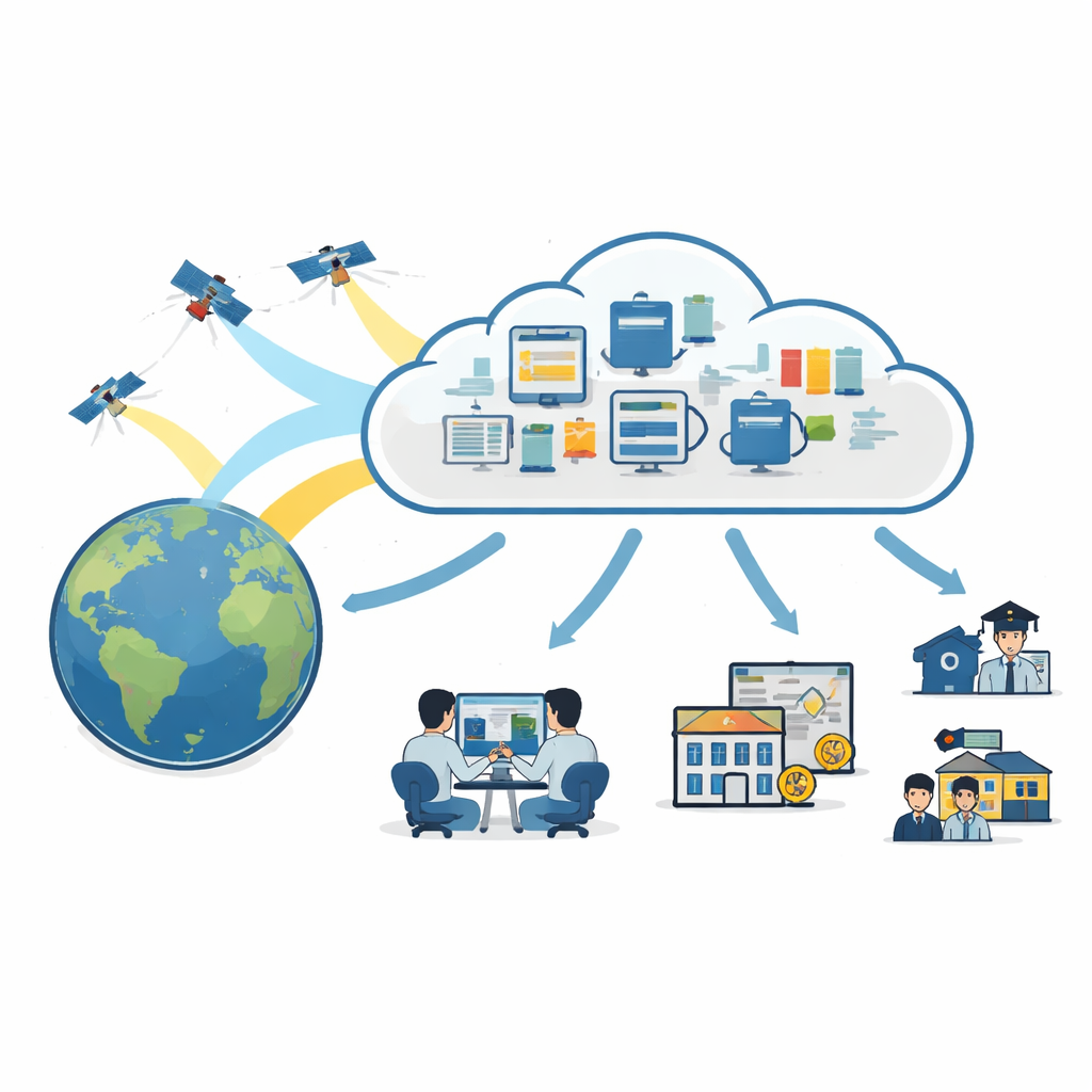
Weather extremes, food security, and air pollution all depend on how our planet is changing over time. Europe’s Copernicus satellites already collect a continuous flood of images of land, oceans and atmosphere, but until recently turning these raw pictures into useful insight required powerful computers and specialist skills. This paper introduces the Copernicus Data Space Ecosystem (CDSE), a publicly funded cloud platform that moves the heavy lifting into the network itself, so anyone from students to startups can work directly with vast streams of Earth observation data without owning a data center.
A Shared Home for Space Data
CDSE is now the official hub for data from the European Union’s Copernicus Programme. Rather than scattering copies across many separate national or private systems, it gathers most of the Sentinel satellite archives and related products into a coordinated cloud environment based entirely in EU member states. The platform covers radar images of land and ice, optical pictures of fields and forests, measurements of sea temperature and height, and maps of air pollution and trace gases. It also mirrors key products from Copernicus services, such as land cover maps, emergency response layers for floods and fires, and ocean indicators. On top of this core, CDSE gradually integrates “contributing missions” and long-term records from other agencies, building a richer picture that links modern sensors to decades of earlier observations.
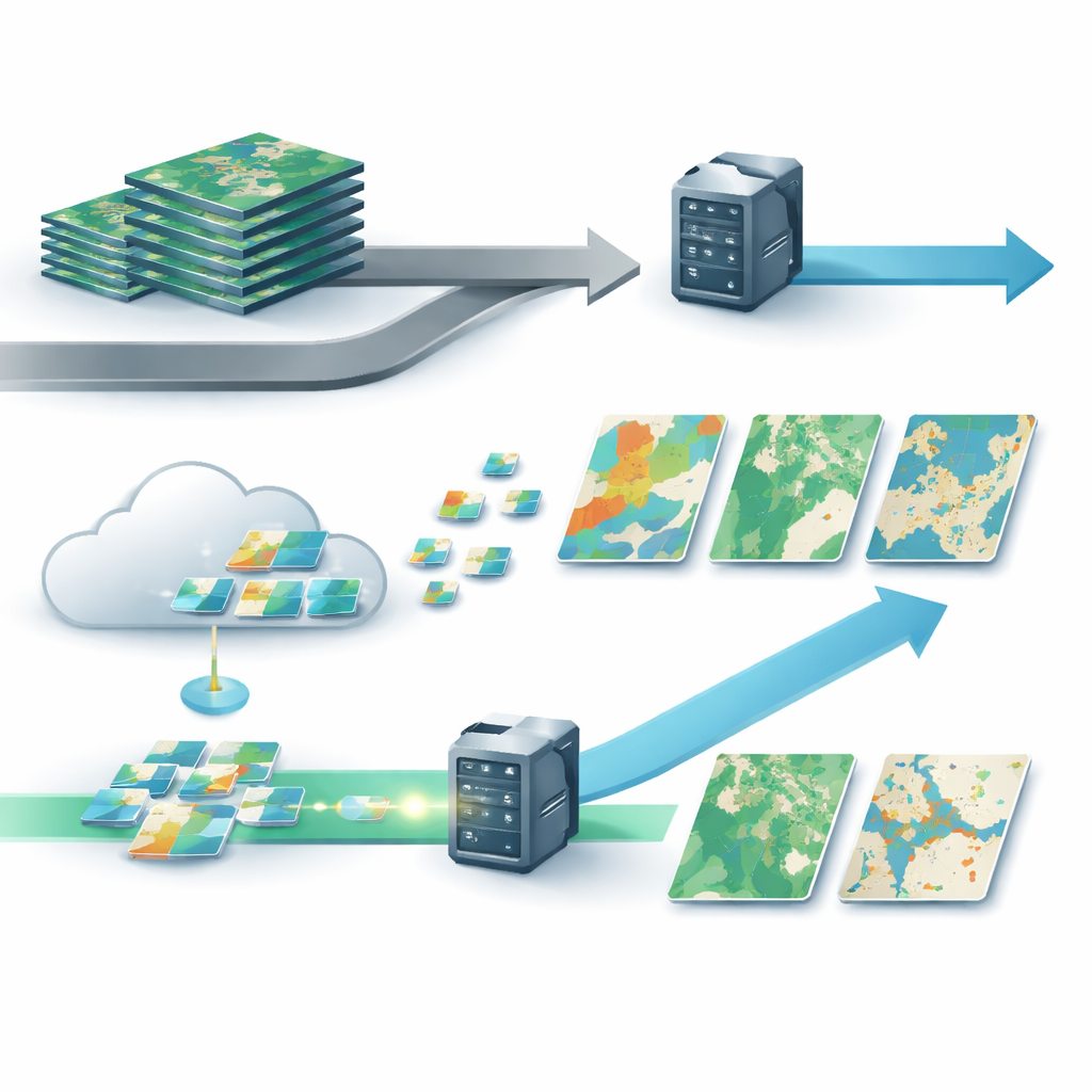
From Downloading Files to Streaming Only What You Need
Traditionally, users had to download entire satellite image files—often gigabytes at a time—even if they only needed data for a small region or a few dates. They then had to unpack, subset, and process these files on their own machines, which was slow and excluded many potential users. CDSE flips this model by storing data in cloud-optimized formats and exposing them through modern web interfaces. Instead of shipping full scenes, the system streams only the necessary pixels, times, and measurement bands, on demand, directly into the requested calculations. In tests described in the paper, a harvest monitoring task that once required 9.6 gigabytes of downloads and about 18 minutes of work was reduced to about 30 megabytes of transferred data and roughly five seconds of processing when run through CDSE’s cloud-based interfaces.
Simple Web Maps and Professional Tools Side by Side
CDSE is designed to serve both casual visitors and seasoned developers on the same foundation. For visual exploration, the Copernicus Browser lets anyone pan and zoom through global imagery, compare scenes across time, and export simple statistics or animations without writing code. Users can define their own combinations of layers and simple formulas, save these “views,” and share them with a link. For more advanced work, the platform offers Jupyter-based coding environments preconfigured with access to all major datasets, as well as standardized interfaces such as openEO and Sentinel Hub APIs. These tools allow users to build complex processing chains, from spectral indices to machine learning models, that run directly inside the cloud near the data, instead of on local computers.
Opening the Door to Bigger Questions and New Players
Because CDSE follows open standards and exposes its services through documented interfaces, it can connect to other data spaces and cloud providers, making it easier to combine satellite information with weather archives, elevation models or local measurements. Benchmark comparisons show that its performance is competitive with other big Earth data platforms, particularly for small to medium-sized regions. Concrete examples—such as nationwide crop monitoring for European farm policy, online lake water quality services used daily by hundreds of citizens, and global crop maps that local users can refine—illustrate how CDSE turns what used to be experimental projects into dependable services. The platform also lowers barriers for artificial intelligence, offering ready-to-use “analysis-ready” mosaics and even precomputed numerical summaries of images (embeddings) that make it easier to train and apply modern models.
Why This Matters for Society
The authors conclude that CDSE marks a practical turning point in how we use satellite data. By unifying storage, access and processing in a publicly governed cloud, it removes the need for most users to handle bulky downloads or maintain their own large-scale infrastructure. This makes serious environmental monitoring and experimentation accessible to far more people and organizations, from small companies to public agencies and classrooms. Just as free access to Copernicus images transformed who could see the Earth from space, CDSE aims to transform who can actually compute with that data, speeding up discovery and supporting more informed responses to climate, food, and disaster challenges.
Citation: D. Kovács, D., Musial, J., Bojanowski, J. et al. Copernicus Data Space Ecosystem establishes public cloud processing for earth observation data. Sci Data 13, 537 (2026). https://doi.org/10.1038/s41597-026-06765-8
Keywords: Earth observation, satellite data, cloud computing, environmental monitoring, Copernicus