Clear Sky Science · en
WorldMove, a global open data for human mobility
Why our daily movements matter
Every day, billions of trips—walking to school, riding the bus to work, visiting parks or shops—quietly shape how cities breathe and grow. Understanding these movements is vital for easing traffic jams, planning greener neighborhoods, and preparing for disease outbreaks. Yet detailed data on where and when people move are usually locked behind corporate walls or privacy rules, and many cities—especially in low‑income regions—have almost no data at all. This article introduces WorldMove, a new global, open, and privacy‑preserving way to study human mobility without tracking any real person.
A world map built from open clues
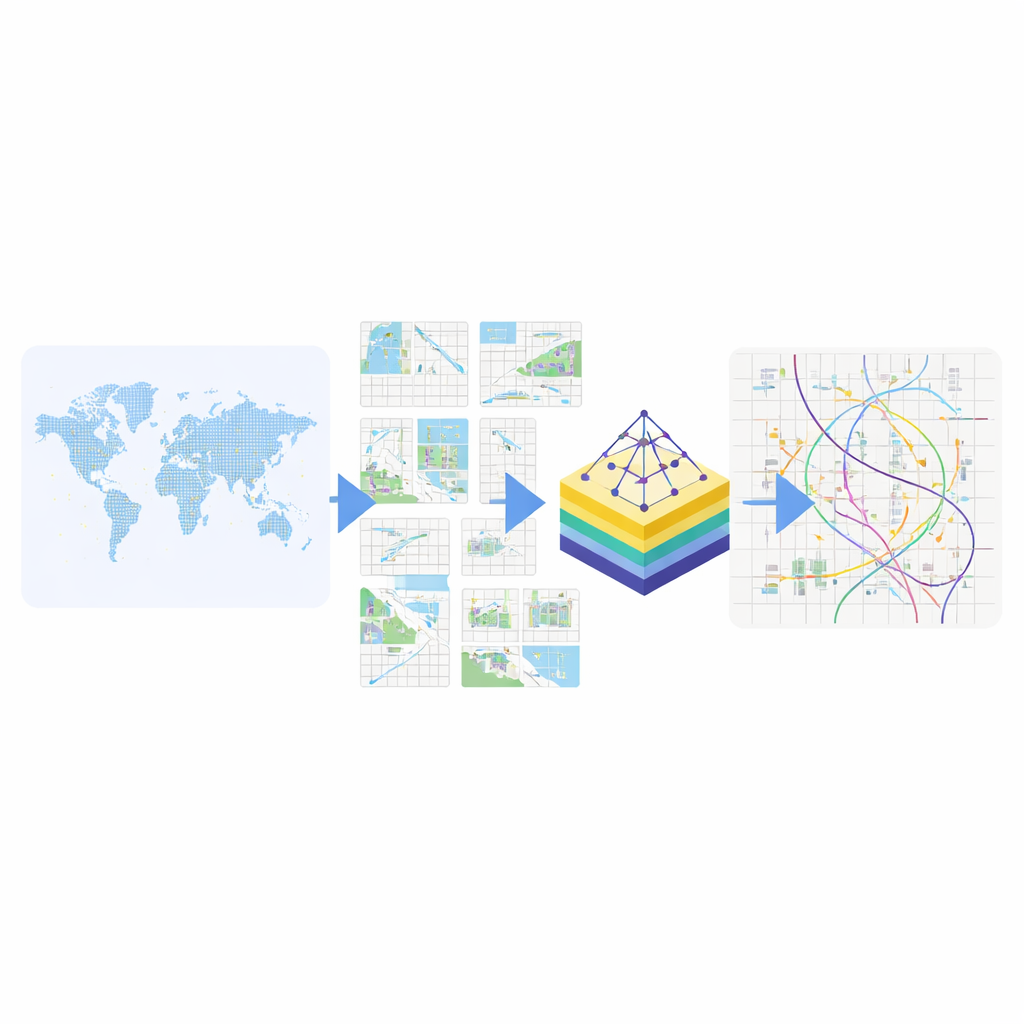
Instead of following individuals through their phones or bank cards, WorldMove starts from publicly available, already anonymized data that describe city spaces rather than people. For more than 1,600 cities across 179 countries, the authors first draw precise city boundaries using an open global map database. Each city is then divided into small, one‑kilometer‑wide squares, like overlaying a uniform grid on the urban landscape. For every square, they collect open information: how many people are estimated to live there, what kinds of places it contains (such as shops, schools, parks, or hospitals), how popular it is as a travel destination based on commuting statistics, and where it sits in a simple local coordinate system. This turns the city into a structured mosaic of tiny areas, each with a rich profile but no personal identifiers.
Teaching an AI to understand places, not people
To teach an artificial intelligence system how people typically move between these areas, the team uses a two‑step learning process. First, they compress each square’s profile into a short numerical “fingerprint” using a technique called an autoencoder. Squares that play similar roles in city life—busy downtown hubs, quiet suburbs, industrial zones—end up near one another in this abstract space, even if they belong to different countries. Then, using real but tightly protected mobility records from six cities in China, the United States, and Senegal, the system learns how these fingerprints tend to be visited over the course of a day and a week. Crucially, it learns patterns in this abstract space rather than memorizing specific routes or individuals.
From abstract patterns back to city streets
Once trained, the model can generate new, realistic‑looking sequences of movement in the abstract fingerprint space, using a modern “diffusion” process that gradually shapes random noise into plausible daily paths. These synthetic paths are then mapped back onto the real city grid by pairing each abstract point with the most similar city square. The number of generated trajectories scales with the city’s population, and can be adjusted by users. The result is a full week of movement histories for many anonymous “virtual residents” in any city, even where no original mobility data exist. Along with the trajectories, the project releases boundary files, grid definitions, and the underlying place profiles, plus code that lets others generate custom datasets.
Checking realism, fairness, and privacy
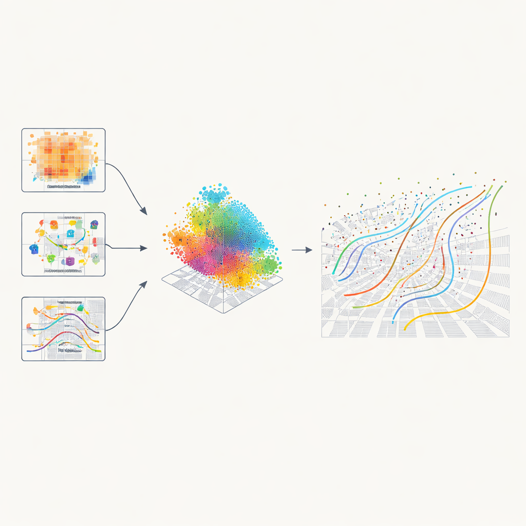
To make sure these virtual journeys are useful, the researchers compare them with the hidden real‑world data across multiple dimensions. They find that basic statistics such as how far people tend to travel, how many distinct places they visit in a day, how long they stay put, and how often they return to favorite spots match closely. Classic “laws” of human mobility—like most trips being short but a few stretching far, or a small set of places accounting for most visits—emerge naturally in the synthetic data. At the city scale, patterns of commuting flows between neighborhoods and rush‑hour crowding also mirror reality. Tests designed to detect privacy leaks show that attackers cannot reliably tell whether a specific pattern came from the training data or was generated by the model, suggesting that individual paths are not being memorized.
New doors for planning, health, and equity
Because WorldMove is open and synthetic, it can be widely shared and combined with other public information. The authors demonstrate how the data can power detailed traffic simulations to estimate carbon emissions from different types of vehicles, and to test how cutting car volumes at rush hour could sharply reduce pollution. In another example, they combine simulated movements with maps of green spaces and neighborhood demographics to study unequal access to parks and its links to mental health. They also show that adding synthetic trajectories to limited real data improves the accuracy of mobility prediction models, especially in cities with only sparse measurements.
A safe way to see how cities move
In essence, WorldMove offers a global “flight simulator” for human movement: rich enough to capture how cities really function, but disconnected from any identifiable person. By learning from a mix of open geographic data and carefully protected samples of real mobility, the system can recreate typical patterns of travel in more than 1,600 cities and extend them to places where little is known. This gives urban planners, transport engineers, and public health researchers a powerful, privacy‑respecting tool to explore what‑if questions—from new bus lines to greener neighborhoods—helping make future cities fairer, cleaner, and better prepared for change.
Citation: Yuan, Y., Zhang, Y., Ding, J. et al. WorldMove, a global open data for human mobility. Sci Data 13, 549 (2026). https://doi.org/10.1038/s41597-026-06555-2
Keywords: human mobility, synthetic data, urban planning, privacy-preserving AI, global cities