Clear Sky Science · en
Divergent urban storm response to convective, frontal and tropical systems
Why cities change the way storms behave
Many people know that cities are hotter than their surroundings, but fewer realize that skyscrapers, pavement and pollution can also reshape how storms form and where the heaviest rain falls. This study looks at four major Texas cities and asks a simple but important question: do different kinds of storms respond differently to urban life, and what does that mean for flood risk in growing metropolitan areas?
Looking at storms one by one
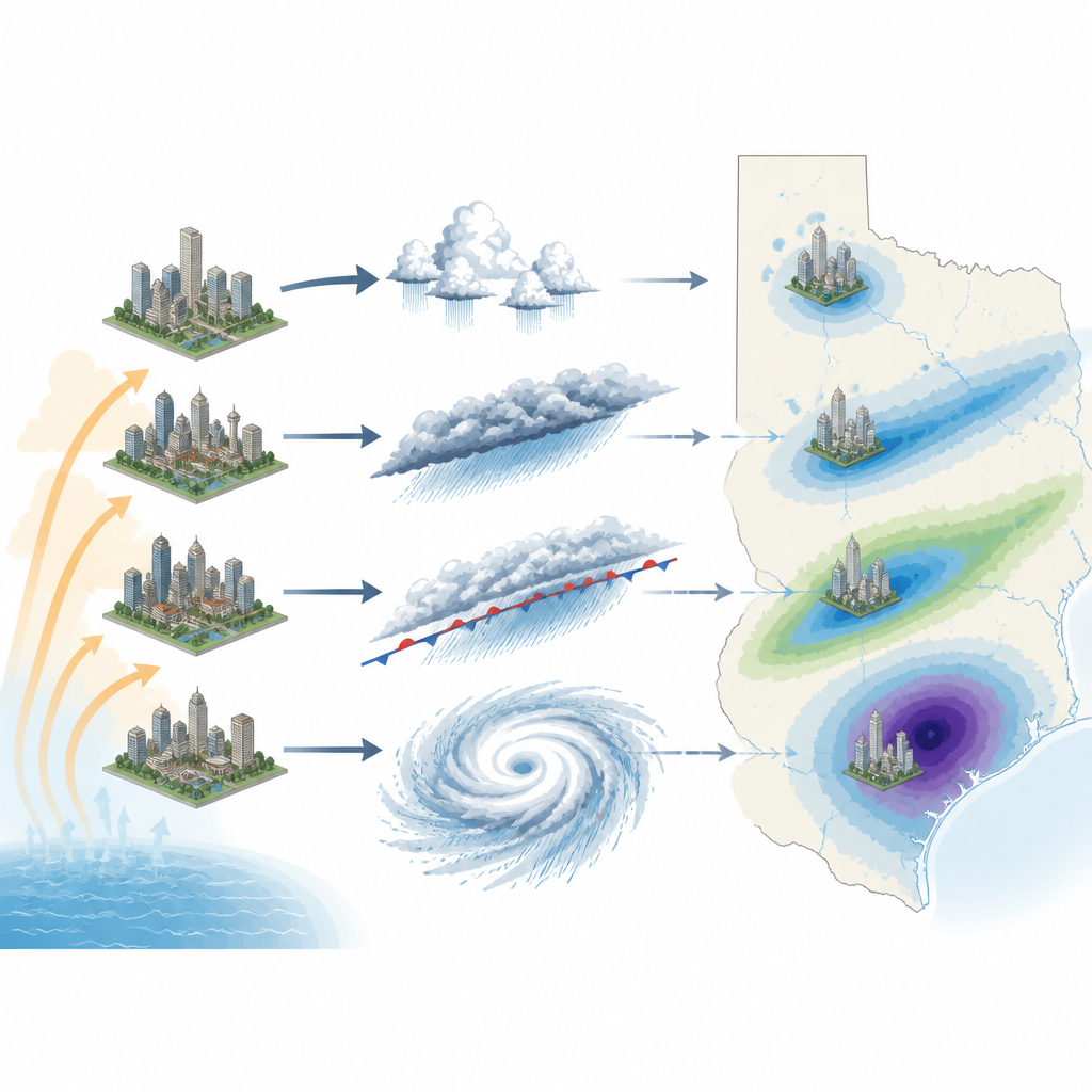
Instead of averaging years of rainfall totals, the researchers tracked more than 40,000 individual warm season storms over Dallas, Austin, San Antonio and Houston between 1995 and 2017. They used three dimensional radar data to see not just how much it rained, but how tall and intense each storm was as it passed over a city. Every storm was grouped into one of five broad types based on its size, speed and structure: brief local "pop up" storms, somewhat larger isolated storms, cold and warm fronts sweeping across the region and sprawling tropical systems influenced by the Gulf of Mexico.
Pop up storms love city nights
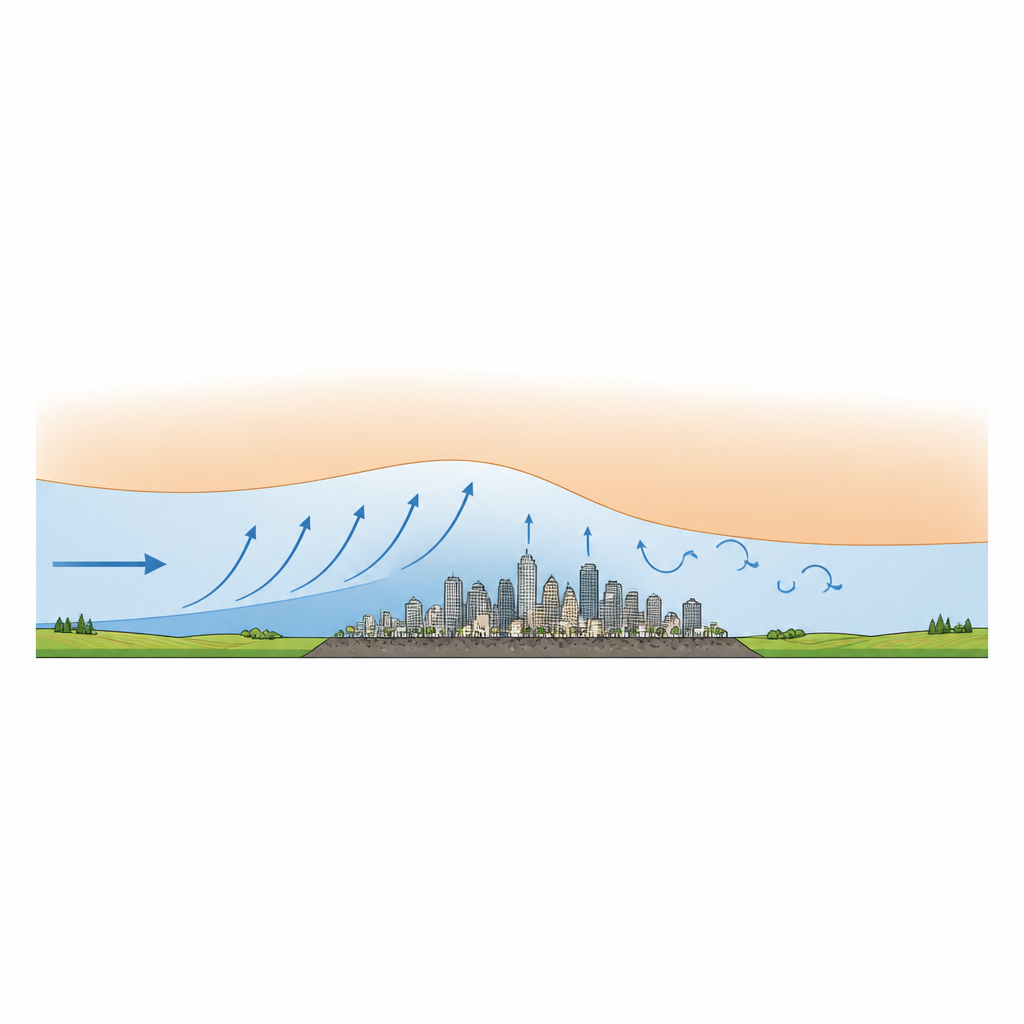
The team found that the smallest, most local storms are more common over cities than over nearby countryside. Single cell and isolated storms occurred 7 to 31 percent more often above urban areas, with Houston showing the strongest increase. These storms also tended to grow taller over cities, with more intense radar echoes high in the clouds, especially above 5 kilometers. The effect was strongest at night and early morning, when cities stay warm while rural areas cool. That extra warmth and the rough urban surface make the lower atmosphere over cities more unstable, helping air rise and feed local downpours that can trigger flash flooding on busy streets.
Big storm systems tell a different story
Larger weather systems behaved very differently. For cold fronts sweeping in with long bands of rain, cities did not change how often they occurred, but did weaken their intensity. Across all four Texas cities, the number of strongly reflective radar cells inside cold frontal storms dropped by roughly one fifth over urban areas compared with surrounding rural regions. The authors suggest that as a cold front approaches a warm city, the urban heat can briefly sharpen the temperature contrast and strengthen the storm just ahead of town. Once the front passes over the city itself, though, the combination of extra heat and surface roughness appears to disrupt the frontal structure, leading to weaker rainfall bands overhead.
Warm fronts and tropical systems show subtle shifts
Warm fronts and tropical systems showed more muted and mixed urban effects. Warm frontal storms did not happen more often over cities, but many individual cases showed slightly stronger radar echoes and somewhat higher storm tops above urban land, hinting at modest intensification that current data cannot yet confirm statistically. Tropical systems, including events like Hurricane Harvey, also showed no consistent change in frequency or overall intensity between city and countryside. However, within these vast rainmakers, the highest reflectivity zones tended to sit at lower altitudes above urban areas, where radar signals are more directly tied to surface rainfall rates. This vertical shift suggests that tropical storms may reorganize their rain fields over cities in ways that are not captured by simple totals.
What this means for city planning
For a non specialist, the take home message is that there is no single "urban rain effect." Cities can invite more frequent and deeper local thunderstorms, soften incoming cold fronts, gently boost some warm fronts and subtly rearrange the structure of tropical rain. Because different storm types dominate different kinds of extreme rainfall, planners and modelers need to treat them separately rather than relying on broad averages. The framework developed in this study shows how to do that, offering a clearer picture of which storms are likely to cause short, intense cloudbursts and which may bring long lasting regional floods as urban areas continue to expand.
Citation: Sui, X., Nielsen-Gammon, J., Yang, ZL. et al. Divergent urban storm response to convective, frontal and tropical systems. Nature 653, 1078–1084 (2026). https://doi.org/10.1038/s41586-026-10479-7
Keywords: urban rainfall, Texas storms, cold fronts, tropical systems, urban heat island