Clear Sky Science · en
Bidirectional yet asymmetric causality between urban systems and traffic dynamics in 30 cities worldwide
Why city traffic tells a bigger story
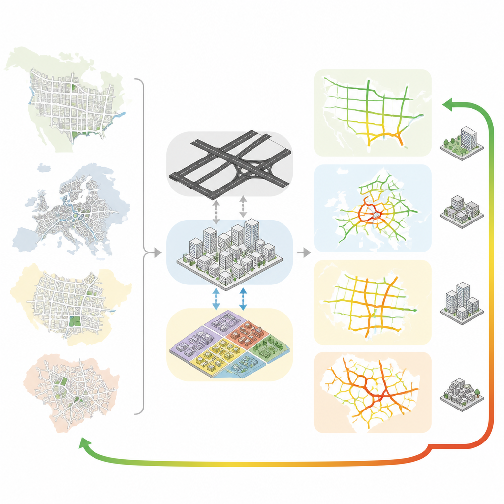
Anyone who has sat in a traffic jam has wondered why some cities seem to flow while others grind to a halt. This study looks beyond simple blame on drivers or roadworks and asks a deeper question: how do the physical shape of a city and the everyday movement of people influence each other over time? By examining 30 cities on six continents, the authors uncover patterns in how streets, buildings, and land uses interact with congestion, and why this two way relationship is far from equal.
How cities shape our daily travel
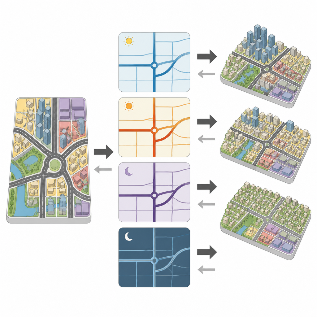
The researchers describe urban systems with three easy to grasp ingredients. Urban structure is the road network, the skeleton that connects neighborhoods. Urban form is the spatial layout, such as how dense or fragmented districts are. Urban function is what different areas are used for, from housing to shops, parks, and workplaces. Using detailed road and land use data, they measure how strongly each of these ingredients is linked with a congestion indicator across thousands of small zones within each city, and across hours of the day. They find that all three are closely tied to traffic, with road networks showing the tightest statistical fit, especially in cities with well developed infrastructure such as Berlin, Zurich, and Stockholm.
Different cities, different patterns
Yet the strength of these links varies widely from place to place. In some high income cities, the three ingredients of urban structure, form, and function together explain most of the differences in congestion from one area to another. In several cities in less developed settings, the same measures explain much less, suggesting that other local factors, such as informal transport or unrecorded land uses, also matter. Even within single cities, specific features can push congestion up or down in different neighborhoods. For example, fragmented land use patterns and clusters of popular leisure sites tend to be linked with heavier traffic on rest days, while more finely grained edges between land uses can ease movement by improving local connectivity.
Untangling cause and effect
Because correlation alone cannot reveal which changes drive which outcomes, the authors develop a new spatio temporal causality framework. First, they combine many local features into three composite indicators that summarize structure, form, and function for each small zone and time period. Then they apply a method that tests whether the evolving traffic patterns can predict changes in these indicators, and vice versa. Across most of the 30 cities, they detect clear two way influences: the built city shapes congestion, and long lasting patterns of congestion feed back to shape the city over time. However, the effect is asymmetric. Overall, the physical and functional layout of cities is a stronger driver of congestion than congestion is of urban change.
City types revealed by causal fingerprints
By comparing the detailed cause and effect curves for all cities, the team groups them into three broad archetypes. In tightly coupled cities, both directions of influence are strong, suggesting that integrated land use and transport policies can have a big impact on congestion. In pattern heterogeneous cities, the strength and timing of these links differ across neighborhoods, calling for tailored combinations of street design, transit improvements, and demand management. In workday attenuated cities, the causal signals weaken on working days, which implies that static changes to the built environment alone will not significantly ease rush hour traffic without supportive operational measures such as pricing or real time control.
What this means for city life
For a lay reader, the main message is that how we plan and use space influences congestion more deeply than we might think, and in ways that are not captured by simple correlations. Road layouts certainly matter, but it is often the placement of homes, jobs, and activities that truly generates traffic pressure. At the same time, persistent traffic patterns can nudge cities to expand rail lines, add roads, or shift land uses. By revealing this uneven two way relationship across a wide range of global cities, the study provides a blueprint for more context aware planning, where decisions about transport, housing, and public spaces are made together to support smoother, more sustainable urban mobility.
Citation: Zhang, Y., Hong, Y., Gao, S. et al. Bidirectional yet asymmetric causality between urban systems and traffic dynamics in 30 cities worldwide. Nat Commun 17, 4671 (2026). https://doi.org/10.1038/s41467-026-71377-0
Keywords: urban traffic, city planning, land use, congestion, human mobility