Clear Sky Science · en
Reconstructing fine-scale 3D wind fields with terrain-informed machine learning
Why Wind Near the Ground Matters
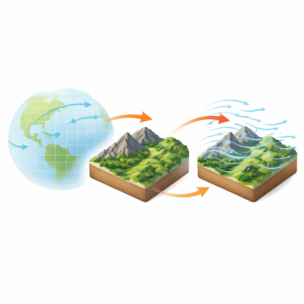
Wind close to the ground powers turbines, drives wildfires, and shapes how storms impact cities and valleys. Yet the weather forecasts we see every day usually blur over the sharp twists and turns that wind takes as it rushes over hills, ridges, and forests. This study introduces FuXi-CFD, a new tool that blends physics-based simulations with artificial intelligence to recreate those fine-scale, three-dimensional wind patterns at the tens-of-meters scale—fast enough to be useful in real-world decision making.
Hidden Wind Patterns in Rough Landscapes
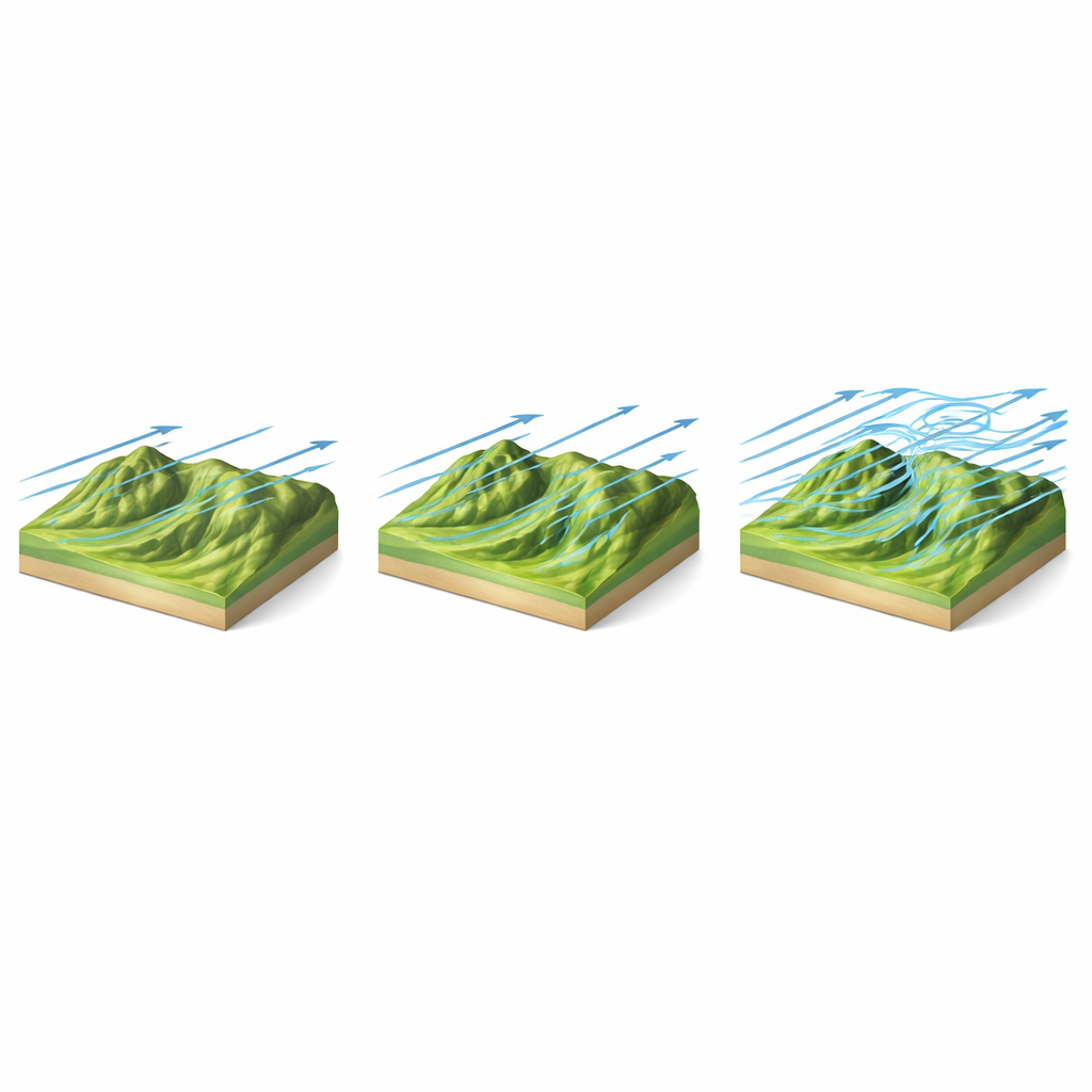
Standard weather and AI forecast models work at kilometer-scale resolution, which is good for tracking large storms but too coarse to capture how mountains and valleys reshape the air just a few dozen meters above the ground. In complex terrain, wind can speed up over ridges, bend sharply around slopes, form jets in valleys, and even circulate back on itself behind steep hills. These local behaviors often look nothing like the smooth, averaged winds predicted at kilometer scales. For siting wind turbines, estimating wildfire spread, or assessing storm risk near the surface, such small-scale details can make the difference between a safe design and an unsafe one.
Marrying Heavy-Duty Physics with Fast AI
To bridge this gap, the authors created FuXi-CFD, a system that learns how real landscapes reshape the wind. They first generated a massive library of high-resolution simulations using computational fluid dynamics (CFD), a gold-standard technique that directly solves the equations of fluid motion over detailed digital maps of terrain and surface roughness. Each simulated case covers a nine-by-nine-kilometer area in southeastern China at 30-meter spacing, with winds resolved from the surface up to a few hundred meters high. In total, more than 12,000 simulations—representing hundreds of thousands of CPU hours—capture how winds respond to different terrain shapes, surface types, and incoming flow directions and speeds.
Teaching a Model to Feel the Terrain
On top of this simulated library, the team trained a deep-learning model designed to act as a “terrain-response operator.” The input is similar to what modern global or regional AI weather systems can provide: coarse horizontal wind at about 100 meters height on a one-kilometer grid, plus high-resolution maps of elevation and surface roughness. From this limited information, FuXi-CFD predicts a full three-dimensional wind field at 30-meter resolution, including horizontal and vertical winds and a measure of turbulence intensity. The model architecture, based on a vision-style Transformer, is tailored to pick up long-range patterns—such as how an upwind ridge influences flow several kilometers downstream—while still honoring sharp local features like slope jets and separation zones.
How Well It Works in the Real World
When tested on terrain shapes it had never seen before, FuXi-CFD reproduced the detailed patterns from the CFD simulations with impressive accuracy. It captured speed-ups over ridges, channeling and turning in valleys, and the way wind patterns smooth out with height. It also inferred vertical motions and turbulence-related features, even though only horizontal winds were supplied as input. Crucially, the model’s skill did not collapse away from the input height level, suggesting that it has learned a coherent three-dimensional structure rather than just making a single-layer correction. Compared with several common deep-learning architectures trained on the same data, FuXi-CFD consistently delivered smaller errors and more realistic vertical profiles.
From Simulations in China to Towers in Europe
To see if this approach holds up outside the lab, the authors validated FuXi-CFD against measurements from tall meteorological towers in Europe, which record wind at multiple heights above complex terrain. Even though the model was trained only on simulated winds over Chinese mountains, it performed well at these European sites, outperforming advanced baselines that extrapolate wind vertically from coarse global reanalysis data. The improvement was most pronounced for stronger winds and for directions where the terrain forces air to climb slopes or flow over irregular ground—exactly the situations that matter most for wind energy yield and extreme-wind hazards.
What This Means for Everyday Uses
By compressing hours of heavy-duty CFD computation into fractions of a second, FuXi-CFD opens the door to near real-time, fine-scale wind maps over rugged landscapes. While the current system is most reliable under moderate-to-strong wind conditions, it already offers a practical way to support turbine placement, power forecasting, wildfire risk prediction, and safety assessments for low-flying aircraft and infrastructure. Future extensions that account for temperature stratification and very weak winds could broaden its reach, but even now the work shows how physics-informed machine learning can fill in the missing details between global forecasts and the complex, three-dimensional winds that actually shape events on the ground.
Citation: Lin, C., Tie, R., Yi, S. et al. Reconstructing fine-scale 3D wind fields with terrain-informed machine learning. Nat Commun 17, 3713 (2026). https://doi.org/10.1038/s41467-026-70562-5
Keywords: wind forecasting, complex terrain, machine learning, computational fluid dynamics, wind energy