Clear Sky Science · en
Climate’s influence on topography encoded in stream network topology and geometry
How Climate Writes Its Story in River Patterns
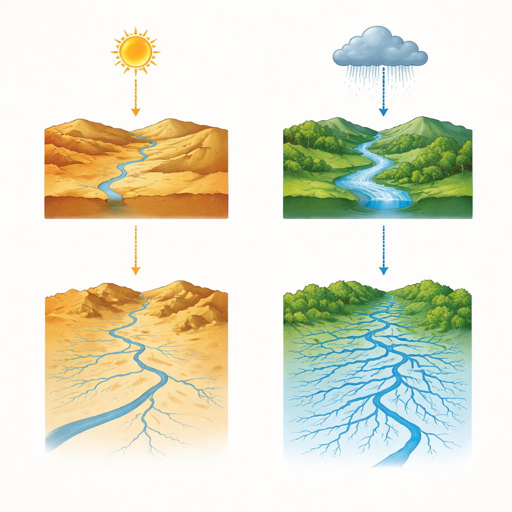
Look down from an airplane on a clear day and you will see rivers and streams etched across the land like the branches of a tree. This paper asks a deceptively simple question: how much of those branching patterns is written by climate? By analyzing more than sixteen thousand U.S. river networks, the authors show that rainfall and dryness influence not just how steep valleys are, but also how often small creeks join big rivers and at what angles they meet. In other words, climate quietly shapes the geometry and wiring of entire drainage systems.
Reading Rivers Like Family Trees
To study these networks, the researchers treat rivers a bit like genealogies. Each stream segment is assigned a “generation,” and the team examines how often small tributaries join larger ones and how those connections repeat across scales. Many American river systems turn out to be “self-similar,” meaning that their branching patterns look statistically alike whether you zoom in on tiny headwater gullies or zoom out to major rivers. Roughly three quarters of the 5th-order networks examined share this repeating structure, revealing that branching rules are surprisingly consistent despite the messy realities of real landscapes.
Feathered Streams and Subtle Climate Signals
Within these self-similar networks, the authors focus on how “feathered” a river system is—how often low-order side channels feed into much larger trunks. They capture this with a single number that rises as small creeks more frequently plug into big rivers. When they map this measure across the United States and compare it with long-term dryness, they find that very arid areas tend to have less feathered networks, while more humid regions are somewhat more intricately branched. Yet this climate link is modest and patchy, suggesting that climate does not directly dictate how streams hook together, but instead works through the shape of the landscape itself.
Angles That Reveal the Shape of the Land
One of the most striking clues comes from the angles at which streams meet. The team distinguishes between junctions where two similar-sized branches merge and those where a small tributary joins a much larger main stem. They find that side tributaries typically join at wider angles, especially in networks that are more heavily feathered. Humid regions, with stronger and more frequent flows, tend to carve steeper side slopes and deeper main valleys, creating bigger contrasts in stream steepness. These contrasts show up as broader junction angles. In contrast, flatter, more uniform slopes in drier regions yield narrower meeting angles and fewer tiny side branches. The researchers show that these angle patterns follow classic geometric expectations once you account for how channel slope depends on drainage area.
Climate’s Hidden Route: From Rain to Rock to Rivers
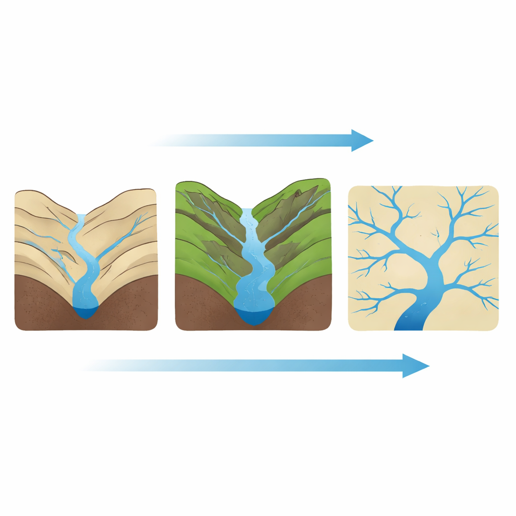
To tease apart cause and effect, the authors use statistical tools that separate direct influences from indirect ones. They discover that climate’s strongest fingerprints appear first in basic landscape features: how steep channels are on average, and how different the slopes are between converging tributaries. Those topographic traits, in turn, control the side-branch angles and how feathered the network becomes. When these mediating effects are considered, the direct link between climate and branching structure becomes quite weak. Instead, climate mainly works by driving erosion, which sculpts valley depth and steepness, which then governs how and where new tributaries form and connect.
What the Study Means for Our Changing World
For a general reader, the key message is that the shape of river networks is no accident. Over long timescales, patterns of rain and dryness carve the land in ways that favor certain branching arrangements. More humid climates tend to produce steeper hillsides, greater contrasts between big rivers and their feeder streams, and wider, more frequent side branches. Drier climates favor simpler networks with fewer, more tightly angled tributaries. The study shows that the wiring of river systems—where floods travel, how sediment and nutrients move, and where life can flourish—is the end result of a long chain from climate to rock to channels. By decoding that chain, scientists can better read Earth’s history from the patterns of its streams and anticipate how these networks might reorganize as climate continues to change.
Citation: Li, M., Seybold, H., Fu, X. et al. Climate’s influence on topography encoded in stream network topology and geometry. Nat Commun 17, 3426 (2026). https://doi.org/10.1038/s41467-026-70200-0
Keywords: river networks, climate and erosion, landscape evolution, stream branching patterns, drainage basin geometry