Clear Sky Science · en
Snow or rain? hybrid AI deciphers surface precipitation phase from satellite observations
Why it matters whether storms bring snow or rain
When a winter storm arrives, whether it falls as snow or rain can make the difference between a scenic snowfall and a dangerous disaster. Sudden shifts from snow to rain can destabilize mountain snowpacks and trigger avalanches, while cold snaps that flip rain into heavy snow can paralyze roads, power lines, and supply chains. Yet in many of the very regions most at risk—remote mountains and high latitudes—we have few ground instruments to tell us what is actually reaching the surface. This study introduces a new artificial intelligence system that reads satellites and atmospheric forecasts together to decide, in near real time, whether precipitation on the ground is snow or rain.
Gaps in watching winter storms from space
Modern weather satellites can already estimate where it is raining or snowing across the globe, but today’s products arrive with delays of four hours or more and often blur rapid changes. Existing systems like the widely used GPM IMERG maps combine many satellite sensors and traditional forecast models, which takes time and limits how finely they can track evolving storms. They also struggle in places with steep terrain and sparse weather stations, such as the Tibetan Plateau or inland mountain ranges, where knowing the exact mix of snow and rain is vital for avalanche control, flood forecasts, and transportation safety.
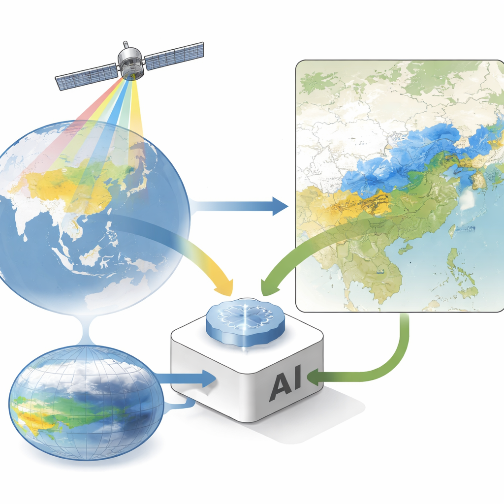
A hybrid AI that fuses satellites and digital atmosphere
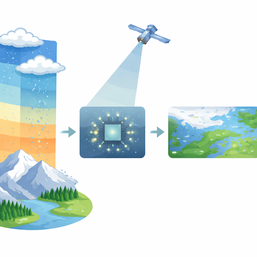
The authors present RePPIC-Net, a “hybrid” AI framework designed to close this gap. It ingests two main information streams. One comes from China’s Fengyun-4B geostationary weather satellite, which continually watches the same hemisphere and provides detailed cloud-top temperatures and cloud patterns every 15 minutes at a resolution of about 5 kilometers. The second stream comes from FuXi, a new AI-based global weather prediction system that produces three-dimensional fields of temperature and humidity throughout the atmosphere within seconds. RePPIC-Net combines these views: satellite images reveal where clouds and precipitation clusters are, while FuXi’s vertical profiles describe the air’s thermodynamic state, which strongly controls whether falling particles will melt into rain or remain snow on their way down.
How the system learns to see snow and rain
To decide what reaches the ground, RePPIC-Net uses a well-known quantity from weather science called the wet-bulb temperature, which reflects how cold a raindrop can get as it evaporates. This temperature is the most reliable single indicator of whether precipitation will be liquid or solid. The model estimates wet-bulb temperature near the surface from FuXi’s fields, adjusted for local terrain height, and converts it into a probability that precipitation is liquid. In parallel, deep-learning networks called UNet and ResUNet analyze the satellite images and atmospheric variables to determine where precipitation is occurring at all and to estimate its intensity. A final post-processing step blends these probabilities and intensities, correcting systematic biases and producing a global map that distinguishes between rain and snow every 15 minutes.
How well it works in real storms
The team tested RePPIC-Net using data from more than 2,000 ground weather stations across China and compared its performance with existing satellite products. Overall, the new system detects rainfall about as well as the current standard and shows smaller systematic errors in both rain and snow amounts. In the crucial range of light to moderate precipitation—where snow often corresponds to heavy storms and blizzards—it is particularly skillful. For this range, RePPIC-Net more accurately spots snowfall and provides clearer separation between snow and rain, especially during rapidly evolving events. Case studies of a major 2023 mixed snow–rain storm in northeastern China and a snowfall over the Tibetan Plateau show that the system pinpoints blizzard zones and mountain snow better than current operational datasets, thanks to its finer resolution and use of 3D atmospheric information. It also retains much of its skill when driven by short-term satellite forecasts, enabling 1–3 hour nowcasts of rain–snow patterns.
What this means for everyday impacts
For non-specialists, the key outcome is that RePPIC-Net can tell, in near real time, whether a storm is delivering snow or rain at the ground across vast, data-sparse areas. By cutting the delay of existing global products from hours to about two minutes of processing, and by improving how well snowfall is detected, the system offers a powerful new tool for early warnings of blizzards, ice storms, and rain-on-snow events that raise avalanche and flood risks. The authors see their approach as a blueprint for future weather monitoring: combining fast AI-driven forecasts with constant satellite watching to track hazardous winter weather more precisely in a warming climate.
Citation: Yang, C., Li, H., Zhu, R. et al. Snow or rain? hybrid AI deciphers surface precipitation phase from satellite observations. Nat Commun 17, 2813 (2026). https://doi.org/10.1038/s41467-026-69487-w
Keywords: snow versus rain, satellite precipitation, weather nowcasting, artificial intelligence in meteorology, winter storm hazards