Clear Sky Science · en
Spatial drivers of multi-type cultural heritage in the Taihu Basin and implications for integrated conservation
Why this landscape of history matters
The Taihu Basin in eastern China is famous for its misty lake views, ancient water towns, and dense web of canals. Behind the postcard scenery lies a big question: how do all these different kinds of historic sites fit together across a whole region, and what really shapes where they appear? This study uses modern mapping tools to uncover the hidden patterns behind temples, old villages, canals, factories, and farm landscapes around Taihu Lake—and offers a new way to protect them as one living cultural whole rather than as scattered, isolated relics.
Many kinds of heritage, one connected region
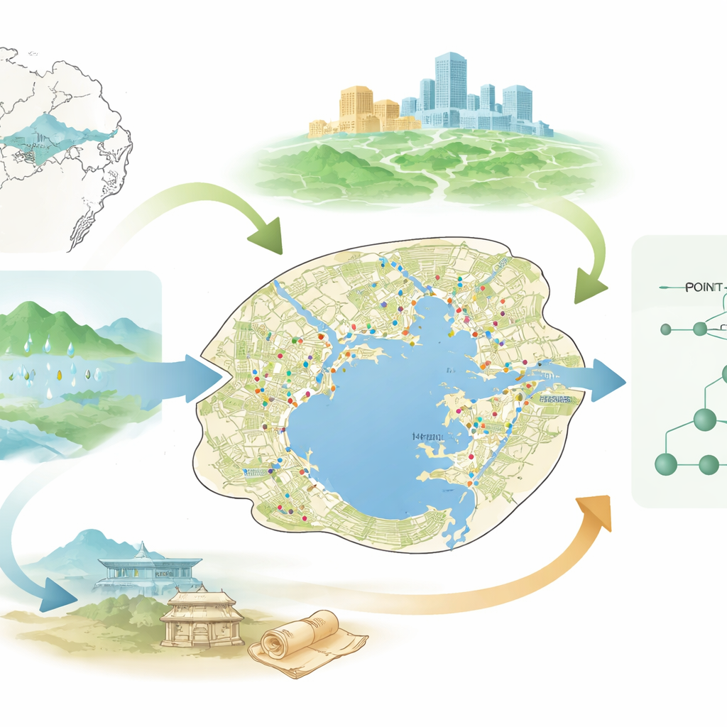
The researchers look at the Taihu Basin as a single natural unit defined by water, not by modern city or provincial borders. Within this basin they mapped 1,199 representative heritage sites, including traditional towns and villages, protected monuments, industrial relics, historic water works, and farming landscapes. Instead of treating each category on its own, they treat the mix as a shared cultural tapestry. By stepping back to the basin scale, they can see connections that are usually hidden when protection is organized city by city, each with its own rules and priorities.
Clustering around the lake and canals
Using spatial statistics, the team finds that these heritage sites do not spread out evenly. They cluster strongly around Taihu Lake and along the historic Beijing–Hangzhou Grand Canal. Together these form a “four-core, multi-zone” pattern, with four dense hubs around Wuxi, Suzhou, Changzhou, and Shanghai, plus many smaller pockets that stitch the region together. Nearly 60 percent of all sites lie within 40 kilometers of the lake, and almost 70 percent within 50 kilometers. About 30 percent fall within a narrow band along the Grand Canal, and more than 80 percent within 50 kilometers of it. In simple terms, if you follow the water—lake shores, riverbanks, and canals—you very quickly find the heart of Taihu’s cultural landscape.
Nature, people, and history working together
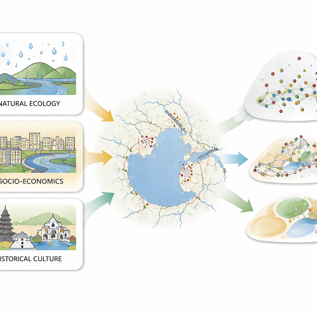
To understand why heritage clusters where it does, the authors examine three broad groups of influences: natural setting, social and economic activity, and historical culture. Natural factors such as rainfall, temperature, sunshine, and distance to rivers provide the basic environmental stage on which communities form. Socio‑economic factors—population density, wealth, night‑time city lights, and distance to roads—reflect where people live, work, and travel today. Historical‑cultural factors, such as dense clusters of scenic areas and intangible traditions, capture the depth and richness of local identity. The analysis shows that water access and pleasant climate laid the groundwork for early settlement, but current economic vitality and tourism patterns now play the leading role in where heritage is maintained, visited, and reused. Historical culture then becomes the spark that can transform old sites into revived places with renewed meaning.
From random sites to an organized network
Rather than seeing each temple, village, or canal lock as a one‑off project, the study proposes organizing them into a three‑level system they call “Point‑Chain‑Unit.” Individual sites are the “points,” especially those with outstanding value that can act as demonstration examples. “Chains” are routes and corridors that link many points along rivers, canals, shoreline roads, or themed travel paths, turning scattered attractions into coherent journeys. “Units” are larger areas—such as clusters around major cities or along key stretches of the lake—where many sites and routes work together and can be planned as one. This approach recognizes that heritage does not stop at a county line and that protecting a town, its surrounding fields, and the water that sustains them is more effective than treating each piece alone.
What this means for protecting living heritage
For non‑specialists, the takeaway is clear: the Taihu Basin’s heritage is more than a collection of pretty old buildings. It is a living system shaped by water, shaped by people, and renewed by culture. The study shows that successful long‑term protection must respect natural patterns like river networks, align with how people actually move and invest today, and draw on the region’s deep cultural memory. By coordinating across city borders and planning at the scale of whole watersheds, the proposed Point‑Chain‑Unit framework offers a practical way to keep Taihu’s historic water towns, canals, and farmlands connected, meaningful, and resilient in the face of rapid development.
Citation: Li, X., Chen, J. & Zhu, R. Spatial drivers of multi-type cultural heritage in the Taihu Basin and implications for integrated conservation. npj Herit. Sci. 14, 282 (2026). https://doi.org/10.1038/s40494-026-02543-2
Keywords: cultural heritage, Taihu Basin, water towns, landscape conservation, heritage corridors