Clear Sky Science · en
Spatiotemporal evolution and influencing factors of traditional overseas Chinese settlement heritage in Peninsular Malaysia (1600s–1950s)
Why old migrant towns still matter today
Across Peninsular Malaysia, many historic Chinese streets, shop houses, temples, and mining towns look like quiet backdrops to everyday life. This study shows that, taken together, they form one of the world’s most extensive migrant settlement systems, built up over three centuries. By tracing when and where 86 traditional Overseas Chinese settlements appeared between the 1600s and 1950s, the authors reveal how trade, rivers, railways, and community networks shaped a whole regional landscape—and why seeing these places as a connected system can change how we protect them.
From scattered port enclaves to a coastal belt
The story begins in the seventeenth and eighteenth centuries, when only a handful of small Chinese communities existed in port towns such as Melaka, Penang, Pekan, Kota Bharu, and Kuala Terengganu. These early enclaves hugged the coastline and relied almost entirely on sea routes. Using digital mapping tools, the researchers found that these first settlements were few, widely separated, and weakly linked to one another. They functioned more as stepping-stones in long-distance trade across the Indian Ocean and South China Sea than as parts of a coherent society within the peninsula itself.
How trade and empire drew people along the shore
Things changed sharply from the late eighteenth to mid-nineteenth century, as British rule deepened and demand for tin and plantation crops surged. Penang rose as a major hub, and many new settlements appeared along the west coast of the peninsula. The study shows that Chinese communities now clustered into a clearer coastal belt, especially in Penang, Perak, and Selangor. These towns combined shops, homes, temples, and guild halls, and they were often located where rivers meet the sea, giving access both to overseas shipping and inland resources. 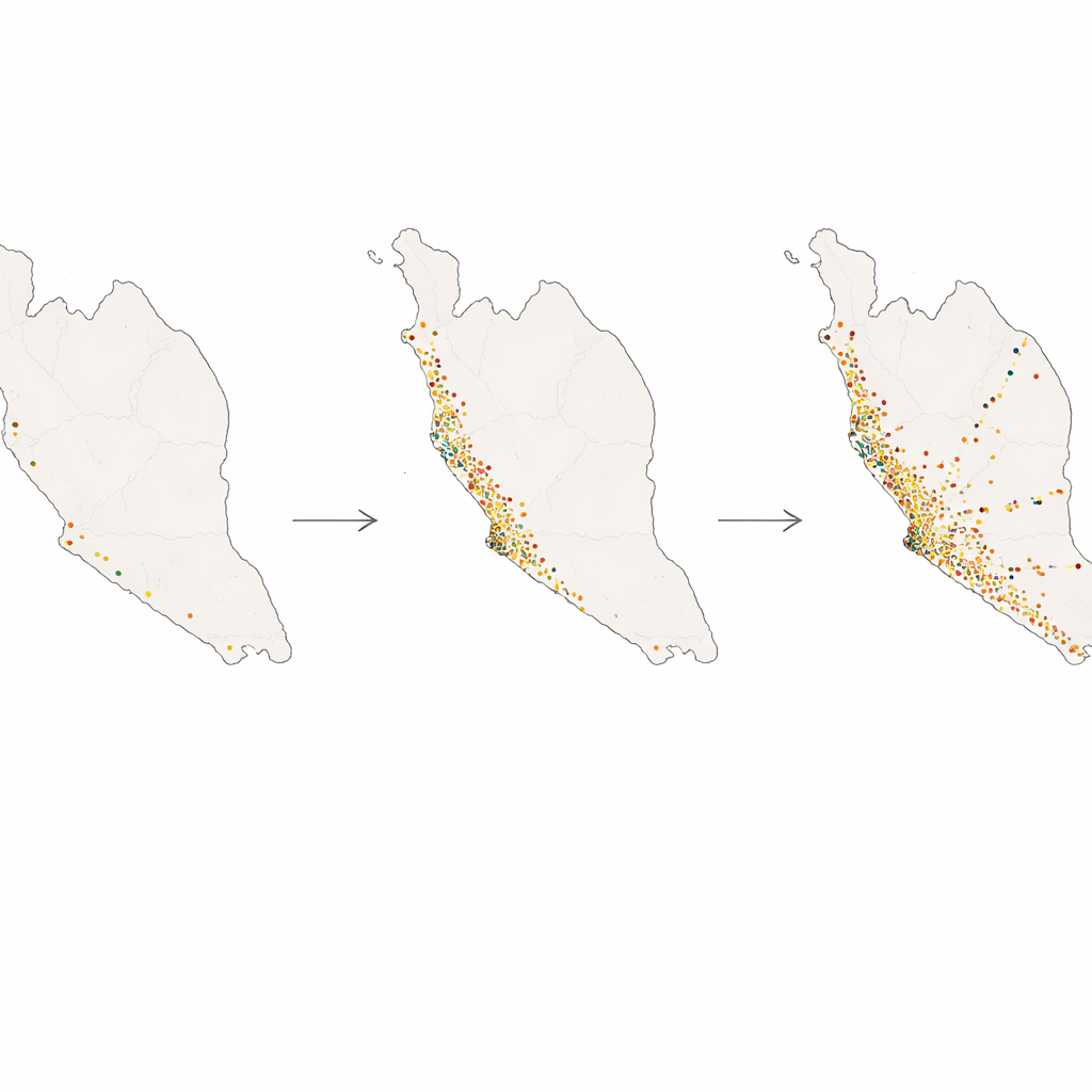
Following rivers and rails into the interior
The largest transformation unfolded from the 1860s to 1950s. With looser migration rules from China and expanding British control, railways and trunk roads pushed deeper into the interior. The authors’ maps reveal that Chinese settlements multiplied and followed these new routes, forming continuous belts along the Straits of Malacca and corridors reaching inland to tin mines and plantations. Yet their basic environmental preferences stayed the same: more than four out of five were built on low, flat land below 50 meters in elevation, close to rivers, lakes, or the coast. In other words, the network stretched inland without abandoning the gentle terrain and water access that had favoured ports in the first place.
Work, water, and community ties
By comparing locations with terrain, waterways, roads, and rail lines, the study uncovers a layered logic behind where these towns grew. Nature provided the stage: low coastal plains and river valleys that were easy to reach, easy to build on, and good for farming. Transport laid down new paths, turning old river routes into modern corridors as tracks and roads followed the same valleys. Economic roles then differentiated the settlements. Coastal towns leaned toward trade; inland belts concentrated around tin mining; farming communities spread more loosely across cultivable lowlands. Binding all of these together were temples, clan halls, and associations that helped migrants find work, settle disputes, and keep shared rituals alive, linking far-flung villages and towns into one social web. 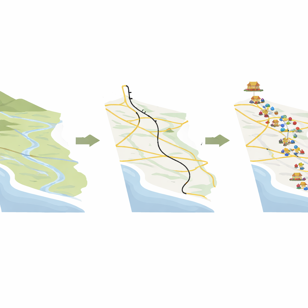
Rethinking heritage as living corridors
For the authors, these findings mean that the traditional Chinese streets and mining towns of Peninsular Malaysia are more than isolated “old quarters.” They are pieces of a regional puzzle that stretches along coasts, rivers, and rail lines—a historical corridor system that stitched together ports, resource frontiers, and faraway homelands. Recognising this broader pattern can reshape conservation. Instead of protecting only individual buildings, planners can think in terms of belts and nodes: port zones, river chains, mining belts, and rural clusters, each with its own role in a shared story of migration and adaptation. Seeing these places as parts of a long-evolving network, rather than static relics, helps explain why they matter—and how they might be cared for in a rapidly changing world.
Citation: Tu, X., Chen, Z., Zhang, J. et al. Spatiotemporal evolution and influencing factors of traditional overseas Chinese settlement heritage in Peninsular Malaysia (1600s–1950s). npj Herit. Sci. 14, 219 (2026). https://doi.org/10.1038/s40494-026-02486-8
Keywords: overseas Chinese settlements, Peninsular Malaysia heritage, migration history, cultural landscapes, GIS spatial analysis