Clear Sky Science · en
Machine-learning-based reconstruction of Ming-dynasty defensive corridors in Yuxian
Why Old Fortresses Still Matter Today
Along China’s Great Wall, the county of Yuxian once formed a crucial shield for the Ming dynasty. Today, its ruined forts, beacon towers, and post roads are scattered across mountains and valleys, making it hard to picture how the whole defense system once worked. This study uses modern mapping and machine-learning tools to reconstruct the “invisible” defense corridors that once linked walls, passes, and farming settlements into a living security network, offering a new way to read history directly from the landscape.
A Mountain Gate to the Heartland
Yuxian lay on the southern edge of a chain of frontier towns, between the high Taihang Mountains and the plains leading to Beijing and the central provinces. In Ming times, this rugged area bristled with defenses: a guard city beside the Huliu River, numerous walled villages that doubled as forts, and beacon towers strung along the Great Wall. Forts were often placed where foothill plains met narrow passes, combining good farmland with strong positions. This mix of steep ridges, river valleys, and man-made strongholds turned Yuxian into both a shield against northern raiders and a granary that helped feed the troops who guarded the border.
From Old Maps to Smart Models
Earlier research on this frontier relied mainly on documents and case studies, leaving many gaps in how the whole system fitted together in space. Here, the authors assemble several kinds of data: historical maps and gazetteers that record forts, guard cities, and post stations; modern digital elevation models that describe the terrain; and a previously reconstructed network of Ming-era post roads. They carefully check the reliability of 65 key heritage sites and survey 278 military locations in and around Yuxian, then analyze how these sites cluster, how they see one another across the landscape, and how they connect to passes and roads. This provides a detailed, map-based picture of where the military system was strongest and how it was shaped by hills, rivers, and ridgelines.
Teaching a Computer to Read the Landscape
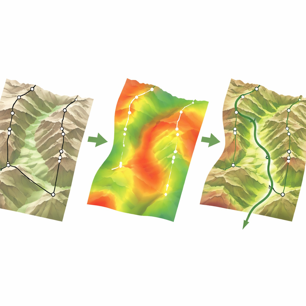
To move beyond simple maps, the researchers train machine-learning models to learn the hidden rules behind where Ming military sites were placed. They feed the models many potential influences: height, slope, ruggedness, distance to rivers and post roads, how dense nearby forts are, and how easily one site can see and be seen by others. Using advanced tree-based algorithms and special “spatial” cross-checks, they avoid fooling themselves with patterns that only appear because points are close together. They then apply a technique called SHAP to open the model’s “black box,” measuring how strongly each factor pushes a location toward being part of a defense corridor or not, and where important thresholds lie—for example, slopes that are steep enough to be defensible but not too steep to move through.
Tracing Hidden Defense Corridors
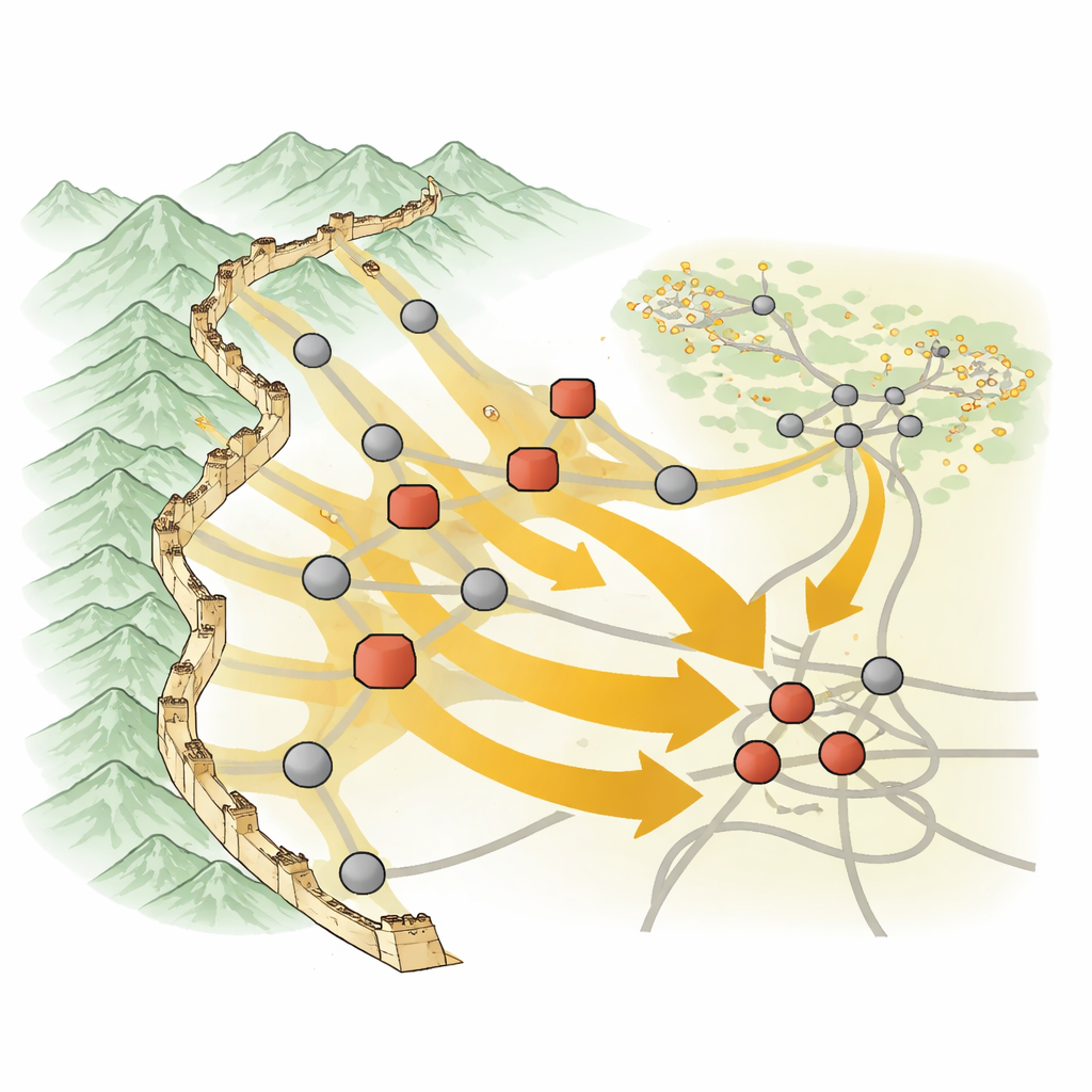
With these insights, the team turns the landscape into a “resistance surface,” where each pixel represents how hard it would be, in defense terms, for a corridor to pass through. Areas with good visibility, a dense cluster of sites, moderate slopes, and access to roads are treated as low-resistance routes. They then use a standard landscape-analysis method to trace paths of least resistance between forts, passes, and other military nodes, revealing multi-layered corridors rather than single lines. The results show strong outer corridors hugging the Great Wall and mountain passes, and deeper corridors that run inland along valleys and ridge shoulders to link satellite forts, guard cities, and post-road hubs. Most known military sites fall within a few kilometers of these predicted routes, and a large share of reconstructed post roads and Great Wall segments align with high-suitability zones.
What This Reveals About an Old War Machine
For non-specialists, the key message is that the Ming frontier around Yuxian was not just a wall and a scattering of forts, but a carefully layered network that balanced food production, rapid communication, and defensive strength. By combining historical records with modern computing, the study shows that line-of-sight between towers and the clustering of settlements were the main forces shaping where defense corridors ran, with terrain and roads fine-tuning the pattern. The method offers a reusable toolkit for other stretches of the Great Wall and similar border regions worldwide, helping planners and heritage managers to recognize, protect, and explain large-scale defense landscapes that are no longer obvious on the ground.
Citation: Zhao, P., Xue, Q., Qin, H. et al. Machine-learning-based reconstruction of Ming-dynasty defensive corridors in Yuxian. npj Herit. Sci. 14, 225 (2026). https://doi.org/10.1038/s40494-026-02438-2
Keywords: Great Wall defense, historical GIS, machine learning archaeology, military landscapes, Ming dynasty Yuxian