Clear Sky Science · en
A robot-assisted pipeline to rapidly scan 1.7 million historical aerial photographs
Bringing Hidden Aerial Histories to Light
Across the 20th century, pilots crisscrossed the globe taking millions of detailed aerial photographs that quietly captured wars, cities, forests, coasts, and farms in transformation. Most of these images now sit in long, dusty archives, hard to reach just when scientists, historians, and the public most want to study how our planet and societies have changed. This article explains how a team built a robot-assisted system that can quickly and safely turn a huge collection of fragile aerial photos into a digital treasure trove that anyone can explore.
A Giant Photo Album of the World
The story begins with a vast archive of about 1.7 million aerial photographs held by the National Collection of Aerial Photography in Edinburgh, originally created by a British government mapping unit after World War II. Flying over more than two million square miles of land in at least 65 countries, survey planes photographed whole regions in overlapping strips, like “mowing the lawn” from the sky. These contact prints—photos the same size as the original film—capture fine details down to roughly a meter or two on the ground, enough to see roads, rivers, farms, and even small buildings. Yet the very scale that makes this archive so valuable also makes it hard to use: a million prints can fill more than a kilometer of shelving, and older materials are slowly fading, curling, or growing mold in storage.
Why Old Photos Are Hard to Save
Simply putting each print on a scanner by hand might sound straightforward, but the reality is slow, costly, and physically punishing. Many prints have suffered from years in damp or unstable conditions. Some are stuck together, others are speckled with mold or silver dust, and many curl or crack if pressed too hard. Conservators must carefully clean, separate, flatten, and sometimes sleeve damaged photos before they can go anywhere near a scanner. This “preservation pipeline” calls for judgment and skill: workers examine each box, vacuum away spores, soak and separate blocked prints, gently press curled ones in a humidifying chamber, and protect the rare photos that are too fragile to be handled normally. Done entirely by hand, the entire collection would take roughly a decade of full-time, repetitive work for humans alone.

Humans and Robots Working Side by Side
To break this bottleneck, the team designed a “cobot” setup, where humans handle complex, delicate decisions and robots take over repetitive, precise motions. After preservation, workers stack batches of prints—interleaved with steel plates to keep them flat—into an input hopper. A robotic arm equipped with suction cups and sensors lifts one print at a time, places it face down on a high-resolution flatbed scanner, and coordinates with an automated lid to start the scan. While one scanner is working, the robot swings to a second scanner, keeping both machines busy. The scanners capture images at 1200 pixels per inch, enough to retain nearly all the visual detail in the original prints. Calibration strips in each scan help confirm sharpness, scale, and tone, and any damaged or missed prints are flagged for special manual rescans during quality checks.
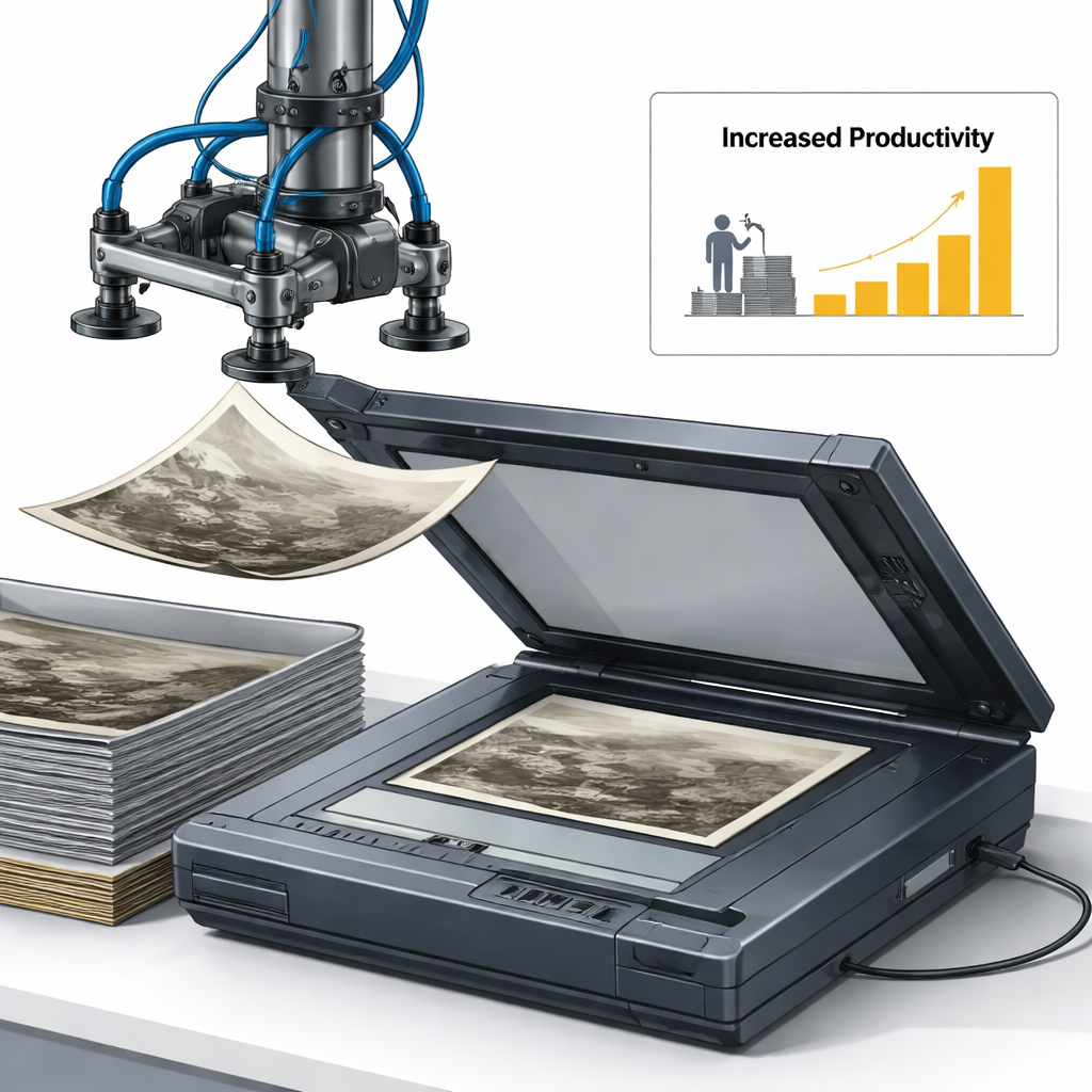
Thirty Times More Work from Each Worker
Because robots can quietly run around the clock and a single person can oversee several machines, the new system dramatically boosts productivity. Although a skilled human can load scanners a bit faster than the robot during a single hour, a person can only work so many hours a week, while the robotic stations can operate 24/7. Under realistic conditions, the authors show that this collaborative pipeline increases the number of images digitized per full-time worker by more than thirty-fold. The system also proved safe—only minor incidents were recorded—and gentle on the precious prints, with over 99.9 percent scanned without any damage beyond small, repairable flaws. When millions of images are involved, such gains make the difference between a project that is impossible in practice and one that can actually be completed.
Unlocking the Past for the Future
By combining human care with robotic stamina, this project turns a once-inaccessible paper mountain into a searchable digital resource. The authors estimate that for very large collections, automation quickly becomes cheaper than manual scanning, opening the door for archives worldwide to rescue their own aerial photo holdings before they decay. Once these images are digitized and tied to modern maps, researchers and citizens will be able to trace glacier retreat, coastline shifts, city growth, and land-use changes over decades with a clarity that satellites alone cannot provide. In simple terms, this work shows how smart use of robots can help us save and share a unique visual record of the 20th century before it disappears.
Citation: Masson, S., Potts, A., Williams, A. et al. A robot-assisted pipeline to rapidly scan 1.7 million historical aerial photographs. npj Herit. Sci. 14, 123 (2026). https://doi.org/10.1038/s40494-026-02365-2
Keywords: historical aerial photography, digitization, robotic scanning, cultural heritage archives, environmental change