Clear Sky Science · en
Spatial patterns of access-density mismatch reveal infrastructure gaps and strategic opportunities for new housing
Why some neighborhoods feel stuck in traffic
Cities are constantly reshaping how people live, work, and move. Yet many residents experience a persistent mismatch: crowded buses in the center, empty park-and-ride lots on the edge, and new homes springing up far from good jobs. This article introduces a simple but powerful idea—the “access–density mismatch”—to explain where transport networks and where people live are out of sync, and how closing that gap can improve everyday life and guide smarter housing and infrastructure investments.
When people and transport fall out of step
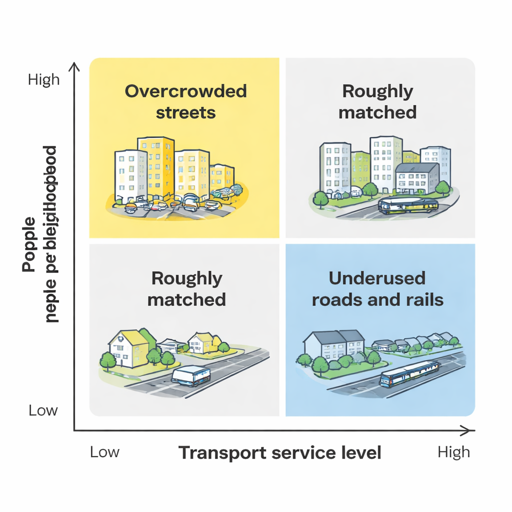
In an ideal city, busy neighborhoods would be served by frequent buses and trains, safe sidewalks, and well-connected roads, while quieter areas would still enjoy reliable, if less intense, service. Reality looks different. The authors define an “access–density mismatch” as a misalignment between how many people live in an area and how easy it is to reach jobs and other destinations. Two basic problems emerge. In some places, population growth has outpaced investment in transport, creating an infrastructure shortfall: streets, buses, and trains simply cannot keep up with demand. In others, roads and rail lines were built ahead of time or in the wrong places, so capacity is underused and costly to maintain. The study shows how these patterns arise from long-term decisions about where to build housing, where companies locate jobs, and how governments fund roads and transit.
Measuring how well neighborhoods are connected
To move from theory to evidence, the researchers examined every census block in the fifty largest U.S. metropolitan areas. They measured “local density” as the number of people reachable within a five-minute walk, and “regional access” as the number of jobs reachable within thirty minutes by car or by transit. Using these measures, they studied how strongly neighborhood density is linked to regional access. Across the country, the two move together: places that can reach more jobs within half an hour tend to attract more residents. But the link is stronger for cars than for transit, reflecting how U.S. road networks often cover more ground and offer more flexibility than bus or rail systems.
Different city shapes, different outcomes
The strength of this relationship varies sharply by region and city type. In compact, transit-rich metropolitan areas—such as New York, Chicago, and parts of the West Coast—increases in transit access are tightly tied to higher residential density, and these regions also show higher shares of commuters using transit. In sprawling or highly car-dependent metros, changes in transit access have a weaker connection to where people live, while better car access more often encourages households to spread out. The study finds that in all but a few cities, car access has a larger effect on residential density than transit access, underscoring how decades of highway building have shaped urban growth more powerfully than transit investment.
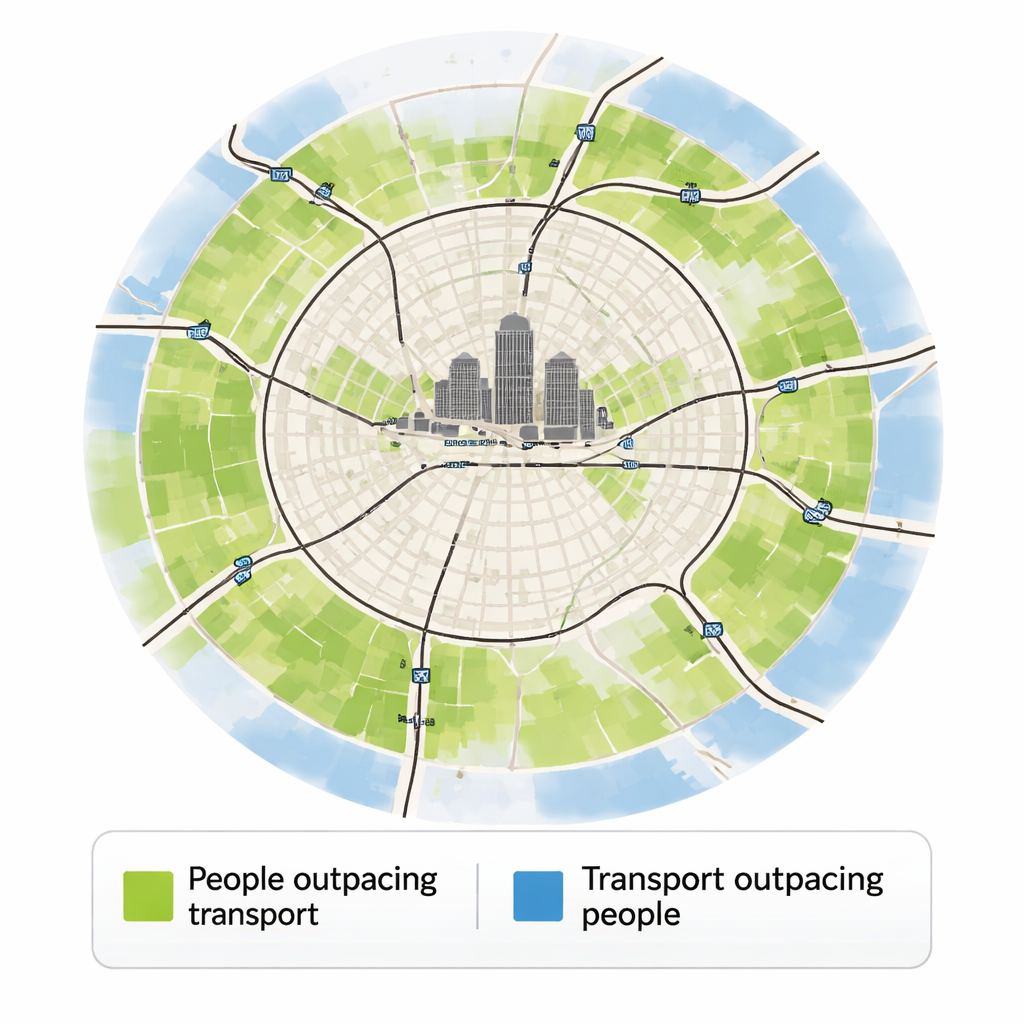
Where the gaps really are on the map
By comparing the density actually observed in each block with the density predicted from its level of access, the authors create detailed maps of mismatch. Near central business districts, many neighborhoods have more people than the transport system seems built to support—especially for transit. This is where residents are most likely to experience crowding, delays, and limited options, signaling a need to improve buses, trains, and walking conditions. On the urban fringe, the opposite pattern dominates: access is high relative to the number of residents, particularly for cars. Highways and major roads extend into areas that remain sparsely populated, indicating “residential growth opportunities” where new housing could be added without overwhelming existing networks.
What this means for better cities
The study concludes that aligning people and transport more carefully can pay off in multiple ways. Directing new housing to areas where roads and transit are already strong can make better use of past investments and reduce pressure to build ever more lanes and parking. At the same time, boosting transit in dense inner neighborhoods can ease crowding, support shorter car-free trips, and lower emissions. While the analysis focuses on access to jobs and offers only a snapshot in time, it provides a clear message for planners and policymakers: cities work best when the places people want to live are matched with the ability to move efficiently, and when new infrastructure is built where it will be used, not where it will sit empty.
Citation: Janatabadi, F., Ermagun, A. & Levinson, D. Spatial patterns of access-density mismatch reveal infrastructure gaps and strategic opportunities for new housing. npj. Sustain. Mobil. Transp. 3, 10 (2026). https://doi.org/10.1038/s44333-026-00080-w
Keywords: urban density, transport accessibility, public transit, housing location, infrastructure planning