Clear Sky Science · en
Rapid intensification of recent extreme precipitation events in southern Norway under warmer climate conditions
Why sudden downpours are getting more dangerous
People living in southern Norway have recently faced sudden cloudbursts with landslides, flooded roads, and damaged homes. This study asks a simple but urgent question: if the same storms happened in a slightly colder or warmer climate, how much worse would they be? Using advanced weather models, the researchers replay three recent extreme rain events—Gyda, Hans, and Bø—under different temperature conditions to see how climate warming might intensify future downpours and expand the areas they hit. 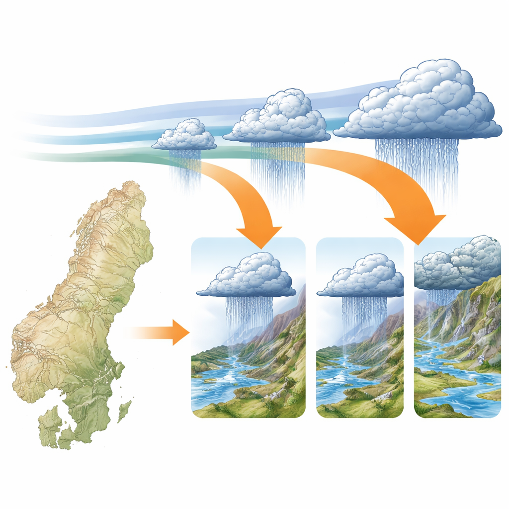
Three memorable storms as natural experiments
The team focused on three real storms that caused major impacts in southern Norway. Gyda, in January 2022, was fueled by an "atmospheric river"—a long, moist air stream from the tropics that hit the mountains and produced heavy rain and snowmelt. Hans, in August 2023, came from two low-pressure systems merging and feeding a steady flow of warm, humid air over southeastern Norway, leading to persistent rain. Bø, in July 2024, was different: a small, intense, and highly localized storm formed when a slow-moving cold front and unstable air triggered powerful showers in a narrow valley. Together, these three cases span winter and summer, broad and localized systems, and different ways the atmosphere can unleash extreme rain.
Replaying the storms in colder and warmer worlds
Instead of looking only at long-term averages, the researchers used a "storyline" method: they kept the large-scale weather patterns of each storm the same, but altered the background temperature and humidity to represent a climate 2 °C colder, 2 °C warmer, and, where relevant, 4 °C warmer than today. This was done with a high-resolution numerical weather model (WRF) that can represent clouds and intense showers over steep terrain down to scales of 1 kilometer and, for Bø, even 200 meters. Before trusting the experiments, they checked that the model reproduced observed rainfall amounts, timing, and affected areas reasonably well against rain gauges and radar data. While the tiny Bø storm remained hardest to capture, the model generally matched or outperformed existing gridded datasets, particularly for the larger Gyda and Hans events.
How much more rain and over how much more land?
When the same storms were placed in warmer conditions, they did not all respond in the same way. For the full multi-day events, total rainfall increased by about 4% per degree of warming for Gyda, 9% for Hans, and a striking 19% for Bø. For the most intense one-hour bursts, the increases were far larger: around 10%, 15%, and 30% more rain per degree for Gyda, Hans, and Bø, respectively. These growth rates are greater than what would be expected from extra moisture in the air alone and show that storm dynamics—such as stronger upward motion and more vigorous cloud growth—amplify the effect of warming. The area exposed to very heavy rain (above a national warning threshold) also expanded sharply with temperature, in some cases several-fold, meaning more locations could be hit during similar future events. 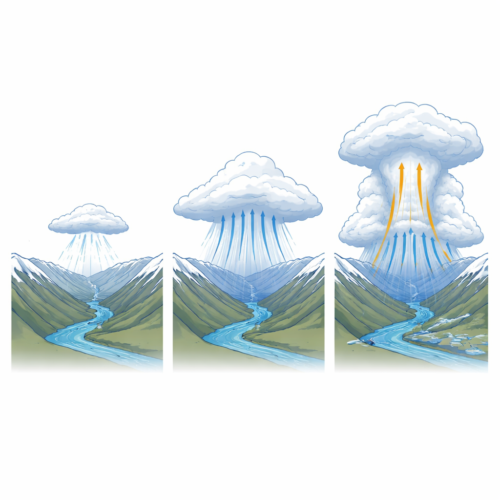
What happens inside a hotter storm
By examining the storms second-by-second and minute-by-minute, the study shows that the briefest, most intense bursts are especially sensitive to warming. For all three events, the maximum one-minute rain rates increased faster than expected as the background temperature rose, in some cases more than four times the standard thermodynamic scaling used in climate science. In the summer storms Hans and Bø, warmer air and higher dew point temperatures strengthened the vertical motion inside clouds and increased ice content high in the atmosphere, signs of more powerful convective towers. These changes help explain why sub-hourly rainfall rates can surge so dramatically in a warmer climate, even if total daily rainfall increases more modestly.
What this means for people and planning
To a non-specialist, the take-home message is clear: when the climate warms, the most intense short-lived downpours in southern Norway can become much stronger and spread over larger areas, even if the weather patterns look similar to today. The study shows that for certain types of storms—especially small, convective ones like Bø—rainfall peaks may rise far faster than the average increase in atmospheric moisture. This means that infrastructure, warning systems, and risk maps based on past rainfall statistics are likely to underestimate future hazards. Planning for landslides, flash floods, and drainage capacity will need to account for not just more rain overall, but for sharper, more localized bursts that can overwhelm systems in minutes.
Citation: Mužić, I., Hodnebrog, Ø., Myhre, G. et al. Rapid intensification of recent extreme precipitation events in southern Norway under warmer climate conditions. npj Nat. Hazards 3, 35 (2026). https://doi.org/10.1038/s44304-026-00200-z
Keywords: extreme precipitation, climate warming, southern Norway, flash flooding, convection-permitting modeling