Clear Sky Science · en
Review on tsunami research and risk mitigation: from prediction models to resilient coastal communities
Why giant waves matter to everyday life
Tsunamis are rare but devastating ocean waves that can cross entire seas in hours and flood coastlines in minutes. This review article explains how scientists are reinventing tsunami prediction: moving from slow, stand-alone physics models to fast, data-rich systems that blend satellites, seafloor sensors, and artificial intelligence. For anyone living near the coast—or simply worried about how societies cope with extreme events—it shows how better forecasts, smarter warnings, and stronger communities can turn seconds and minutes of advance notice into lives saved.
How tsunamis form and why they are so hard to predict
Tsunamis are not just oversized versions of ordinary waves. They are driven by sudden movements of the sea floor during big earthquakes, underwater landslides, volcanic eruptions, and even unusual weather patterns. These events can shove huge volumes of water upward in seconds, sending long, low waves racing across the ocean faster than a jetliner. The problem is that these sources are varied, often poorly understood, and sometimes leave only weak early clues. Forecast centers must decide within minutes whether to sound alarms, where the waves will hit hardest, and how high they might run up onto land—all while knowing that a missed warning can be deadly and a false alarm can erode trust and cause costly disruption.
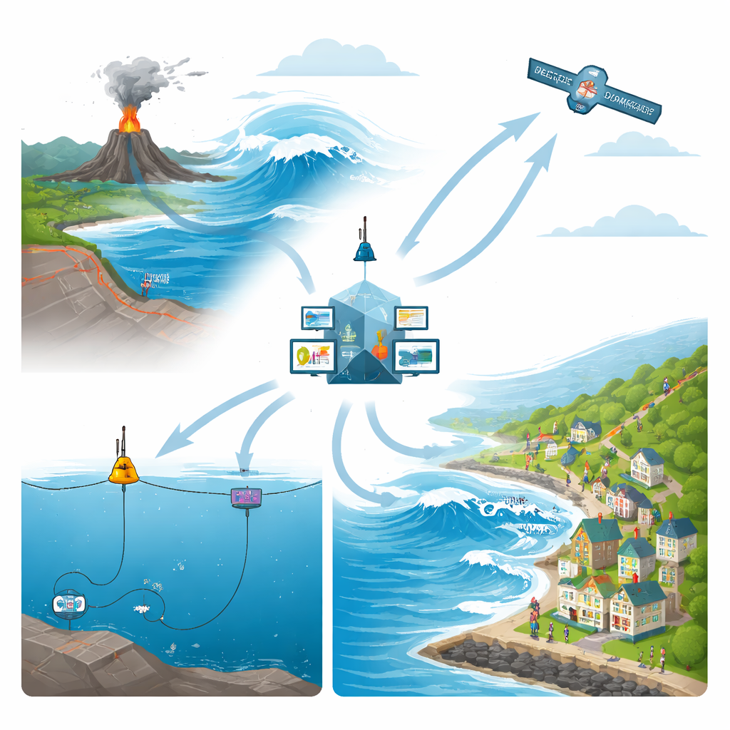
Listening to the ocean from the seabed to space
Over the last two decades, a quiet revolution has taken place in how we watch the ocean. Networks of deep-ocean buoys and seafloor pressure sensors can now detect subtle changes in water pressure as tsunami waves pass far offshore. Coastal tide gauges record rapid changes in sea level as waves approach land. On land and under the sea, seismic and satellite-based positioning instruments measure how the Earth’s crust shifts during an earthquake, helping reconstruct how much the seafloor has moved. Radar and optical satellites add a bird’s-eye view, capturing sea-surface disturbances and mapping flooded areas and damage after an event. The article shows how these very different data streams, each with its own strengths and blind spots, are being woven together into global monitoring systems that can track tsunamis from their birth to their landfall.
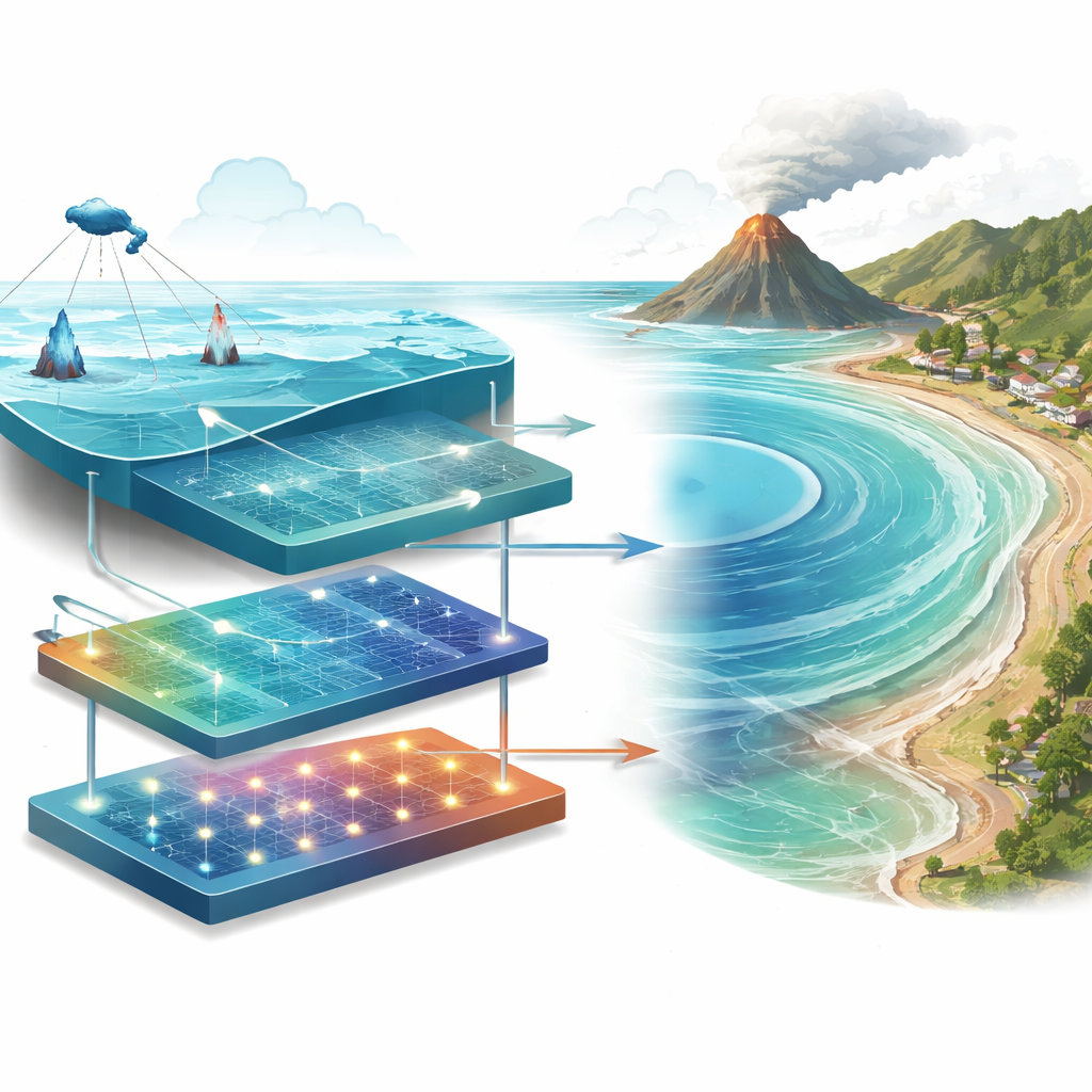
From equations to intelligent forecasting
For many years, tsunami prediction relied almost entirely on physics: equations describing how water flows across the ocean and onto shorelines. These models remain the scientific backbone of the field because they make the underlying processes transparent. But high-resolution simulations can take too long to run when a dangerous wave may arrive in 10 to 20 minutes. The review describes how researchers are now building faster, more flexible tools using machine learning and artificial intelligence. Some data-driven models learn patterns linking seismic signals or offshore wave measurements directly to expected coastal flooding, producing near-instant estimates. Others serve as surrogates for heavy physics codes, mimicking their results at a fraction of the cost. The most promising approaches mix both worlds—using AI to speed up calculations or interpret complex signals, while keeping physical laws in the loop so that predictions remain realistic.
Turning forecasts into real-time decisions
Accurate numbers alone do not protect people; they must feed into warning systems and on-the-ground choices. The paper explores how real-time forecasting centers are being redesigned as automated pipelines. Once an earthquake or other trigger is detected, data from seabed instruments, tide gauges, and satellites are pulled in automatically; models run on high-performance computers or cloud platforms; and the outputs are turned into maps and risk levels. Increasingly, these results are framed in probabilistic terms, describing not just a single expected wave height but a range of possibilities and how confident forecasters are. At the same time, new decision-support tools use AI to help prioritize evacuations, plan routes away from danger, and allocate emergency resources—while raising important questions about transparency, human oversight, and who is accountable when automated systems influence life-or-death calls.
Planning for safer coasts in the long run
Beyond immediate warnings, the review looks at how tsunami science supports long-term safety. Risk studies now combine hazard models with detailed information on buildings, infrastructure, and populations to pinpoint where people and assets are most exposed. Planners use both worst-case scenarios and probability-based analyses to design evacuation routes, safe assembly areas, and building codes. The article also highlights future directions such as “digital twins” of coastal regions—virtual copies of real coastlines that are constantly updated with new data and can be used to test emergency plans in silico—as well as large, reusable AI models trained on global data. Learning from small events and near-misses, not just disasters, is seen as crucial for refining these tools. In the end, the authors argue that the goal is not only better wave forecasts, but more resilient communities that can anticipate, withstand, and recover from tsunamis.
What this all means for coastal communities
The article concludes that tsunami forecasting is shifting from a narrow, model-centered activity to a broader information service aimed squarely at saving lives and reducing damage. By fusing physics, big data, and artificial intelligence, scientists can now deliver faster and more nuanced warnings, and they can express their uncertainty in ways that support difficult choices under pressure. Yet technology is only part of the story: clear communication, fair access to data and tools, and strong institutions are just as important. For people living by the sea, this evolving system promises not only earlier alerts when a giant wave is on the way, but also smarter planning and investments that make coastal life safer even before the ocean stirs.
Citation: Ma, T., Shen, L., Chen, Z. et al. Review on tsunami research and risk mitigation: from prediction models to resilient coastal communities. npj Nat. Hazards 3, 34 (2026). https://doi.org/10.1038/s44304-026-00195-7
Keywords: tsunami forecasting, early warning systems, artificial intelligence, coastal resilience, natural hazard risk