Clear Sky Science · en
Uneven recoveries: a deep learning assessment of the 2019 Midwest floods and their impact on rural communities
Why these floods still matter
The record-breaking floods that swept across Nebraska and the broader Midwest in 2019 did more than wash out roads and fill the news cycle for a few weeks. For many small towns and rural neighborhoods, the damage has stretched on for years, reshaping where people live, how they work, and whether their communities can survive the next big storm. This study follows what happened long after the waters receded, using satellite images and artificial intelligence to track which places bounced back, which did not, and why that uneven recovery matters for anyone living in a flood‑prone area.
Following communities from space
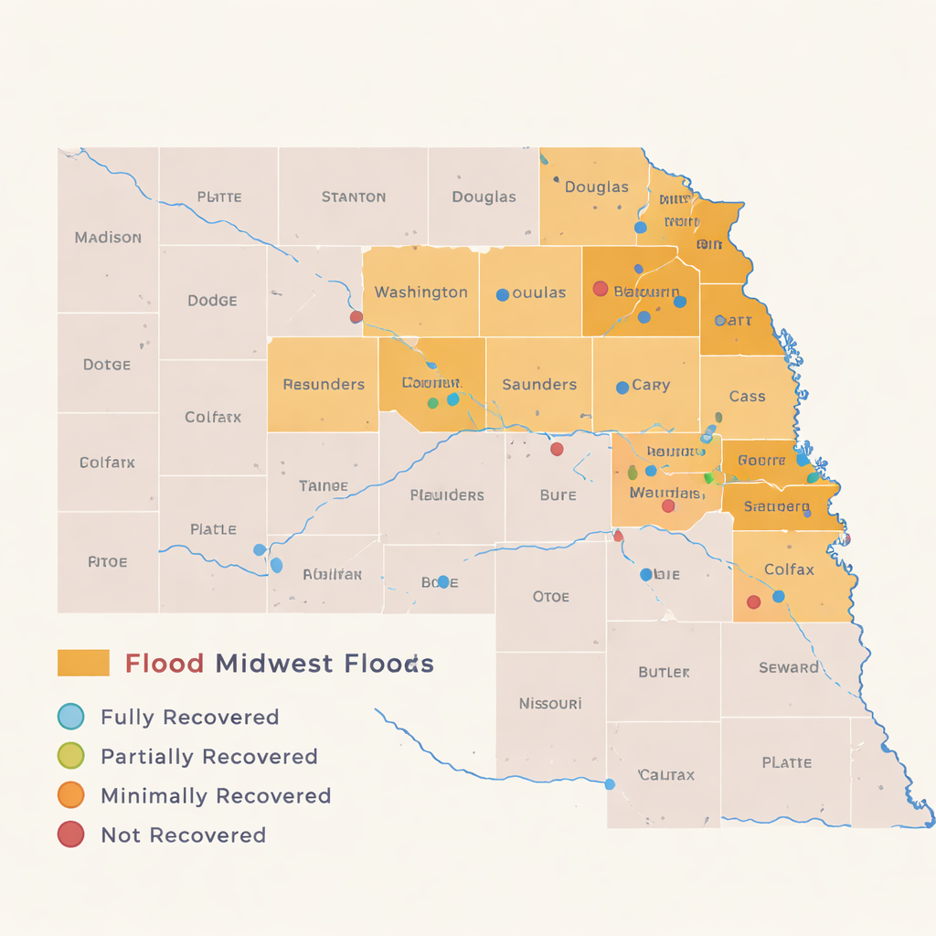
The researchers focused on 59 flood-hit communities in eastern and central Nebraska, from tiny towns of a few hundred residents to suburban areas near Omaha. They examined 70 specific sites—neighborhoods, roads, bridges, parks, and public facilities—using high-resolution aerial imagery taken before the floods in 2018 and at several points afterward (2020, 2022, and 2024). Each site was sorted into four plain-language categories: fully recovered (rebuilt and functioning), partially recovered (slow or incomplete rebuilding), minimally recovered (little visible action), or not recovered (still destroyed or gone). This simple scorecard allowed the team to compare progress across places and types of infrastructure.
Smart algorithms meet human judgment
To handle thousands of detailed images, the team turned to a deep learning approach known as a Siamese U‑Net. In essence, the model compares two images of the same place taken at different times and labels each pixel as “no change,” “demolished,” or “new building.” This makes it possible to automatically map where structures vanished or appeared across large areas. But the researchers also discovered the limits of automation: the model was excellent at spotting buildings that had been torn down, but it often missed or misread new construction. Subtle repairs, small new homes, or partially rebuilt structures tended to look too much like the old landscape. To correct for this, the team overlaid a second layer of careful human review, manually tracing buildings and fixing errors so that the final maps reflected what was truly happening on the ground.
Who gets their homes and roads back
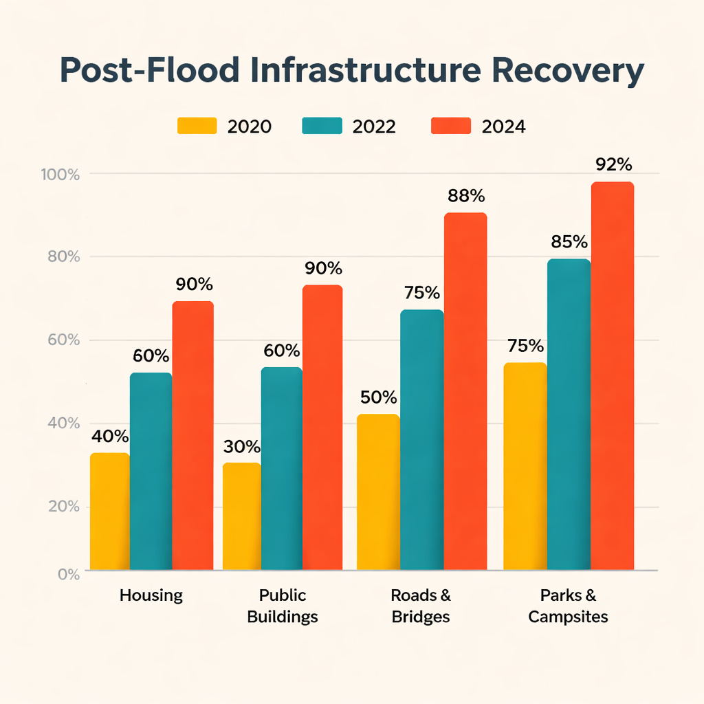
The combined machine-and-human assessment revealed stark contrasts. By 2024, nearly half of the 70 sites were judged fully recovered, yet more than a quarter had not recovered at all. Roads and bridges came back fastest: over 85% were restored as early as 2020, and transportation remained the clear recovery winner throughout the study period. Parks and campsites also fared well, climbing above 90% recovery by 2024. Public facilities such as community buildings saw only modest progress, with just over half restored. Housing was the slowest and most fragile sector: only about 16% of housing sites had recovered by 2020, rising to roughly 37% by 2024, and when all years were combined, a mere 28% of housing locations were counted as recovered. For many rural residents, that meant persistent vacant lots, boarded-up homes, and a shortage of affordable places to live.
Uneven outcomes from town to town
Recovery also varied sharply by county. Some places, such as Cherry and Pierce Counties, reached full recovery at the sites studied, while others, including Sarpy and Holt, were left with a large share of never-recovered locations. Case studies illustrate what those statistics look like on the ground. Paradise Lakes, a mobile home community in Bellevue, suffered such severe damage that more than 200 homes were condemned and eventually demolished; years later, the land remains largely vacant, deepening the local housing crunch even as new levees are built nearby. The tiny Village of Winslow pursued a bold plan to move the town to higher ground, but funding delays and complex land deals have left relocation incomplete more than six years after the flood. In contrast, Camp Ashland, a key National Guard training site, received tens of millions of dollars to rebuild with elevated, flood‑ready buildings and stronger levees, making it a showcase of rapid, well-resourced recovery.
Lessons for a future of bigger storms
Looking across the state, the authors argue that long-term resilience is shaped as much by money, planning capacity, and social vulnerability as by the size of the flood itself. Areas with strong institutions, better infrastructure, and ready access to federal funds tended to restore critical assets quickly. Rural and low-income communities, often with aging populations and limited tax bases, were more likely to be stuck with damaged homes, drawn-out decisions over buyouts, or stalled relocation. The study concludes that tracking recovery through tools like deep learning, anchored by careful human checks, can help pinpoint where people are being left behind. For non-specialists, the take-home message is clear: rebuilding after a disaster is not just about patching roads; it is about ensuring that the hardest-hit communities have the resources and support to recover their homes and futures before the next flood arrives.
Citation: Jahan, R.N., Mason, J.B., Jahangeer, J. et al. Uneven recoveries: a deep learning assessment of the 2019 Midwest floods and their impact on rural communities. npj Nat. Hazards 3, 8 (2026). https://doi.org/10.1038/s44304-026-00171-1
Keywords: flood recovery, rural communities, Nebraska floods, satellite imagery, disaster resilience