Clear Sky Science · en
Urbanization signatures on climate and soils uncovered by crowd-sensed plants
Why city plants can tell us about our future
As more of humanity crowds into cities, we know urban life feels hotter and drier, but we still lack a clear picture of how city living reshapes local climate and the ground beneath our feet. This study shows that ordinary plants, recorded by citizens with smartphone apps, can act as millions of tiny sensors. By listening to what grows where, the authors reveal how European cities change temperature, moisture and soils—and why pockets of urban nature, especially forests, are crucial for keeping cities livable.
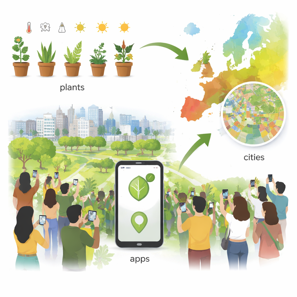
Turning phone photos into environmental maps
The researchers tapped into more than 80 million plant observations collected by people using popular identification apps across Europe. Each plant species has long been known by botanists to prefer certain conditions—warmer or cooler, wetter or drier, more acidic or more alkaline soils, and so on. By combining these expert “preference scores” with the locations where species were photographed, the team developed what they call mobile crowd sensing of environments. They translated plant records into detailed maps of temperature, light, moisture, soil fertility, salt content, soil acidity and how heavily soils have been disturbed.
Reading the fine print of city climates
Across 326 European cities, from Mediterranean towns to Nordic capitals, the plant-based maps picked up familiar large-scale patterns: southern regions emerged as warmer and generally drier, northern regions as cooler and moister. Mountain ranges stood out as cooler areas with less-disturbed soils. Zooming into individual cities, however, revealed a striking patchwork. Dense built-up districts consistently appeared as hot spots, while urban forests and riverside green corridors showed up as cooler, moister zones, confirming and refining the classic urban heat island picture using only plant records.
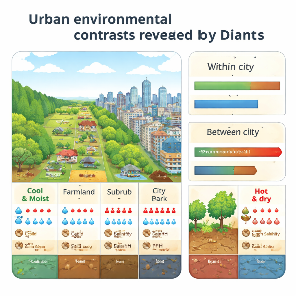
How different parts of a city shape the ground and air
By comparing land-use types—continuous building blocks, suburban housing, industrial zones, urban parks, forests and farmland—the study uncovered a set of recurring “environmental profiles.” Built-up areas were not only warmer but also drier, brighter, more salt-polluted, more alkaline and more physically disturbed than green spaces, especially forests. In most regions, forests were the coolest and wettest parts of the urban fabric and had the least damaged soils. In southern Europe, irrigation made many urban green spaces wetter than nearby natural vegetation, while rocky forest and pasture sites often remained dry. Overall, the differences from one land-use type to another inside a city were as large as the differences between entire regions of Europe.
Local variety, global sameness
The team then asked how these internal contrasts compare with differences between cities separated by hundreds or thousands of kilometers. They found that the environmental gap between, say, a city center and its urban forest can match the gap between two cities 1,500 to 3,000 kilometers apart. Yet when the same type of land use was compared across cities, a different pattern emerged. Forested areas varied a lot from city to city, reflecting local geology and climate, whereas built-up zones looked surprisingly alike in their temperature, light and soil conditions. In other words, cities foster strong local diversity between green and gray spaces, but the gray spaces themselves are becoming environmentally similar across Europe.
What this means for building better cities
For non-specialists, the takeaway is clear: the way we pave, build and manage land profoundly reshapes city climates and soils, and not just by making them hotter. Dense development tends to create hot, dry, bright, salty and heavily disturbed ground, while urban forests and other robust green areas offer cooler, moister and more varied conditions. Because environmental contrasts within a single city can rival those across half a continent, protecting and expanding high-quality green spaces is a powerful tool for keeping cities comfortable, resilient and healthy. And by harnessing everyday plant photos from citizens, planners and scientists now have a fast, low-cost way to monitor these hidden changes and steer urban growth toward more livable futures.
Citation: Tautenhahn, S., Jung, M., Rzanny, M. et al. Urbanization signatures on climate and soils uncovered by crowd-sensed plants. Nat Cities 3, 126–135 (2026). https://doi.org/10.1038/s44284-025-00378-9
Keywords: urban climate, urban soils, citizen science, urban green spaces, environmental homogenization