Clear Sky Science · en
Fault-controlled magma pathways driving seismicity and eruption risk in Eastern Turkey
Hidden Fire Beneath a Famous Fault
Beneath the rugged mountains of eastern Turkey, the same forces that drive deadly earthquakes are quietly steering molten rock. This study shows that along the eastern North Anatolian Fault Zone—a major fault responsible for historic quakes—magma is stored and guided by the fault itself. Understanding how slipping rocks and rising melt interact helps explain subtle ground movements seen from space and reveals why some areas may face both earthquake and eruption risks at the same time. 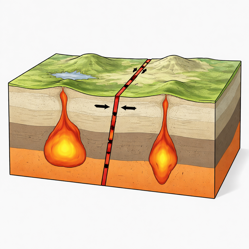
Where Plates Collide and Rocks Stretch
Eastern Anatolia sits where three tectonic plates—moving slabs of Earth’s outer shell—converge and jostle for space. Here, the North Anatolian Fault Zone slices westward across Turkey, meeting other major faults at the Karlıova Triple Junction. As the Anatolian block is squeezed and pushed west, long, narrow basins open along the fault, and deep mantle rocks partially melt. That melt feeds scattered volcanoes and domes that trace fault-bounded corridors across the landscape, tying visible volcanism at the surface to large-scale plate motions at depth.
Imaging Underground Lakes of Melt
To peer below the surface, the authors used seismic tomography, a technique similar to a medical CT scan but based on earthquake waves instead of X‑rays. Where seismic waves slow down and compressional and shear waves travel at unusually different speeds, the rocks are often hot and saturated with melt or fluids. The team found two vertically extensive, melt-rich zones beneath the Erzincan Basin in the west and the Karlıova Triple Junction in the east, stretching from roughly 5 to 15 kilometers deep and continuing more weakly down toward 30 kilometers. The western body appears hot and mushy, with very few earthquakes inside it, while the eastern body is surrounded by frequent quakes, suggesting cooler, more brittle rock with less melt. These patterns indicate that both features act as magma reservoirs, but they behave very differently in terms of how they store and release energy.
How Fault Motion Primes Magma to Rise
Finding melt is only part of the story; the study also asks how ongoing fault slip affects these reservoirs. Using detailed three-dimensional computer models, the researchers simulated how steady right‑lateral motion along the fault reshapes the stress field in the crust over a thousand years. 
Why One Side Lifts and the Other Sinks
Satellite measurements show that ground in the western Erzincan Basin is slowly rising by about a centimeter per year, while the eastern side subsides by a similar amount. The model results reproduce this imbalance: the larger, shallower western reservoir, sitting inside a soft, intensely broken fault zone, focuses both shear and tensile stresses and more easily builds excess pressure. This combination promotes uplift and keeps the system close to mechanical failure. In contrast, the eastern reservoir is smaller, more stable, and requires higher internal pressure to reach the same failure conditions, consistent with subsidence and the absence of recent eruptions there, even though melt is still present at depth.
Shared Hazards Along a Magma‑Guiding Fault
The work paints the Erzincan–Karlıova corridor as a magma-driven, shear‑dominated fault system where earthquakes and potential volcanism are tightly linked. The fault’s damage zone acts like a pre‑cut pathway that channels both stress and melt, allowing tectonic motion alone—without dramatic magma buildup—to bring the western reservoir close to rupture. Similar behavior is seen in other fault–volcano systems around the world, suggesting this may be a common way that transform faults manage magma. For residents and planners, the message is clear: even in regions with little recent volcanic activity, deep, long‑lived magma storage beneath active faults can quietly raise the stakes of future earthquakes and justify continuous, integrated monitoring of ground movement, seismicity, and gas emissions.
Citation: Karaoğlu, Ö., Koulakov, I., Eken, T. et al. Fault-controlled magma pathways driving seismicity and eruption risk in Eastern Turkey. Commun Earth Environ 7, 266 (2026). https://doi.org/10.1038/s43247-026-03286-5
Keywords: North Anatolian Fault, magma reservoirs, earthquake–volcano interaction, seismic tomography, Eastern Turkey